
Mild temps this week; Update on rain chances
No frost the next few days

Go Deeper.
Create an account or log in to save stories.
Like this?
Thanks for liking this story! We have added it to a list of your favorite stories.


Updated at 7 p.m.
It was a beautiful Sunday afternoon in the Twin Cities metro area and across much of central and southwestern Minnesota.
The Sunday high temperature at Minneapolis-St. Paul International Airport was 76 degrees. That’s well above the Twin Cities average May 7 high of 66 degrees.
Temperature trends
Monday highs will be in the 60s across much of northern Minnesota and western Wisconsin, with 70s in much of southern Minnesota and some 50s near Lake Superior:
Turn Up Your Support
MPR News helps you turn down the noise and build shared understanding. Turn up your support for this public resource and keep trusted journalism accessible to all.

Metro area highs will be around 70 degrees.
Twin Cities metro area highs are projected to be in the mid 70s Tuesday, followed by upper 70s Wednesday, Thursday and Friday.
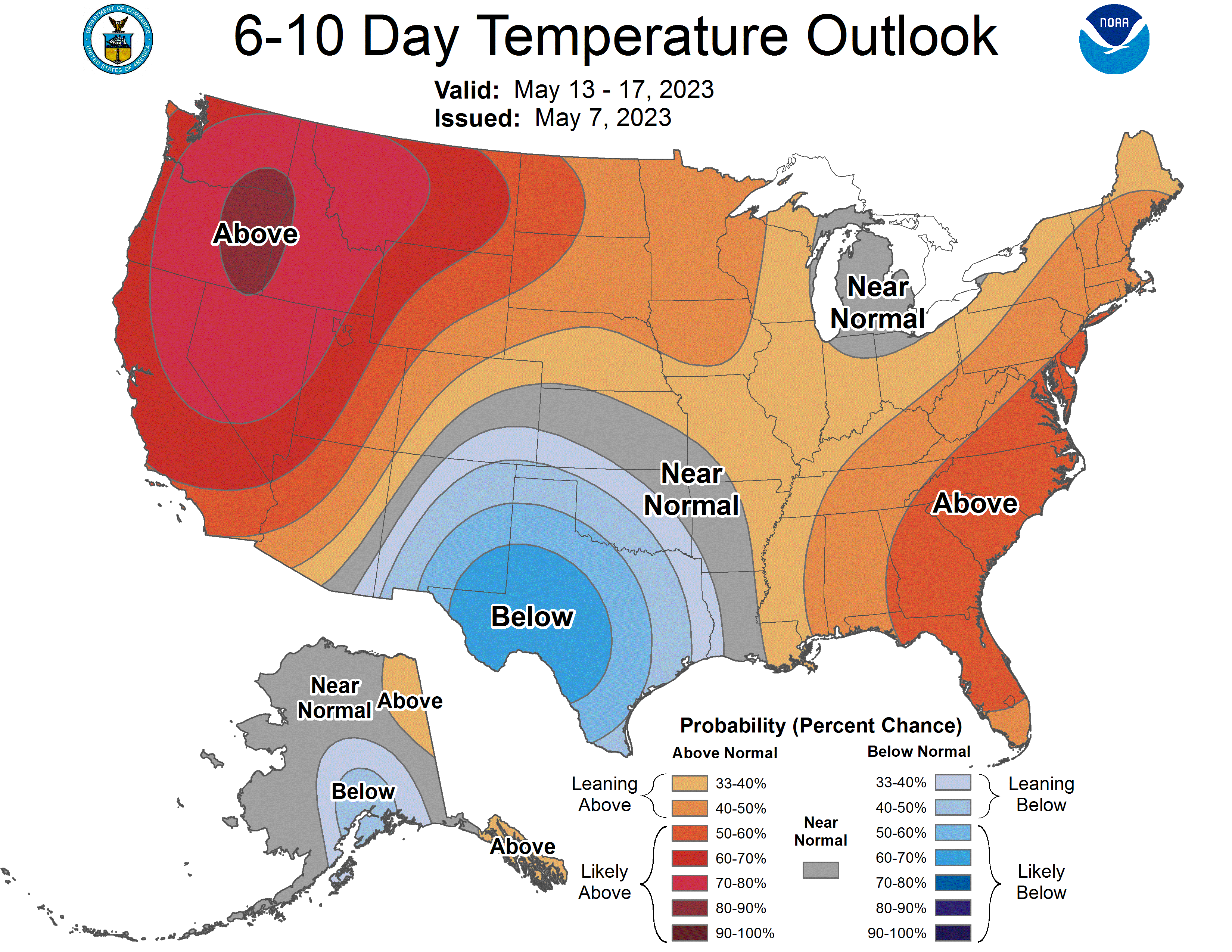
Above-normal temps may continue next weekend and beyond. The NWS Climate Prediction Center shows a tendency for above-normal temps from May 13 through May 17:
Areas of fog overnight/early Monday
Dense fog will linger over parts of northeastern Minnesota Sunday night and into Monday morning. A dense fog advisory continues in some areas, including Duluth, until 10 a.m. Monday:

Here are details of the advisory:
URGENT - WEATHER MESSAGE National Weather Service Duluth MN 115 PM CDT Sun May 7 2023 MNZ020-037-080615- /O.CON.KDLH.FG.Y.0005.000000T0000Z-230508T1500Z/ Southern Lake-Carlton and South St. Louis- Including the cities of Two Harbors, Silver Bay, and Duluth 115 PM CDT Sun May 7 2023 ...DENSE FOG ADVISORY REMAINS IN EFFECT UNTIL 10 AM CDT MONDAY... * WHAT...Visibility one quarter mile or less in dense fog. * WHERE...Southern Lake and Carlton and South St. Louis Counties. This includes the Tribal Lands of the Fond du Lac Band. * WHEN...Until 10 AM CDT Monday. * IMPACTS...Hazardous driving conditions due to low visibility. PRECAUTIONARY/PREPAREDNESS ACTIONS... If driving, slow down, use your headlights, and leave plenty of distance ahead of you.
There’ll also be areas of fog elsewhere in Minnesota and western Wisconsin Sunday night and early Monday.
Rain chances
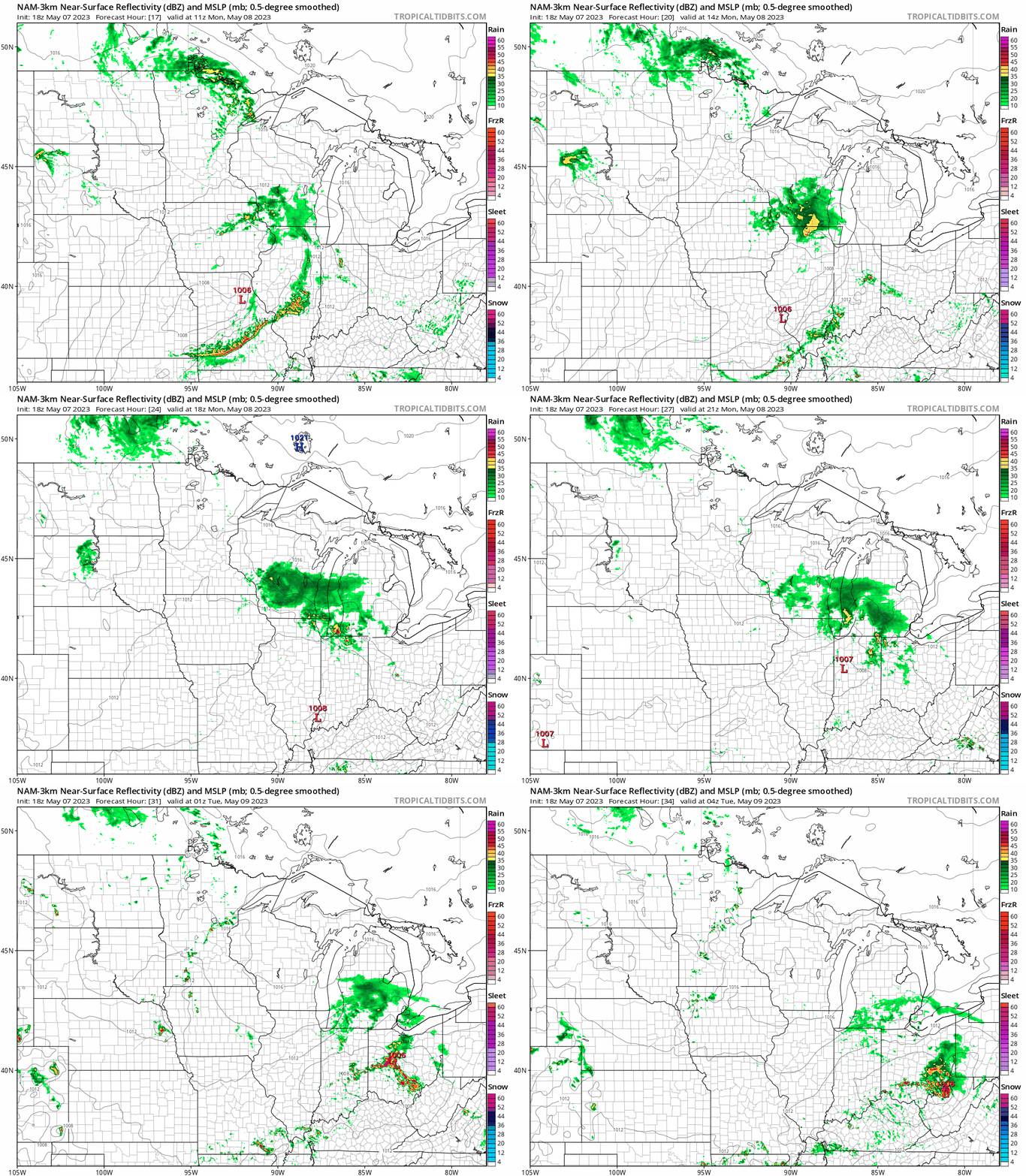
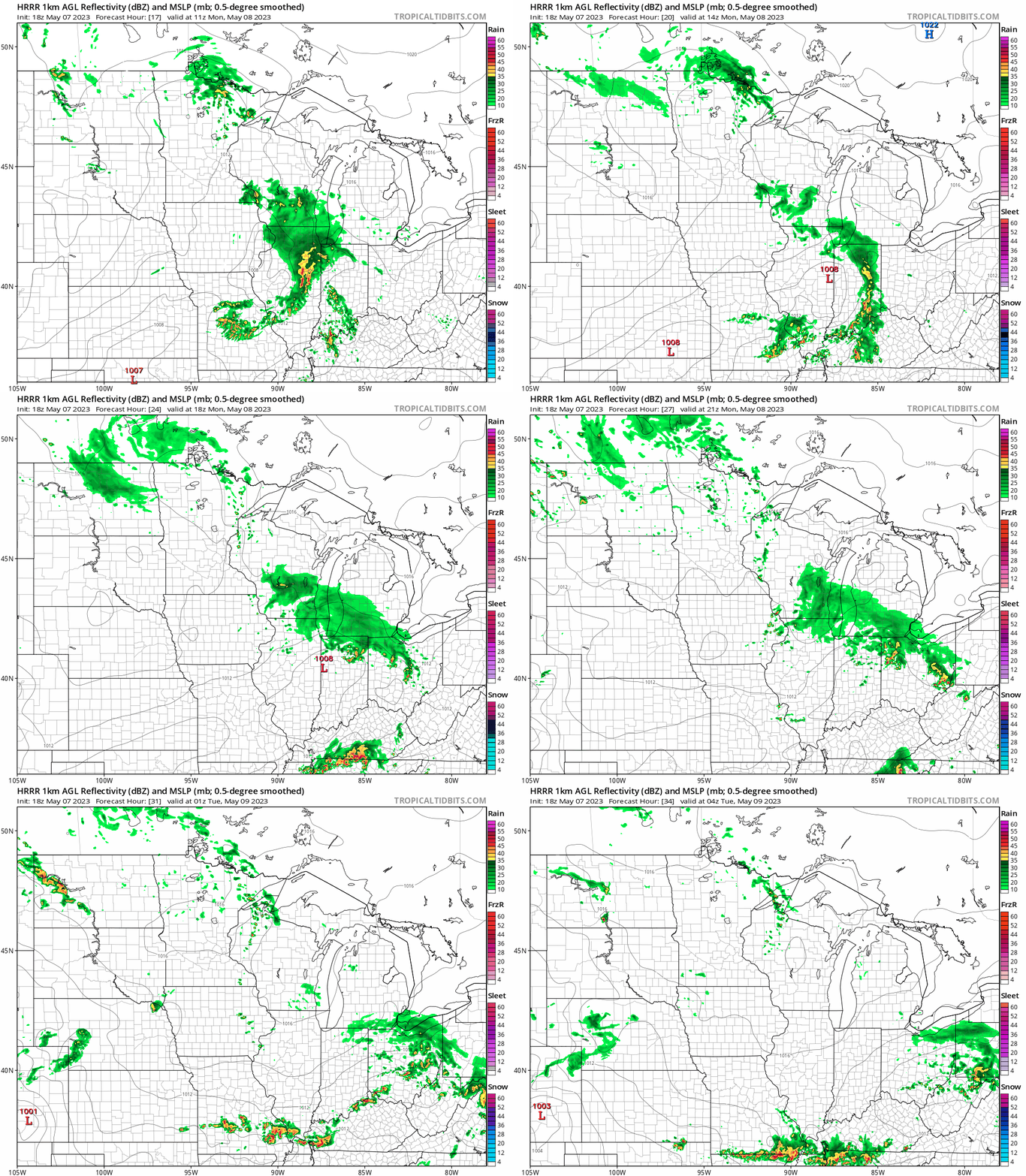
Far northern Minnesota will have the best chance of showers Sunday evening and overnight Sunday night, with an isolated thunderstorm also possible. Parts of southeastern Minnesota and western Wisconsin could also see scattered showers at times and an isolated thunderstorm
The best chance of showers and an isolated thunderstorm Monday morning and afternoon will be in northern Minnesota and also from far southeastern Minnesota into Wisconsin. Scattered showers and thunderstorms are possible anywhere in Minnesota and western Wisconsin Monday evening.
The National Oceanic and Atmospheric Administration’s North American Mesoscale (NAM) forecast model shows the potential rain pattern from 6 a.m. Monday to 11 p.m. Monday:
NOAA’s High-Resolution Rapid-Refresh model shows the following rain pattern for that same time period:
You can find updated weather information for Minnesota and western Wisconsin on the MPR News network.
You can also check the following NWS sites for updated weather info: Twin Cities, Duluth, La Crosse, Sioux Falls, and Grand Forks.
After Monday, the highest rain chances this coming week are expected to be on Thursday and Friday.
No more frost?
There are not any indications of frost or freezing temps in central or southern Minnesota over the next 7 days. That’s good news for gardeners!
Programming note
You can hear my live weather updates on MPR News at 7:35 a.m., 9:35 a.m. and 4:39 p.m. each Saturday and Sunday.

