
Wet on and off through Saturday night; drier, warmer north
Up to 2 inches of additional rain could fall in SW Minnesota

Go Deeper.
Create an account or log in to save stories.
Like this?
Thanks for liking this story! We have added it to a list of your favorite stories.


We’ll have occasional areas of scattered showers and some thunder through Saturday night, especially for southern and southwestern Minnesota. Heavy rain is possible in parts of southern Minnesota Saturday into Saturday night.
80s in northern MN; ice-outs ahead of fishing opener
It was northern Minnesota’s turn to see the first 80-degree readings of the season Thursday. Duluth hit 80, 11 days earlier than the normal first date. Brainerd hit 80, Hibbing reached 82 degrees and Moorhead topped out at 83 degrees.
These readings came on average about two days earlier than normal, while southern Minnesota’s 80s in early April came nearly a month early this year.

The warmth this week has helped clear ice from lakes in northern Minnesota. Lake Winnibigoshish went out Thursday and Lake Vermillion went out on Wednesday. We’re still waiting on Kabetogama, Lake of the Woods, Gunflint and Burntside lakes.
Turn Up Your Support
MPR News helps you turn down the noise and build shared understanding. Turn up your support for this public resource and keep trusted journalism accessible to all.

Here’s a shot from Devil Track Lake in Cook County where you can see lots of ice still.

Heavy rain potential, severe weather Saturday
A vigorous upper-level low is visible on satellite imagery looking almost like a hurricane over southwestern Nebraska early Friday. This feature is the weather culprit for the next 48 hours.
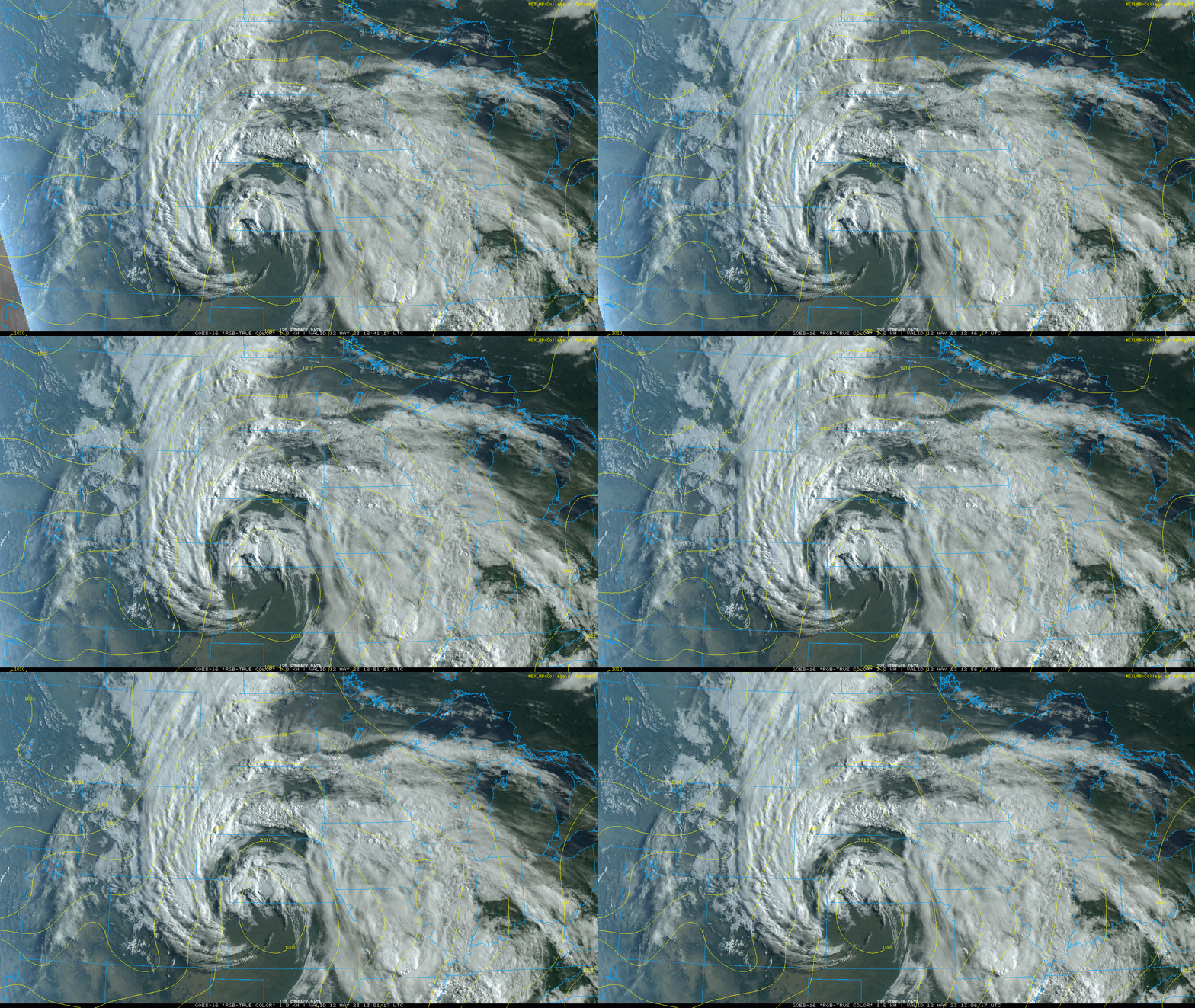
Occasional bands of showers and thunder will rotate around this low as it moves north and then darts east over the weekend.
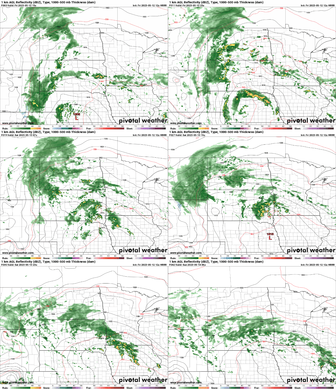
The more frequent and heavier rains will be across southern and western Minnesota into early Sunday. Up to 1 to 2 inches of additional rain could fall south and west of the Minnesota River. This is on top of nearly 2 to 5 inches of rain some areas saw already this week.
There’s a slight risk for excessive rain Saturday into Saturday night for portions of southern Minnesota.

In addition, thunderstorms that develop Saturday afternoon and evening could produce isolated tornadoes across far southern Minnesota into Iowa as shear increases near the center of the storm system.

There will be lingering showers in southeastern Minnesota Sunday while most of central and northern Minnesota clear out for Sunday afternoon. We’ll see sunshine and dry weather for most of Minnesota Monday through Wednesday.

