
Weekend weather: Very nice; dry with comfortable temperatures
Air quality alert for Minnesota until 6 a.m. Friday
Go Deeper.
Create an account or log in to save stories.
Like this?
Thanks for liking this story! We have added it to a list of your favorite stories.


I’ll get to the very pleasant weekend forecast after I cover the details of our current air quality alert.
Smoke from Canadian wildfires has prompted the Minnesota Pollution Control Agency to issue an air quality alert for all of Minnesota through the overnight hours of Thursday night, ending at 6 a.m. Friday:

Here are alert details from the MPCA:
The Minnesota Pollution Control Agency (MPCA) has issued an air quality alert for the entire state of Minnesota. The alert runs until Friday, May 19, at 6 a.m.
A band of very heavy ground-level smoke from wildfires in northern Alberta and Saskatchewan is currently moving along a cold front in northwestern Minnesota. The smoke will continue to move south and east and eventually impact the entire state of Minnesota. The smoke should clear rapidly overnight into Friday morning.
Fine particle levels are expected to reach the red air quality index (AQI) category, a level considered unhealthy for everyone, across all but far eastern Minnesota. This area includes The Twin Cities Metropolitan Area, St. Cloud, Mankato, Moorhead, East Grand Forks, Roseau, Bemidji, Alexandria, Marshall, Ortonville, Worthington and the tribal nations of Red Lake and Mille Lacs. In the red area, everyone should avoid prolonged time outdoors.
Fine particle levels are expected to reach the orange AQI category, a level considered unhealthy for sensitive groups, across southeastern, northeastern, and far east central Minnesota. This area includes Rochester, Duluth, Ely, International Falls, Two Harbors, and the tribal nations of Fond du Lac and Grand Portage. In the orange area, sensitive groups should avoid prolonged time outdoors.
You can monitor air quality info at the MPCA site.
Turn Up Your Support
MPR News helps you turn down the noise and build shared understanding. Turn up your support for this public resource and keep trusted journalism accessible to all.
The Wisconsin Department of Natural Resources has issued an air quality alert today through noon on Friday for most of western Wisconsin. Here are details, via the National Weather Service:
WIZ014>016-023>028-191715- Polk-Barron-Rusk-St. Croix-Pierce-Dunn-Pepin-Chippewa-Eau Claire- Including the cities of Osceola, Rice Lake, Ladysmith, Hudson, River Falls, Menomonie, Durand, Chippewa Falls, and Eau Claire 1103 AM CDT Thu May 18 2023 ...AIR QUALITY ALERT IN EFFECT UNTIL 12 PM CDT FRIDAY... The Wisconsin Department of Natural Resources has issued an Air Quality Advisory for PM2.5 which will remain in effect until 12:00 PM CDT friday. This advisory affects people living in the following counties: Barron, Chippewa, Dunn, Eau Claire, Pepin, Pierce, Polk, Rusk, and St. Croix. Wildfire smoke originating from Canada will move into the state from northwest-to-southeast beginning around noon today. PM2.5 concentrations will likely increase sharply at times before steadily diminishing as cleaner air moves in. The air quality index is expected to reach the UNHEALTHY FOR SENSITIVE GROUPS level. Areas further west will have the potential to reach the UNHEALTHY air quality index level, while areas further northeast will have the potential to see lesser impacts within the MODERATE air quality index level. People with heart or lung disease, older adults, and children should reduce prolonged or heavy exertion. For more information on current air quality, plese see: https://airquality.wi.gov
The Wisconsin DNR has also issued an air quality alert from midnight Thursday night through Friday evening for much of southern Wisconsin.
Nice weekend
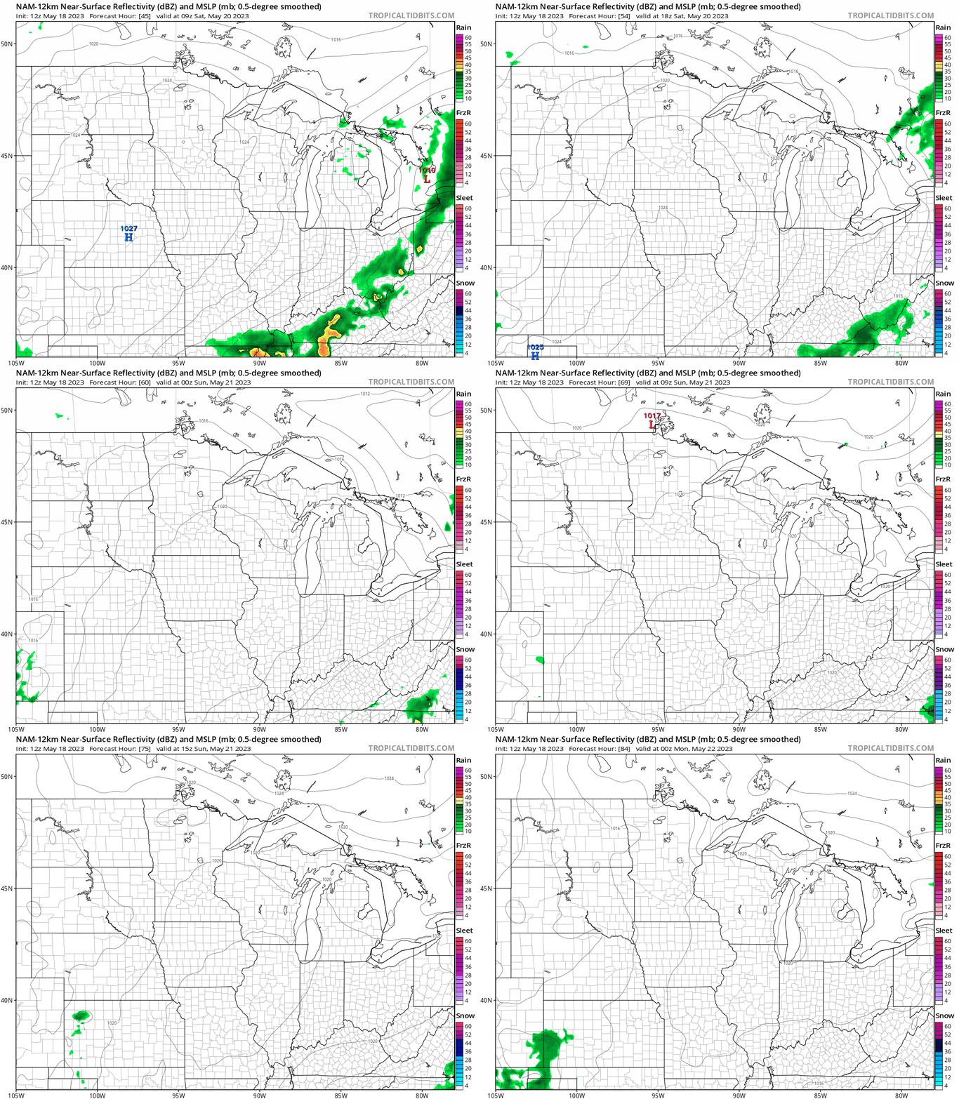
We have nice weather in the weekend forecast, which is a nice change from recent weekends.
A nearby high pressure system will give us dry weekend weather and ample sunshine across most of Minnesota and western Wisconsin.
The National Oceanic and Atmospheric Administration’s North American Mesoscale (NAM) forecast model shows the potential rain pattern from 4 a.m. Saturday to 7 p.m. Sunday:
You can find updated weather information for Minnesota and western Wisconsin on the MPR News network.
Weekend temperatures
Near-normal temperatures are very pleasant this time of year.
The average Twin Cities high temperature on May 20 is 71 degrees. Metro area highs are expected to reach the lower 70s this Saturday.
Most of Minnesota and western Wisconsin will have Saturday afternoon highs in the 70s:

Sunday highs will also be mainly in the 70s, with much cooler 60s and 50s near Lake Superior due to gusty east-northeasterly winds:

Twin Cities metro area highs are expected to reach the upper 70s on Sunday.
Programming note
You can hear my live weather updates on MPR News at 7:35 a.m., 9:35 a.m. and 4:39 p.m. each Saturday and Sunday.

