Updraft® - Minnesota Weather News

Another pleasant day on Sunday; Summery start to the work week

No cold snaps in sight
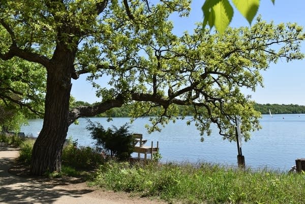
rt0520har
Saturday sunshine at Lake Harriet, Minneapolis
Ron Trenda/MPR News

It was a pleasant, sun-splashed Saturday across Minnesota and western Wisconsin.

The Saturday high temperature at Minneapolis-St. Paul International Airport was 73 degrees, which is a couple of degrees higher than the Twin Cities average May 20 high temp. Most of Minnesota and western Wisconsin topped out in the 70s Saturday afternoon.

There’s a layer of smoke aloft over parts of far northern Minnesota. That smoke layer is from Canadian wildfires. The smoke is not expected to reach ground level, so it won’t affect the air that we breathe as it expands a bit southward on Sunday.

Dry Sunday in most areas

A high-pressure system that currently extends from Missouri through Minnesota will move slowly eastward Saturday night and Sunday. Most of Minnesota and western Wisconsin will remain dry through Sunday. There could be a few passing sprinkles in northeastern Minnesota Sunday afternoon and evening as a cool front moves through.

The National Oceanic and Atmospheric Administration’s North American Mesoscale (NAM) forecast model shows the potential rain pattern from 4 a.m. Sunday to 10 p.m. Sunday:

rt0520rad9
Simulated radar from 4 a.m. Sunday to 10 p.m. Sunday
NOAA, via Tropicaltidbits.com

You can find updated weather information for Minnesota and western Wisconsin on the MPR News network

Sunday highs will be mainly in the 70s:

rt0521h11
Sunday forecast highs
National Weather Service

A few spots in southwestern Minnesota could touch 80. Cooler 50s and 60s are expected in northeastern Minnesota as gusty easterly winds develop Sunday afternoon.

Monday highs reach the 80s in western Minnesota, with upper 70s to around 80 in most of eastern Minnesota and western Wisconsin:

rt0522h11
Monday forecast highs
National Weather Service

There will be some 60s Monday near Lake Superior.

Twin Cities metro area highs are projected to be around 80 degrees on Monday, followed by lower 80s Tuesday then upper 70s Wednesday and Thursday and back to 80 on Friday.

It looks like above-normal temps will continue next weekend and into the start of the following week. Here’s the May 26 through May 30 temperature outlook from the NWS Climate Prediction Center:

rt0520ext2
Temperature outlook May 26 through May 30
NWS Climate Prediction Center

That’s good to see, since it covers the Memorial Day weekend.

Programming note

You can hear my live weather updates on MPR News at 7:35 a.m., 9:35 a.m. and 4:39 p.m. each Saturday and Sunday.

Dear reader,

Your voice matters. And we want to hear it.

Will you help shape the future of Minnesota Public Radio by taking our short Listener Survey?

It only takes a few minutes, and your input helps us serve you better—whether it’s news, culture, or the conversations that matter most to Minnesotans.

Volume Button
Volume
Now Listening To Livestream
MPR News logo
On Air
BBC World Service