
Beautiful weekend weather; Summery temps for the coming week
Update on river levels
Go Deeper.
Create an account or log in to save stories.
Like this?
Thanks for liking this story! We have added it to a list of your favorite stories.


After a chilly start, temperatures are recovering nicely today. Even warmer temps are on tap for Sunday.
We’ll have plenty of sunshine this weekend. There could be some smoke aloft over parts of northern Minnesota later today and on Sunday, due to Canadian wildfires.
Dry weekend
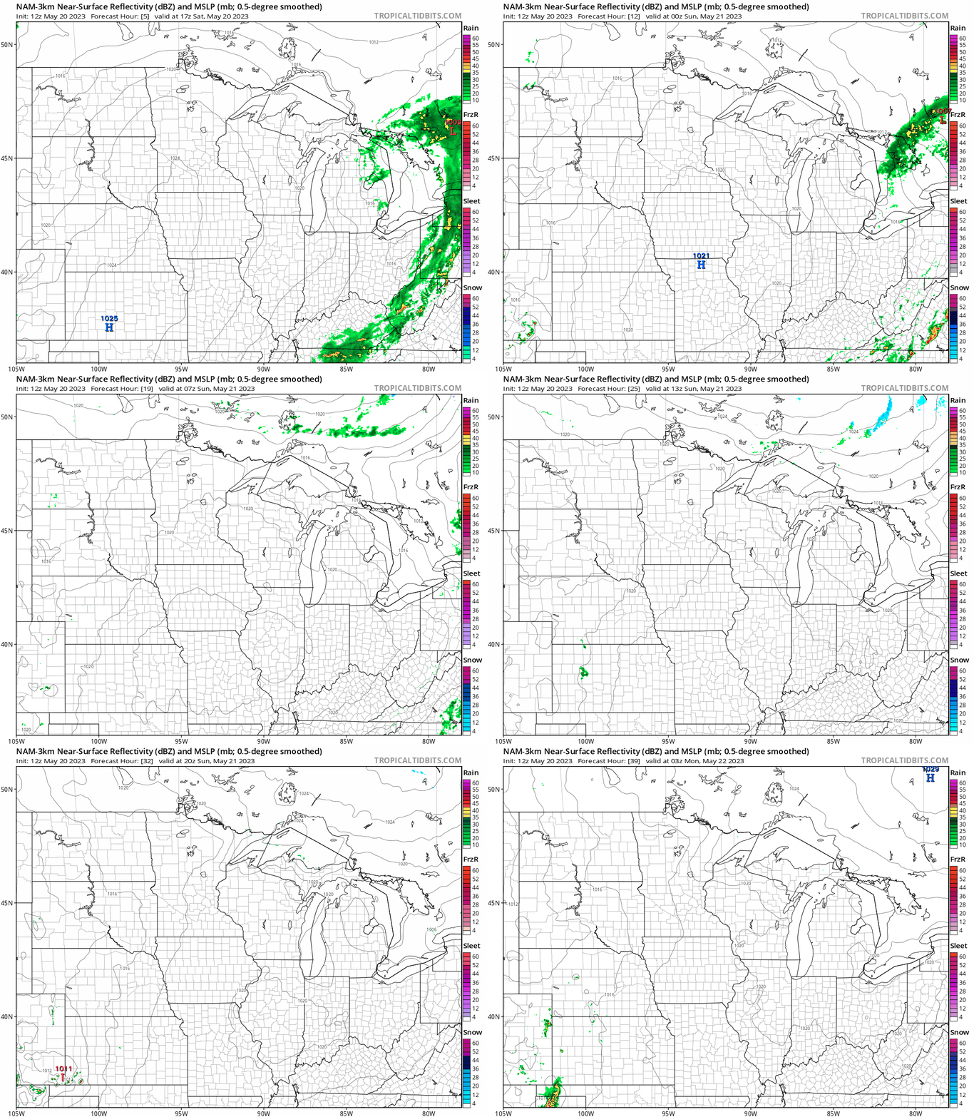
Most of Minnesota and western Wisconsin will have a dry weekend, thanks to a nearby high-pressure system.
The National Oceanic and Atmospheric Administration’s North American Mesoscale (NAM) forecast model shows the potential rain pattern from noon Saturday to 10 p.m. Sunday:
Turn Up Your Support
MPR News helps you turn down the noise and build shared understanding. Turn up your support for this public resource and keep trusted journalism accessible to all.
You can find updated weather information for Minnesota and western Wisconsin on the MPR News network.
Temperature trends
Saturday high temps will be mainly in the lower 70s across Minnesota and western Wisconsin, with a few spots reaching the mid-70s. The average Twin Cities high temperature is 71 degrees this time of year.
Low temperatures late Saturday night/early Sunday morning will be mainly in the 40s:

Parts of the Twin Cities metro area will bottom out in the lower 50s.
Sunday highs will be well into the 70s in most locations:

Sunday highs are expected to be in the 60s near Lake Superior, as gusty east-northeasterly winds develop Sunday afternoon.
Twin Cities metro area highs are projected to be around 80 degrees on Monday, followed by lower 80s Tuesday and Wednesday, then around 80 Thursday and back to the lower 80s Friday.
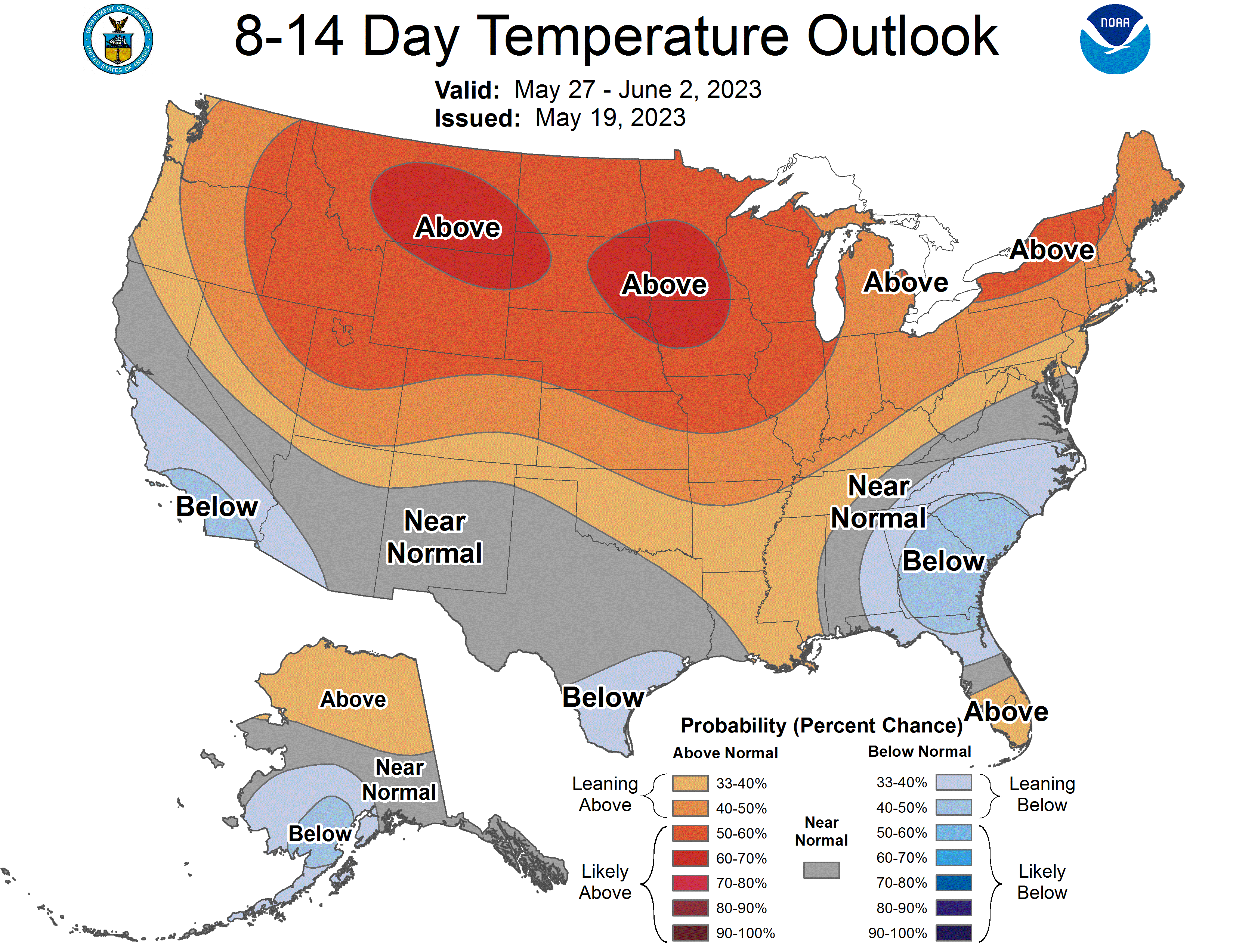
The NWS Climate Prediction Center shows a strong tendency for above-normal temps next weekend into the first couple days of June:
River update
Several rivers are reaching a second spring crest, thanks to the heavy rain that fell over portions of southern Minnesota last weekend and the previous Wednesday night and Thursday.
You can check the river levels at various locations in Minnesota and western Wisconsin here. This is how the linked map looked Saturday morning:

You can zoom in on the linked map page and get detailed info on river levels at a specific location.
River levels are measured in relation to the height above a local benchmark. In some locations, river levels are listed in feet above sea level.
Here’s the hydrograph of recent, current and forecast levels for the Minnesota River at Jordan, which is at moderate flood stage:

The Minnesota River at Jordan will fall through the coming week.
The Mississippi River at St. Paul is at minor flood stage and it’s forecast to crest slightly below moderate flood stage this weekend, then fall this coming week:

You can check the Saturday flood statement from the Twin Cities NWS office here. Just click on the “Text Data” tab at the linked site.
Weather nugget
January and February were warmer than normal in the Twin Cities, then March and April were colder than normal. May is running 3.2 degrees warmer than normal in the Twin Cities and it is expected to finish warmer than normal.
Programming note
You can hear my live weather updates on MPR News at 7:35 a.m., 9:35 a.m. and 4:39 p.m. each Saturday and Sunday.

