
A bright and breezy Sunday; recap of Saturday's storms
Very dry dew points today
Go Deeper.
Create an account or log in to save stories.
Like this?
Thanks for liking this story! We have added it to a list of your favorite stories.


Parts of Minnesota saw some much-needed rain on Saturday. Rainfall amounts varied widely.
Minneapolis-St. Paul International Airport tallied just six-hundredths of an inch of rain on Saturday. Holman Field Airport in St Paul reported 42/100ths of an inch. I had 1.62 inches of rain in St. Paul, Saturday afternoon. Radar estimates were even higher than that in very small parts of southeastern Ramsey County, northeastern Dakota County and southwestern Washington County:

Heavy rain caused street flooding Saturday afternoon in portions of South St. Paul and West St. Paul.
Radar estimates showed around 9 inches of rain Saturday near Franklin, Minn. in Renville County, which prompted flood warnings in that area Saturday evening.
Turn Up Your Support
MPR News helps you turn down the noise and build shared understanding. Turn up your support for this public resource and keep trusted journalism accessible to all.
There was a report of wind damage around 3:15 p.m. Saturday in Winsted in McLeod County, with large tree limbs down. Around that same time, near Waverly in Wright County, there was a report of large tree limbs down and a hayfield was flattened and there was crop damage due to hail and strong winds. The storms downed some trees and power lines in Howard Lake (Wright County) Saturday afternoon.
Quiet weather today
A cool Canadian high pressure system is spreading into Minnesota Sunday.
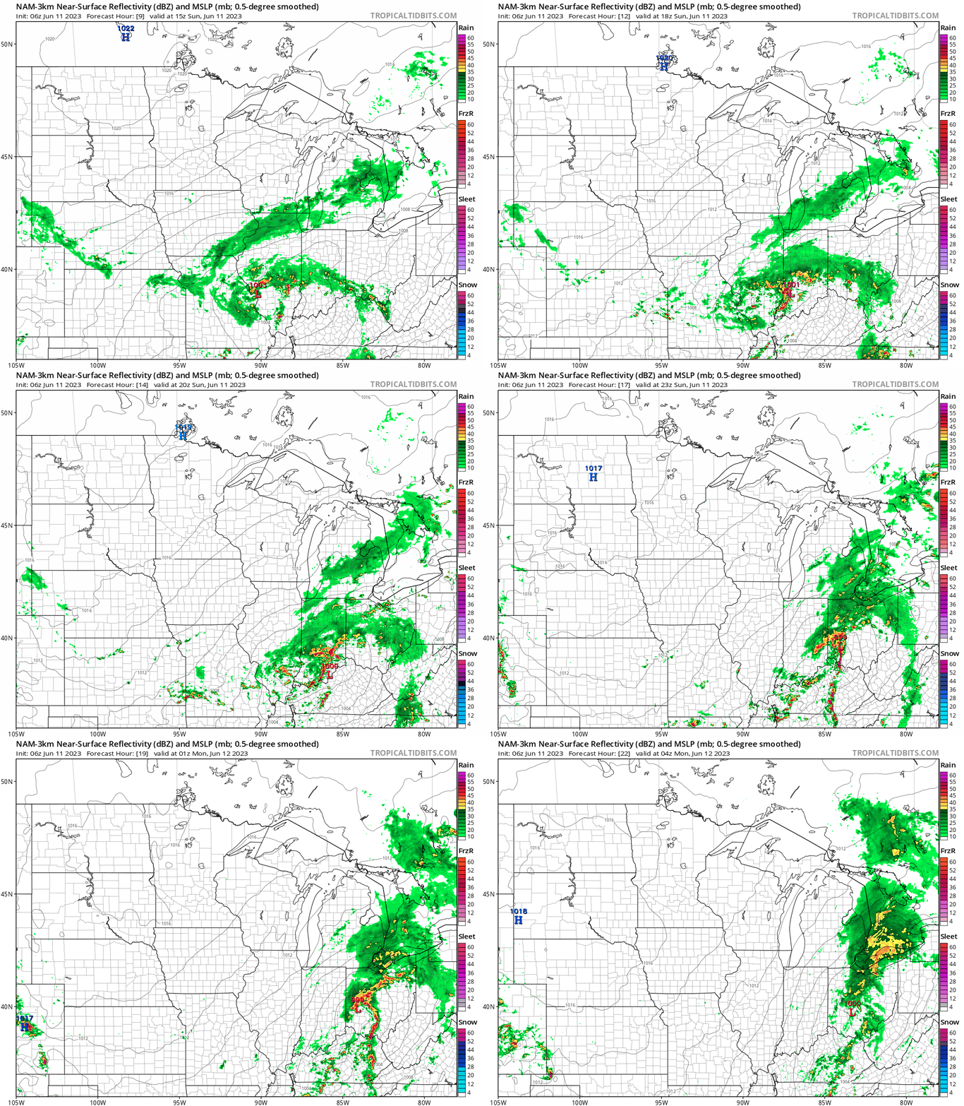
It’ll be a sun-splashed and breezy day. NOAA’s North American Mesoscale forecast model shows the surface pressure pattern and the potential rain pattern from 10 a.m. Sunday to 11 p.m. Sunday:
You can find updated weather information for Minnesota and western Wisconsin on the MPR News network.
Sunday temps and dew points
The average Twin Cities high temperature is 78 degrees on June 11.
Sunday highs will be mainly in the lower 70s, with some mid-70s in the far northwest:

Parts of northeastern Minnesota and northwestern Wisconsin will have Sunday highs in the 60s.
We’ll have very dry air today, with afternoon dew points in the upper 30s to lower 40s:

Update
A new Updraft will be posted around 10:20 a.m. today. It’ll include a look at the week ahead.
Programming note
You can hear my live weather updates on MPR News at 7:35 a.m., 9:35 a.m. and 4:39 p.m. each Saturday and Sunday.

