
Highs near 90 much of the week; rain potential late in the week
Unhealthy air in central, southern Minnesota by Tuesday afternoon

Go Deeper.
Create an account or log in to save stories.
Like this?
Thanks for liking this story! We have added it to a list of your favorite stories.


Hot weather builds back in for Minnesota this week. While most did not see significant rain over the weekend there’s at least another developing chance by late this week.
Hit and miss weekend rains
Keeping with the familiar pattern lately, weekend rains were hit and miss. There were heavy showers, but those were few and far between. Where spotty heavy showers did hit, up to 1 to 3 or more inches fell, but most were left pretty dry.

Minneapolis-St. Paul International Airport picked up just 1 one-hundredth of an inch (.01) while St. Cloud received 5 one-hundredths (.05) and Mankato measured 34 one-hundredths (.34).
Heat dome develops; late week rain potential
A heat dome — a nearly stationary upper-level area of high pressure — will reestablish itself over the central United States into Canada resulting in a hot, sunny week ahead.
Turn Up Your Support
MPR News helps you turn down the noise and build shared understanding. Turn up your support for this public resource and keep trusted journalism accessible to all.
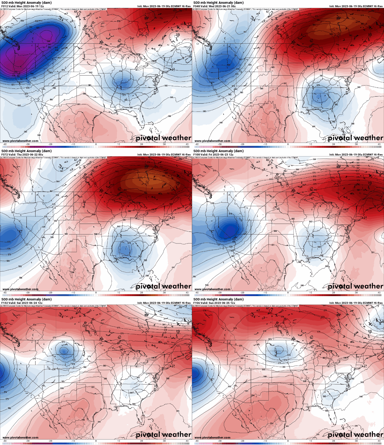
By the weekend a slowly moving upper-level trough will push its way from the west coast through the western edge of the heat dome creating slowly increasing chances of rain and thunder late this week into the weekend.

While it’s still very early with this system and a lot can change, there are hopeful signs that this system could produce some decent rainfall.

The pattern before that will yield potentially several 90 degree days for southern and western, Minnesota so find a way to stay cool.

With hot, sunny days and light winds, surface level ozone could become an issue. The Minnesota Pollution Control Agency is forecasting unhealthy air for sensitive groups for much of central and southern Minnesota by Tuesday afternoon.


