Hot Monday, Tuesday with thunderstorm chances
Monday may bring the hottest temperatures yet for some
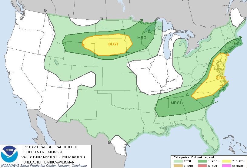
Go Deeper.
Create an account or log in to save stories.
Like this?
Thanks for liking this story! We have added it to a list of your favorite stories.
Monday and Tuesday will be hot and muggy with thunderstorm chances. Severe weather is possible along with locally heavy rainfall with cooler temps moving in midweek.
Hot, muggy with occasional storms
The hottest temperature so far in the Twin Cities has been 92 degrees on four different occasions this year so far. We look to surpass that Monday afternoon with highs in the mid-90s for much of southern Minnesota.

A heat advisory is in effect for the Twin Cities area from 1 p.m. through 7 p.m. Monday.

After some spotty showers early there will be some isolated late-day storms possible Monday, especially in central and northern Minnesota.

Portions of northern and western Minnesota have a marginal risk of severe weather (level 1 out of 5) late in the day with a slight risk (level 2 out of 5) in the west central part of the state.

The same cool front will continue to progress south Tuesday touching off a better chance of more widespread storms especially later in the day. Ingredients come together to produce a potentially better chance of severe storms. A slight risk (level 2 out of 5) of severe weather is forecast for portions of central and southern Minnesota Tuesday.

Behind the cool front we’ll see temperatures in the 70s south Wednesday with just 60s north. Temperature rebound to normal by Friday again.
Turn Up Your Support
MPR News helps you turn down the noise and build shared understanding. Turn up your support for this public resource and keep trusted journalism accessible to all.