
Most of Minnesota now in drought; minor rain chances ahead
Normal temperatures return by the weekend

Go Deeper.
Create an account or log in to save stories.
Like this?
Thanks for liking this story! We have added it to a list of your favorite stories.


Updated 10:35 a.m.
Despite some locally heavy rainfalls drought continues its expansion. Thursday will be cooler than normal. Rain chances are spotty in the forecast.
Most of Minnesota now in drought
For the first time this year, a majority of Minnesota is in drought. Drought expanded to encompass 57 percent of the state, up from 39 percent two weeks ago. Severe drought also expanded to 8 percent, up from 5 percent a week ago.

It is worth noting that the recent drought monitor includes data through 7 a.m. Tuesday, so rainfall from the Fourth of July is not included in the monitor. This might slightly affect the severe drought expansion into eastern portions of the Twin Cities metro area.
Rainfall over the past seven days was heavy in Wisconsin and in northeastern Minnesota, which helped to remove Duluth and parts of the North Shore from severe drought. The region remains in moderate drought.
Turn Up Your Support
MPR News helps you turn down the noise and build shared understanding. Turn up your support for this public resource and keep trusted journalism accessible to all.

In case you’re curious about the pocket of southwestern Minnesota without drought, that’s a lingering effect from the deluge of rains those areas saw in early May.
Remember when the Minnesota River shot back up, sending the Mississippi levels back up? Some areas saw up to 8 inches of rain.

The area sticks out like a sore thumb when we look at precipitation anomalies (difference from normal) for the past 90 days still. If the dry pattern continues though, it’s only a matter of time before drought creeps into that area.
The map is a good example of how it can be luck of the draw with some areas in deficits of several inches while just miles away one can be nearly at normal or in surplus.
Spotty rain chances; warmer temps ahead
It was a chilly morning in northeastern Minnesota early Thursday. The low temperature dipped to 35 degrees in Hibbing with several places reaching the upper 30s.

In the Twin Cities, we dropped to 56 degrees, the coolest reading in almost three weeks but only nine degrees cooler than the normal low of 65.
We’ll see highs remain cooler than normal statewide Thursday, mostly in the 70s. This is our third consecutive day of cooler than normal high temperatures, something that has not happened since mid-May.

Low temperatures Thursday night will again be comfortable mostly in the 50s to around 60 in the Twin Cities with more upper 40s in northeast Minnesota.

We do have the chance of showers in northern and western Minnesota Friday and again Sunday in northern Minnesota. Southeastern Minnesota and the Twin Cities may see some spotty chances early next week with only isolated chances over the weekend.
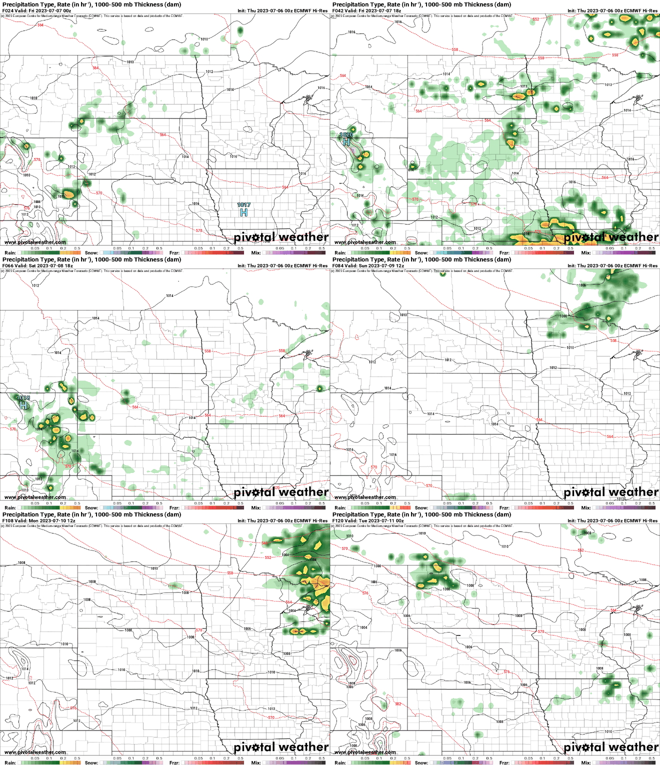
Forecast total rainfall through Monday favors northern Minnesota for measurable rainfall, but it’s likely there won’t be significant rainfall anywhere in the state.


