Spotty thunderstorms possible Wednesday; warmer Thursday

Go Deeper.
Create an account or log in to save stories.
Like this?
Thanks for liking this story! We have added it to a list of your favorite stories.


Areas of rain will continue to drift across southern Minnesota. More spotty showers and storms are possible in central Minnesota Wednesday afternoon. Thursday will be warmer.
Potential showers, thunderstorms Wednesday
Wednesday’s weather will be dominated by two main areas of rain showers. The first is a large area of rain drifting across southern Minnesota through the morning.
The next area to watch will be instability-driven Wednesday afternoon with spotty showers and thunderstorms possible in central Minnesota.

Earlier it had looked like one or two storms might become severe Wednesday afternoon across southern Minnesota but the National Oceanic and Atmospheric Administration’s Storm Prediction Center has updated the risk and pushed it south into Iowa.
Turn Up Your Support
MPR News helps you turn down the noise and build shared understanding. Turn up your support for this public resource and keep trusted journalism accessible to all.

High temperatures will still be slightly below normal thanks to the cloud cover and areas of showers Wednesday. Most places will remain in the 70s for highs.

Warmer temps Thursday
Temperatures will be warmer Thursday, back to normal levels with highs in the low to mid-80s south and upper 70s north.

There’s a chance of some isolated showers or thunderstorms mainly in northeastern Minnesota Thursday with much of the rest of Minnesota remaining dry.

Friday will bring a better chance of at least some spotty showers and thunderstorms especially in the eastern half of the state.

Update on potential auroras north
There could still be some slightly increased geomagnetic activity Wednesday night for some lucky viewers. A KP index of 4 is forecast, which means some aurora could be visible in far northern Minnesota and into Canada.

Space weather models are trying to handle what appears to be a lopsided ejection of material from the sun that originated early Monday, reaching earth Wednesday and Thursday.
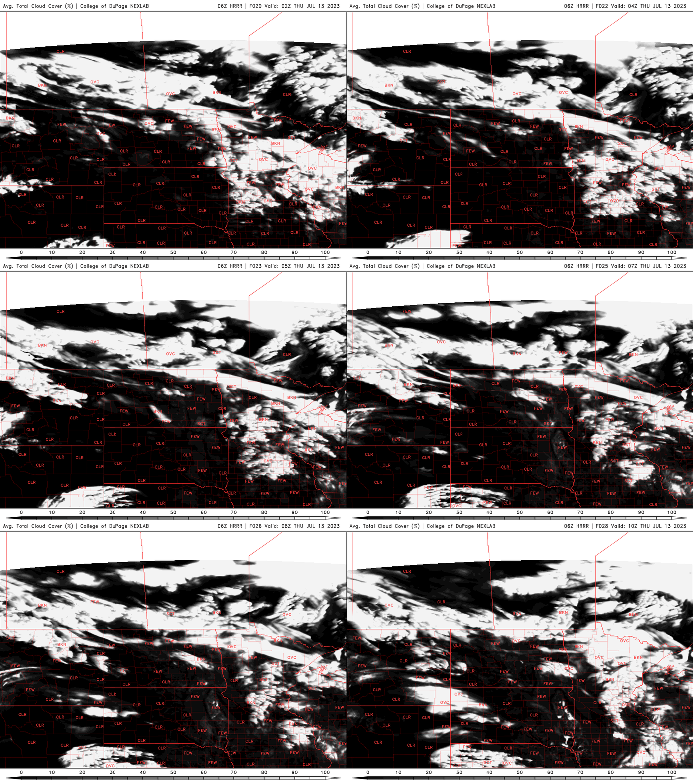
Skies will not be clear but also not totally overcast across northern Minnesota. The cloud forecast loop below goes from 9 p.m. Wednesday through 5 a.m. Thursday. If activity pans out, the peak is forecast to be through about 4 a.m. Thursday.