
Spotty afternoon thunder Saturday; heat builds for next week
There’s a marginal risk of an isolated severe storm or two Saturday

Go Deeper.
Create an account or log in to save stories.
Like this?
Thanks for liking this story! We have added it to a list of your favorite stories.


Spotty afternoon storms are possible Saturday. A couple isolated storms could become severe. Temperatures will be seasonable but a heat wave is building for next week.
Spotty afternoon storms Saturday
A second upper level disturbance combined with day time heating and slightly higher dew points will lead to at least some spotty to scattered showers and thunderstorms Saturday afternoon and evening.

There’s a marginal risk (level 1 out of 5) of severe storms. Some isolated storms could produce some severe criteria (one inch or bigger) hail.
High temperatures will be well into the 80s for much of the state except for northeast Minnesota which will remain in the 70s.

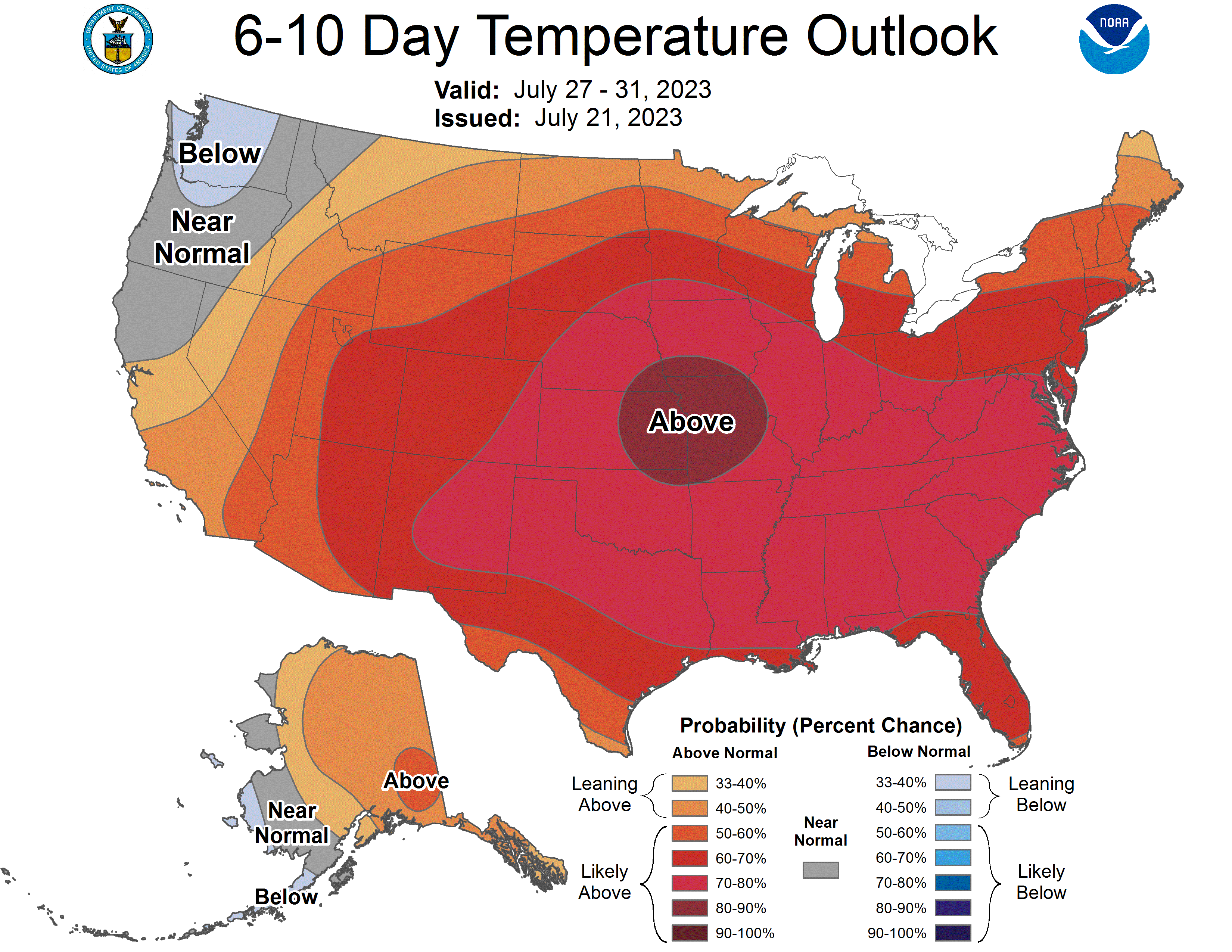
Heat likely next week
There’s a strong likelihood of a heat wave gripping much of southern and western Minnesota next week. Highs will be in the 90s all week long south and west with the possibility of 100 degrees for some places.
Turn Up Your Support
MPR News helps you turn down the noise and build shared understanding. Turn up your support for this public resource and keep trusted journalism accessible to all.

