
Isolated storms and 90 degrees likely Wednesday
Marginal severe risk Wednesday just north of the Twin Cities

Go Deeper.
Create an account or log in to save stories.
Like this?
Thanks for liking this story! We have added it to a list of your favorite stories.


August is getting a little hot and thundery this week.
A marginal (level 1 of 5) risk for severe storms is in place Wednesday from about the northern Twin Cities to Alexandria to the North Shore. (map above)
The atmosphere over Minnesota will be unstable enough to produce a few isolated storms that could approach severe limits Wednesday. Remember that severe criteria are 1-inch diameter hail or larger and winds of 58 mph or higher.
Isolated storms
The National Oceanic and Atmospheric Administration’s Weather Research and Forecasting model is typical of several that develop isolated thunderstorms during the day Wednesday. The loop below runs between noon and 7 p.m. Wednesday.
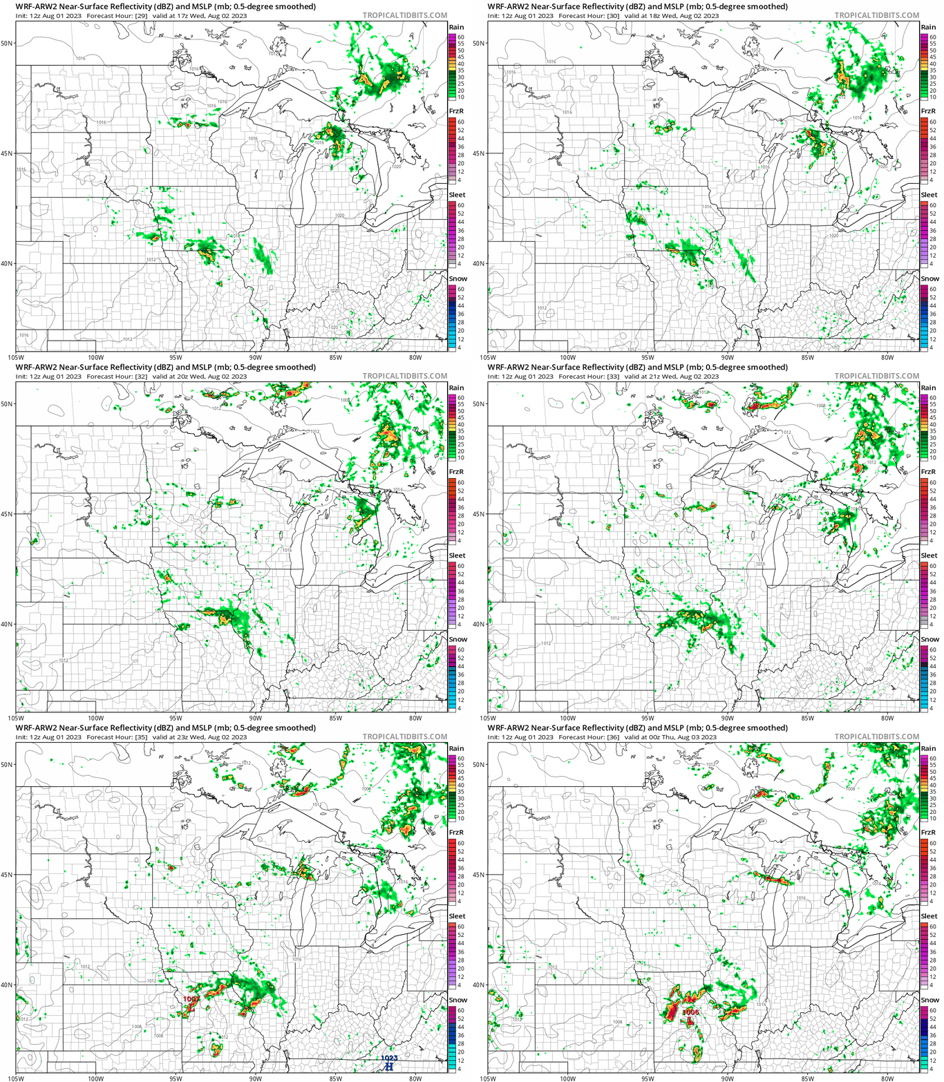
Notice how spotty the storm coverage is likely to be Wednesday.
Heat builds
Any storms that form Wednesday will have plenty of heat to feed off of. Highs will reach the lower 90s across much of southern and western Minnesota Wednesday afternoon.

Thursday may be a few degrees hotter.

Turn Up Your Support
MPR News helps you turn down the noise and build shared understanding. Turn up your support for this public resource and keep trusted journalism accessible to all.

