Very warm Friday; weekend rain develops
Some places could see 1-2 inches of rainfall or more
Go Deeper.
Create an account or log in to save stories.
Like this?
Thanks for liking this story! We have added it to a list of your favorite stories.


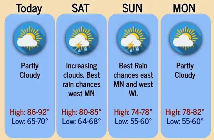
Friday will be another very warm day south with highs near 90 for some but less humid than the last couple of days. Rain and storms develop west to east Saturday into Sunday.
Another very warm day Friday
Friday will be near 90 for places like the Twin Cities and a few other southern Minnesota spots.

Dew points will still be somewhat sticky, although not as humid as the last couple of days. Dew points will be more comfortable, in the 50s, in northern Minnesota.

Storm system brings significant rain potential this weekend
An upper-level low is cutting into the northwestern edge of the upper-level ridge / heat dome around Montana into the western Dakotas. This feature is already creating a mass of clouds, showers and a few thunderstorms.
Turn Up Your Support
MPR News helps you turn down the noise and build shared understanding. Turn up your support for this public resource and keep trusted journalism accessible to all.

The low will track east over the weekend bringing rain to western Minnesota by early Saturday and eastern Minnesota by late Saturday into Saturday night and Sunday.
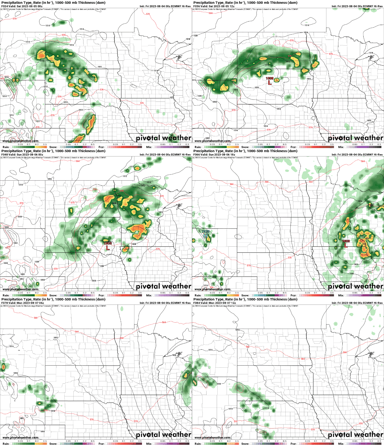
The official forecast calls for a widespread 1 to 2 inches of rain in central Minnesota.

There are differences still in the models dependent on how the upper low fully organizes and waves of thunderstorms that could impact how much moisture and where it develops.

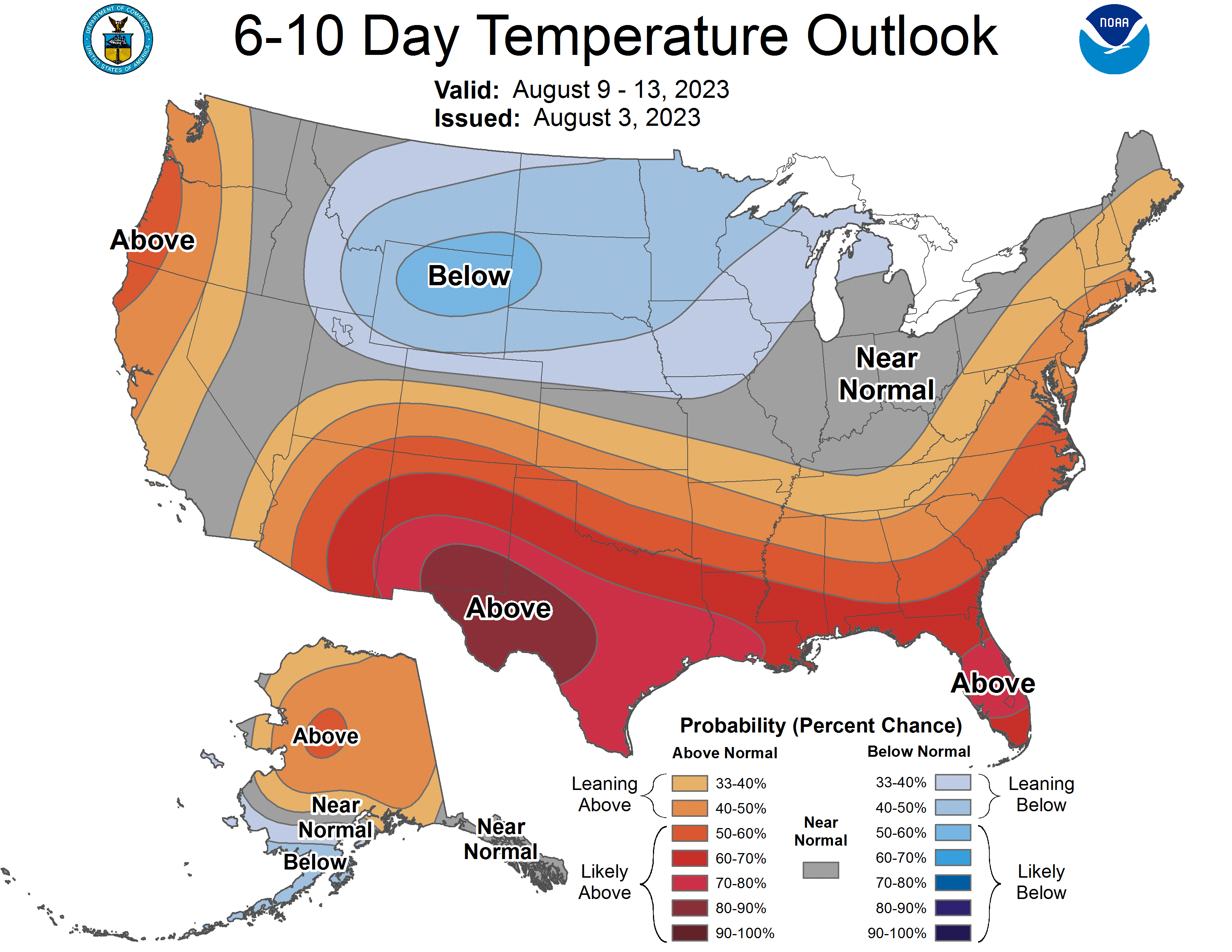
Next week will then be bright but cooler behind the system with highs in the 70s to low 80s. These temperatures will be near or slightly below normal.