
Update on weekend rain chances; cooler on Sunday
Heavy rain possible in some areas Saturday night and Sunday
Go Deeper.
Create an account or log in to save stories.
Like this?
Thanks for liking this story! We have added it to a list of your favorite stories.


Updated at 3:20 p.m.
Our Saturday will feature summery temperatures and dew points. Most of Minnesota and western Wisconsin will see highs in the 80s. Parts of northeastern Minnesota will top out in the 70s.
Portions of eastern Minnesota and southwestern Minnesota have seen spotty morning showers. By Saturday afternoon, the best chance of scattered showers and thunderstorms is espected to be in west-central and southwestern Minnesota. An isolated shower or thunderstorm will also be possible elsewhere in Minnesota and western Wisconsin Saturday afternoon.
Severe weather outlook
Far southwestern Minnesota (shaded yellow) could see some scattered severe thunderstorms Saturday afternoon and Saturday night, based on the Saturday severe weather outlook from the NWS Storm Prediction Center:
Turn Up Your Support
MPR News helps you turn down the noise and build shared understanding. Turn up your support for this public resource and keep trusted journalism accessible to all.
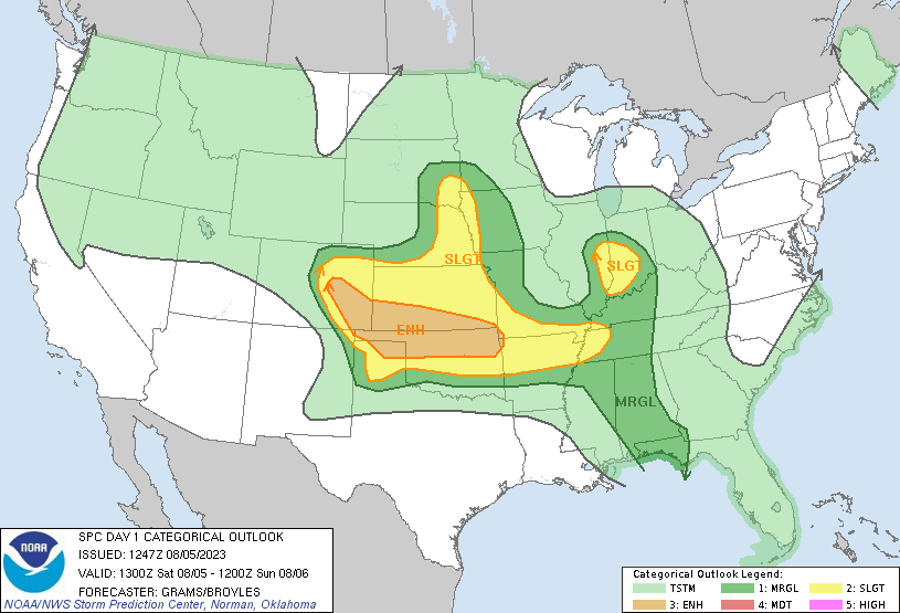
The dark-green shaded area could see an isolated severe thunderstorm Saturday afternoon and Saturday night.
____________________________________________________________________________________
3:20 p.m. Update
The NWS Storm Prediction Center has issued a tornado watch that includes three counties in southwestern Minnesota until 10 p.m. this Saturday:
Here are details of the tornado watch:
URGENT - IMMEDIATE BROADCAST REQUESTED Tornado Watch Number 589 NWS Storm Prediction Center Norman OK 300 PM CDT Sat Aug 5 2023 The NWS Storm Prediction Center has issued a * Tornado Watch for portions of Western Iowa Southwest Minnesota Northeast Nebraska Southeast South Dakota * Effective this Saturday afternoon and evening from 300 PM until 1000 PM CDT. * Primary threats include... A couple tornadoes possible Scattered damaging wind gusts to 70 mph possible Scattered large hail events to 1.5 inches in diameter possible SUMMARY...Widely scattered severe thunderstorms will develop through the remainder of the afternoon into the evening over the watch area. A few of the stronger storms will be capable of a tornado risk, in addition to a large hail and severe wind hazard. The tornado watch area is approximately along and 60 statute miles east and west of a line from 50 miles north northwest of Sioux Falls SD to 20 miles south southwest of Tekamah NE. For a complete depiction of the watch see the associated watch outline update (WOUS64 KWNS WOU9). PRECAUTIONARY/PREPAREDNESS ACTIONS... REMEMBER...A Tornado Watch means conditions are favorable for tornadoes and severe thunderstorms in and close to the watch area. Persons in these areas should be on the lookout for threatening weather conditions and listen for later statements and possible warnings. && OTHER WATCH INFORMATION...CONTINUE...WW 588... AVIATION...Tornadoes and a few severe thunderstorms with hail surface and aloft to 1.5 inches. Extreme turbulence and surface wind gusts to 60 knots. A few cumulonimbi with maximum tops to 450. Mean storm motion vector 26030.
Updates
You can hear updated weather information for Minnesota and western Wisconsin on the MPR News network. Also check out the MPR News display of National Weather Service radar.
You can also check these National Weather Service sites for updated weather info: Twin Cities, Duluth, La Crosse, Wis., Sioux Falls, S.D., and Grand Forks, N.D.
Rain outlook Saturday evening through Sunday evening
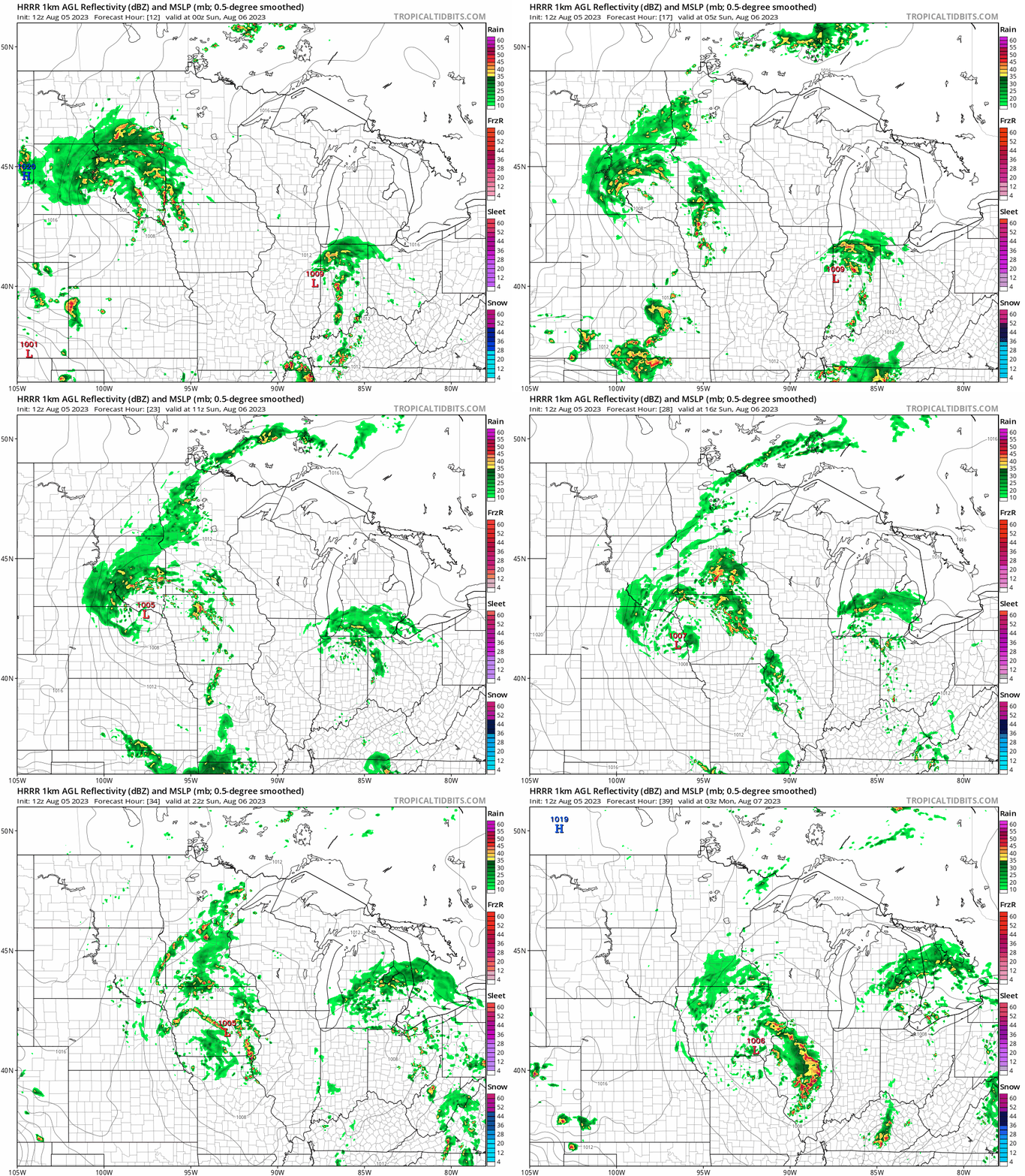
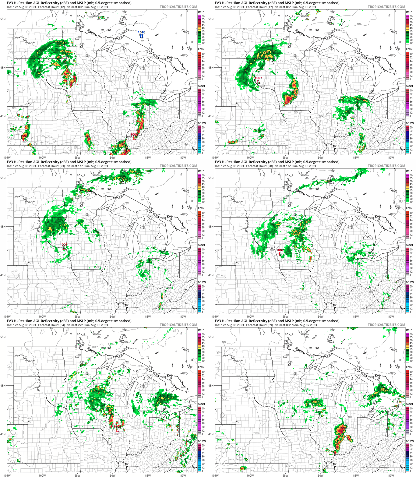
The rain and (and embedded thunderstorm) coverage expands to the east and northeast Saturday night and Sunday. There are interesting differences in rain coverage among the various forecast models.
The National Oceanic and Atmospheric Administration’s High Resolution Rapid Refresh (HRRR) model shows the following rainfall pattern from 7 p.m. Saturday to 10 p.m. Sunday:
NOAA’s FV3 forecast model shows the following rainfall pattern for that same time period:
NOAA’s North American Mesoscale (NAM) forecast model shows the following rainfall pattern:
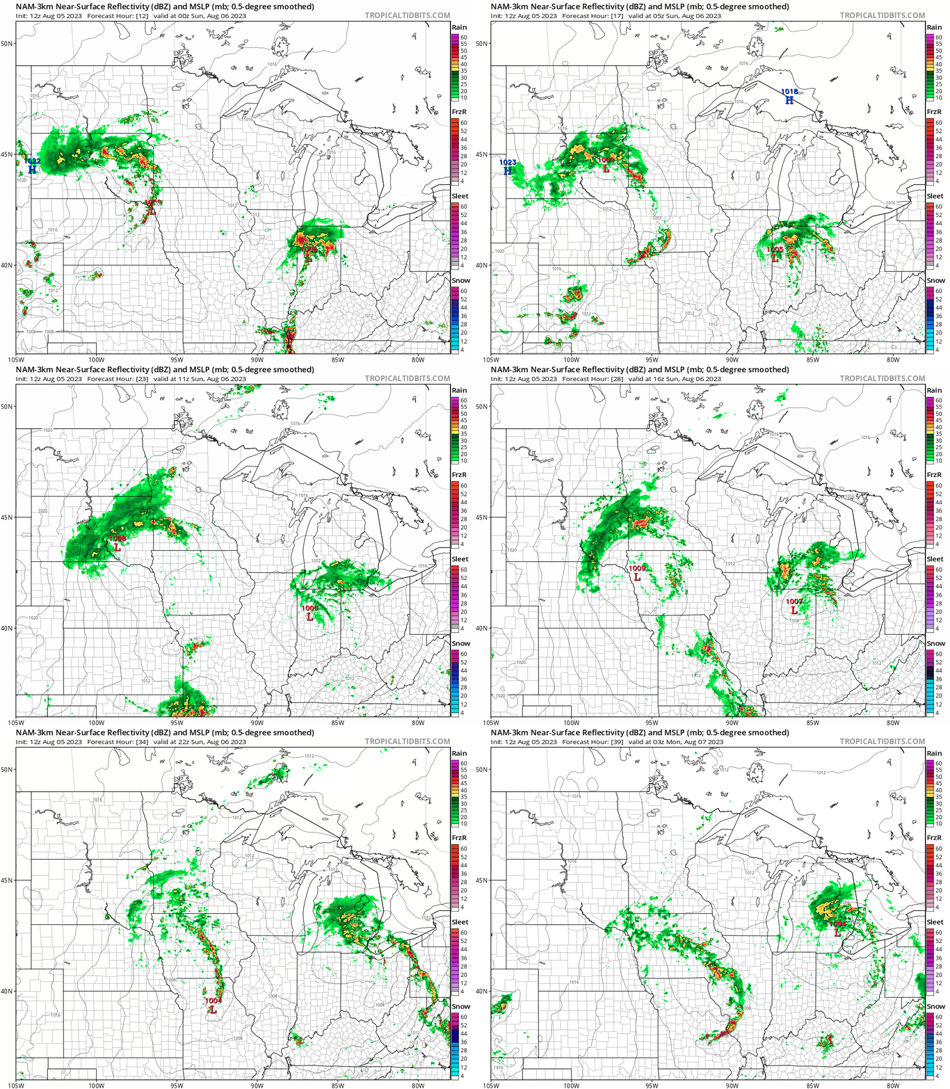
The NAM model shows less rain for the metro area than the other two models.
Rain totals
The National Oceanic and Atmospheric Administration’s HRRR forecast model shows weekend rainfall totals of two-inches or higher (purple shades) across portions of southwestern and south-central Minnesota:

NOAA’s FV3 model shows a somewhat similar pattern:

NOAA’s NAM model keeps the two inch or higher rain totals primarily in southwestern Minnesota:

Afternoon update: New computer model information puts Twin Cities metro area rainfall at less than one inch this weekend, with most of that rain on Sunday.
Temperature trends
The average Twin Cities high temperature is 82 degrees this time of year. Sunday highs will be in the 70s in the metro area and most of Minnesota:

There will be some upper 60s in parts of southwestern Minnesota and portions of west-central Wisconsin could top 80 degrees.
Monday highs will be mainly in the 70s, with a few spots in the Twin Cities metro area touching 80 degrees:

Twin Cities metro area highs are projected to reach the lower 80s on Tuesday, followed by upper 70s Wednesday and Thursday then 80 on Friday.
Programming note
You can hear my live weather updates on MPR News at 7:35 a.m., 9:35 a.m. and 4:39 p.m. each Saturday and Sunday.

