
Air quality alerts across western Minnesota; new heat wave looks likely
String of days in the 90s starts this weekend
Go Deeper.
Create an account or log in to save stories.
Like this?
Thanks for liking this story! We have added it to a list of your favorite stories.


Smoke is once again prompting air quality alerts for western Minnesota. Enjoy the seasonable weather Tuesday and Wednesday before another heat wave hits.
Wildfire smoke prompts more air quality issues
Here we go, yet again. Canadian wildfire smoke is moving back into the region from the northwest.

The smoke is prompting more air quality alerts, primarily for western Minnesota into early Wednesday.

Air quality is expected to diminish to the “unhealthy for sensitive groups” category for western Minnesota and remain moderate in eastern Minnesota.
Turn Up Your Support
MPR News helps you turn down the noise and build shared understanding. Turn up your support for this public resource and keep trusted journalism accessible to all.
Check the latest Minnesota Pollution Control Agency air quality conditions, alerts and forecasts:
Seasonable, pleasant Tuesday and Wednesday
Enjoy the cooler weather we have Tuesday and Wednesday, even though we’ll be right near normal for high temperatures. After midweek, it’s going to get hot again. Highs Tuesday and Wednesday will be mainly in the low 80s south to 70s and even a few 60s north.

Tuesday night will bring cooler readings under clear skies with 50s and 40s for early morning lows Wednesday.

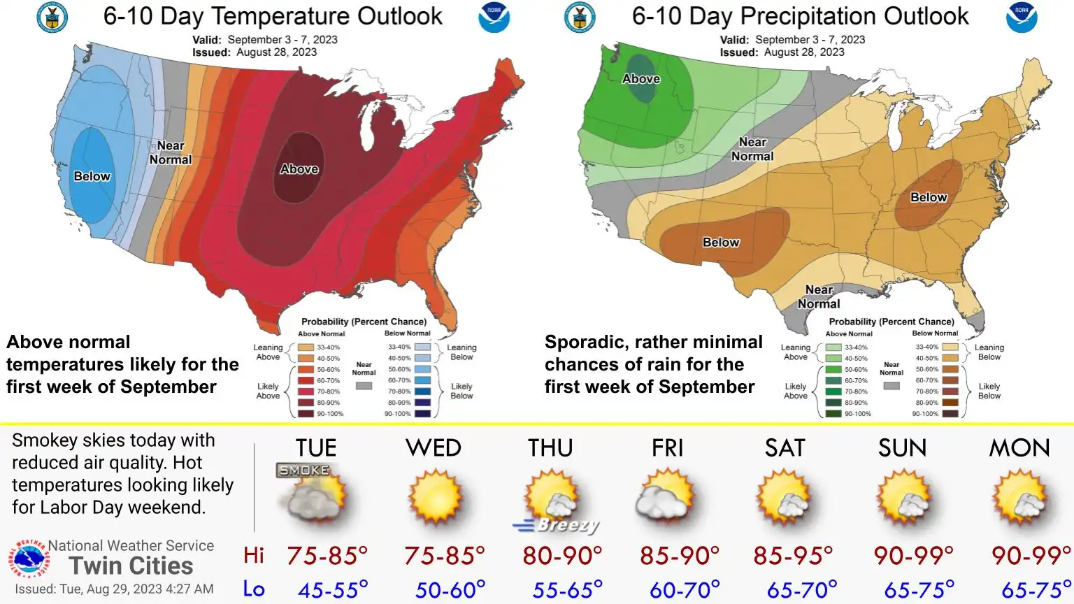
Another heat wave looks increasingly likely
By Thursday and Friday south winds will increase and become blustery as much warmer air moves in again. Highs by Friday will be in the upper 80s with some low 90s appearing in the west. Saturday should see more widespread 90s across southern Minnesota.

We could see a string of 90s for southern Minnesota starting Saturday into next week.


