
Unhealthy air across western Minnesota; cooler conditions persist
Next chance of rain late Sunday

Go Deeper.
Create an account or log in to save stories.
Like this?
Thanks for liking this story! We have added it to a list of your favorite stories.


It’ll be much cooler Wednesday and windy. Clouds will linger for much of eastern and central Minnesota. Air quality will be unhealthy at times in the western half of the state.
Storm reports and rainfall from late Tuesday
We had one last day in the 90s Tuesday across southeastern Minnesota. It was the fifth consecutive day in the 90s in the Twin Cities. It’s the longest September heat wave we’ve had in 45 years.
It also brings our total of 90 degree days up to 32, making it the most since 1988 when we had the most on record of 44 days.

A cold front has brought an end to the latest heat wave and touched off some severe weather in northeastern Minnesota. There were several hail reports and also reports of trees down from the Iron Range to the North Shore.
Turn Up Your Support
MPR News helps you turn down the noise and build shared understanding. Turn up your support for this public resource and keep trusted journalism accessible to all.

Northeastern Minnesota also saw a broad area of 1 to 2 inches of rain with locally higher amounts of 3 to 4 inches around Aitkin and Cotton.

Unhealthy air across western Minnesota
Wildfire smoke has reduced air quality to unhealthy levels in western Minnesota Wednesday. The air quality alert has been expanded to include the western two thirds of Minnesota through 6 p.m. Wednesday evening.

Conditions should improve later in the day into Thursday. Check the Minnesota Pollution Control Agency’s latest air quality conditions, alerts and forecasts:
Cooler Wednesday into Thursday
Expect a cool, cloudy and breezy day Wednesday behind last night’s cold front. Winds will be 10-25 mph from the northwest with higher gusts in western Minnesota.
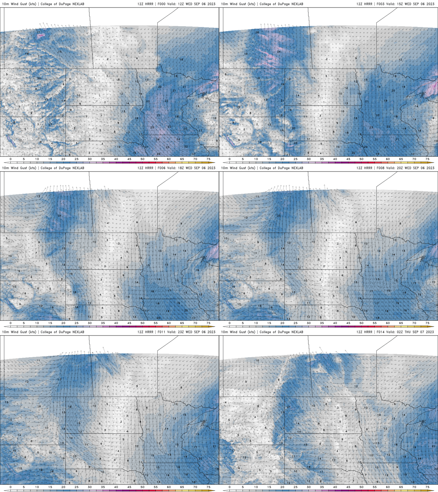
High temperatures will be just in the 60s for most, although parts of northeastern Minnesota will be cooler and far western Minnesota will likely crack 70 where they’ll see more in the way of sunshine. There will be lingering showers in northeastern Minnesota.

Overnight Wednesday night will be downright cool statewide with most places in the 40s. Lows will be mainly in the 50s in the Twin Cities urban core and southeastern Minnesota.

Thursday will become generally brighter as low clouds slowly diminish. Highs will be mostly in the low 70s in central and western Minnesota though northeast Minnesota will be just in the 60s.

Warming back up Friday and Saturday
By Friday we’ll have sunny skies and warmer temperatures. Highs will be mostly in the 70s statewide, right near normal. Saturday will be warmer still with highs near 80 in southern Minnesota.

The next chance of rain moves in late Sunday into Monday as another cool front approaches Minnesota.


