Warming trend this week with rain potential later in the week
Highs will be 10 to 15 degrees above normal for some
Go Deeper.
Create an account or log in to save stories.
Like this?
Thanks for liking this story! We have added it to a list of your favorite stories.
Monday will be warmer with increasing high clouds and the chance of an isolated shower in southern Minnesota. Tuesday and Wednesday will bring highs in the 80s south.
Warmer than normal temperatures with an unsettled pattern developing
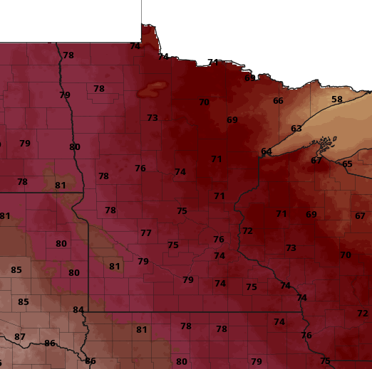
After a seasonably cool weekend, temperatures climb back above normal for most of this week. Highs Monday will be well into the 70s with some low 80s west. Northeast Minnesota will remain somewhat cooler with highs in the 60s.
Clouds will increase through the day as a weak disturbance passes through the region. There’s the slightest chance of an isolated shower or two in southern Minnesota.
Highs Tuesday will be even warmer with 80s across southern Minnesota and 70s north. Those temps will persist through Friday.
A potentially unsettled pattern develops starting Wednesday west into the weekend with several chance of rain. It’s still early but we could see some hopeful rains.
Turn Up Your Support
MPR News helps you turn down the noise and build shared understanding. Turn up your support for this public resource and keep trusted journalism accessible to all.