
One more summerlike day Tuesday; showers and much cooler air ahead
A more typical October chill sets in by late week

Go Deeper.
Create an account or log in to save stories.
Like this?
Thanks for liking this story! We have added it to a list of your favorite stories.


Tuesday will bring one more day in the 80s for southern Minnesota. A cold front will spark showers and thunder later in the day into the overnight. Much cooler air is coming.
Thunderstorm chance, big temperature drop
Tuesday will be another July-like day with highs in the 80s across southern Minnesota, well above the normal which is in the mid-60s.

A cold front will be the focus for some scattered showers and thunderstorms in the west that will make their way east in the late evening and overnight Tuesday night.
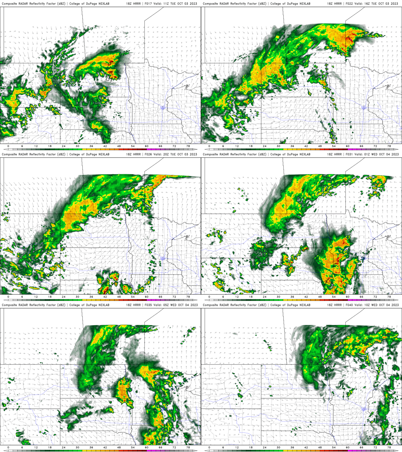
This cold front is just the first that will be knocking down temperatures this week. Highs Wednesday will still be above normal, but cooler, in the 70s south and 50s far north.

A clipper system brings the chance of more spotty showers Thursday into Friday and will knock down temperatures even more. Highs Friday and Saturday will be in just the 50s in southern Minnesota and 40s north, the coldest such readings since late April.
Turn Up Your Support
MPR News helps you turn down the noise and build shared understanding. Turn up your support for this public resource and keep trusted journalism accessible to all.

