
Mild Friday, late showers up north; windy Saturday; big changes next week
Highs Friday will be more than 10 degrees above normal

Go Deeper.
Create an account or log in to save stories.
Like this?
Thanks for liking this story! We have added it to a list of your favorite stories.


Another clipper system is approaching Minnesota pulling in warmer air and creating showers late in the day for northern Minnesota. Saturday will be windy behind it.
Next week could bring big changes to the state’s weather.
Mild Friday as clipper system moves through
Another clipper system is pulling in much warmer air ahead of it along with sunshine for most of Minnesota most of the day. Highs will be well into the 60s with even some low 70s in southwestern Minnesota.

Showers will develop late in the day for northern and northeastern Minnesota into northwestern Wisconsin overnight. Some showers will linger into Saturday for northeastern Minnesota.
Turn Up Your Support
MPR News helps you turn down the noise and build shared understanding. Turn up your support for this public resource and keep trusted journalism accessible to all.
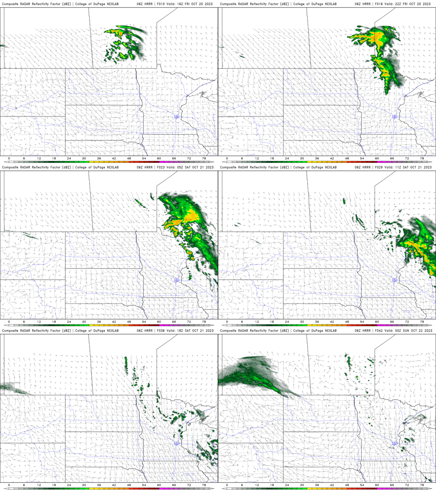
Windy Saturday with lingering showers north
In the wake of the clipper, it will be windy statewide Saturday with gusts as high as 25 to 35 mph from the northwest.
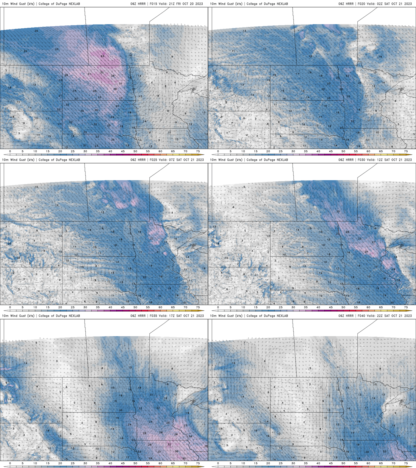
Saturday and Sunday will be cooler but seasonable with highs mostly in the 50s to even near 60 in far southern Minnesota. Parts of northeastern Minnesota will be cooler in the upper 40s.

Mild start next week, then temps drop
We begin next week rather mild with highs back into the 60s across southern Minnesota, well above the normal of low to mid-50s.

The next storm system arrives Tuesday night into Wednesday bringing more rainfall potential for much of Minnesota, although some models disagree on the track.
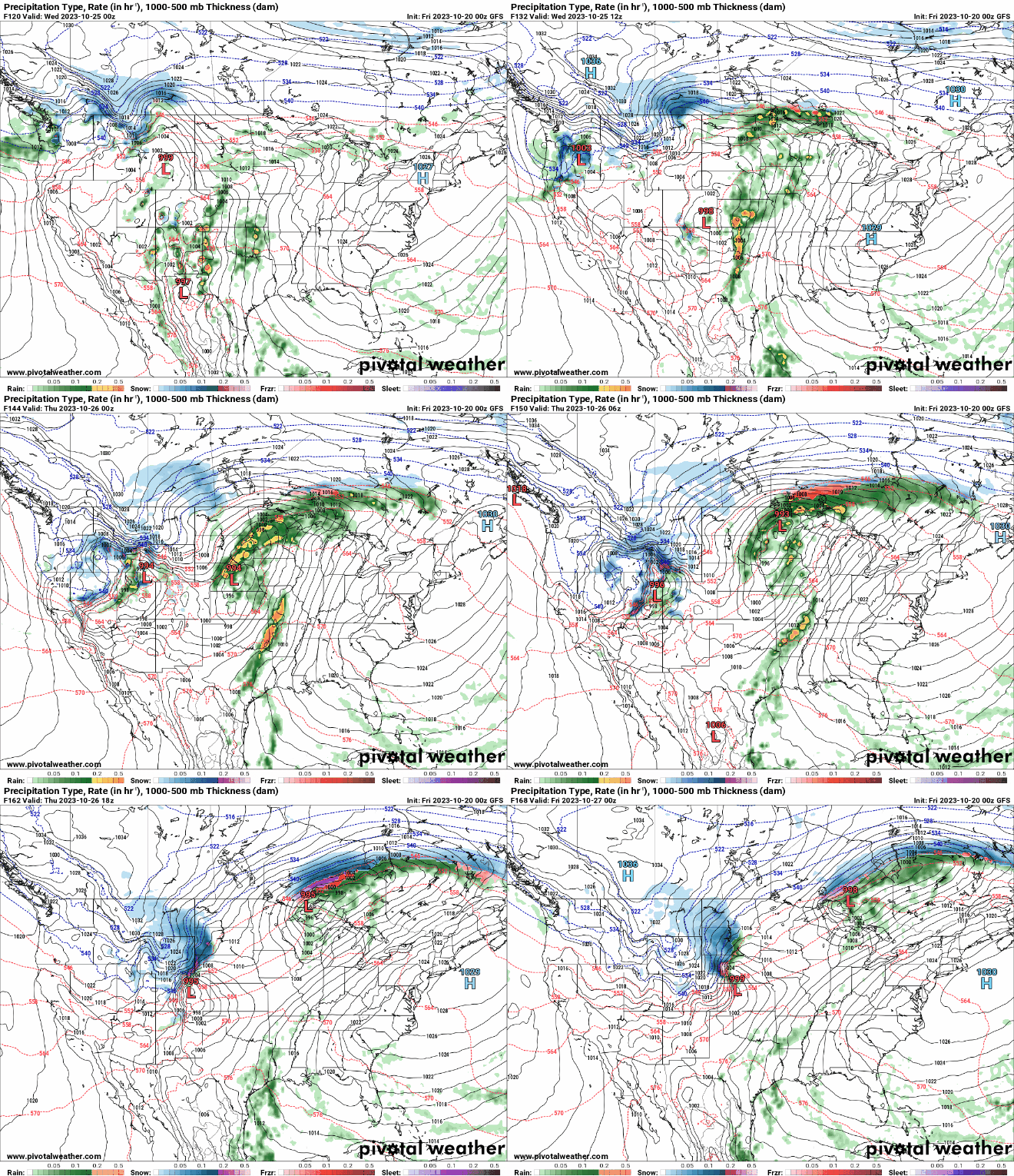
We could be set up for an active pattern with a couple other disturbances moving through that will draw down some of the coldest air of the season.
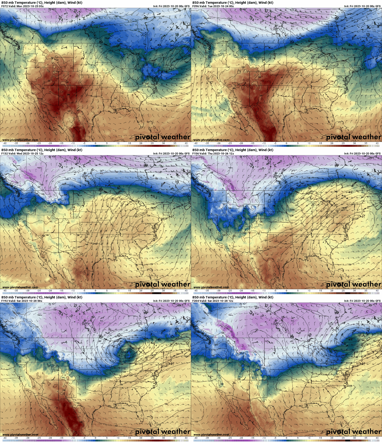
The trusty European Centre for Medium-Range Weather Forecasts model has at times brought in the cold also, but in recent runs has kept the mild air around.
The maps below show the differences between the European Centre model, NOAA’s Global Forecast System model (American) and the Environment Canada model for high temperatures next Saturday, Oct. 28.

These temperatures will affect the potential for snowfall too. At this point, northern Minnesota looks favored for potentially its first snowfall, but there remains a lot of uncertainty with the extent of cold air and moisture tracks.


