
Mild Tuesday with thunderstorms possible; more rain ahead and cold air
A second storm system develops Wednesday night
Go Deeper.
Create an account or log in to save stories.
Like this?
Thanks for liking this story! We have added it to a list of your favorite stories.


Thunderstorms develop again Tuesday into Tuesday night. Another storm system will bring more rain Wednesday night with snow possible northwest early Friday.
A stormy setup
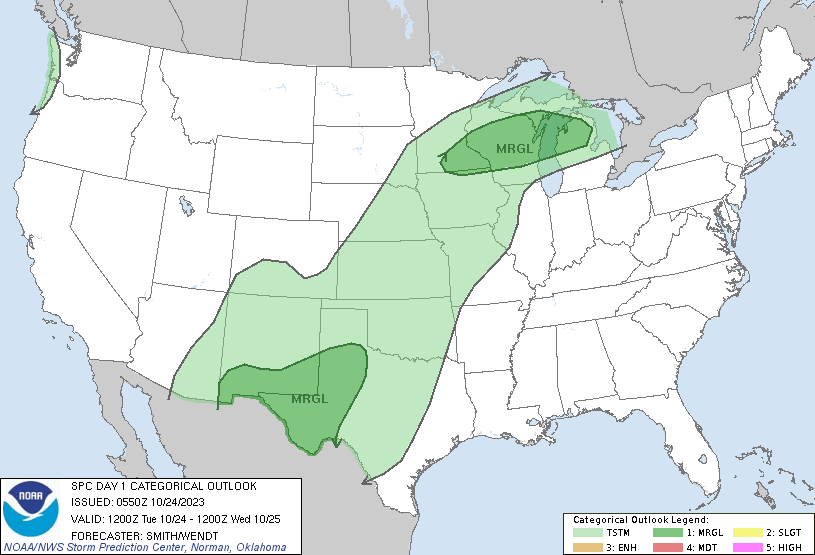
There will be two main areas to watch for precipitation Tuesday. One will be an area of storms that redevelop later in the day Tuesday in southern Minnesota. Some of those storms will be strong. Another will be scattered showers across far northern Minnesota.
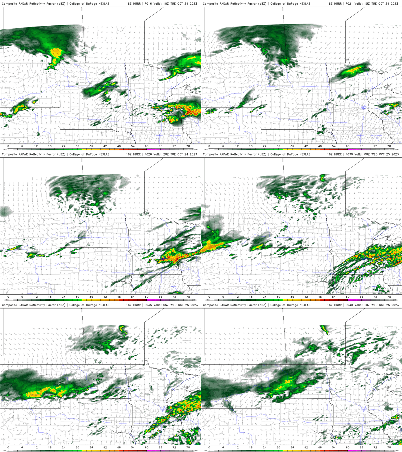
Tuesday will be mild with highs into the 60s in southern Minnesota with even 70s in southeast Minnesota. Northwest Minnesota will start to cool off with highs in the 40s.

There’s a marginal risk (level 1 of 5) of severe weather with the storms that develop in southern Minnesota. The primary threat is some large hail.
Wednesday and Thursday will continue with above normal temperatures in southern Minnesota but cold will start to seep in across northern Minnesota. A second round of moisture develops Wednesday night into Thursday and Friday. Some of that precipitation will turn over to snow in northwest Minnesota Thursday night into early Friday.
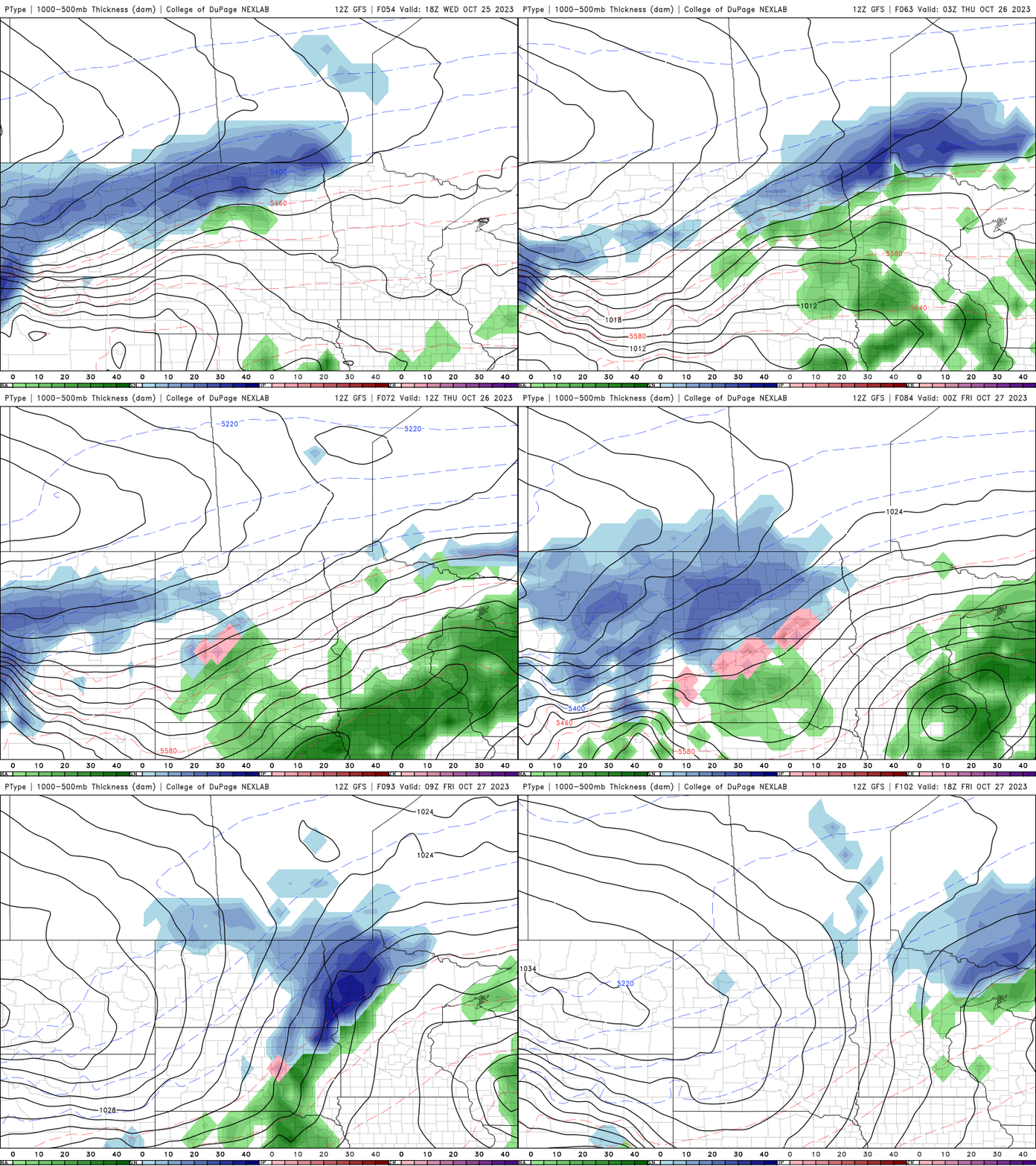
It will be much colder behind this second system with highs just in the 20s, 30s and low 40s Saturday and Sunday. Snow showers will also be possible mixed with sprinkles.
Turn Up Your Support
MPR News helps you turn down the noise and build shared understanding. Turn up your support for this public resource and keep trusted journalism accessible to all.

