
A dry break most of Wednesday but more rain develops; snow northwest
Temperatures drop from north to south into Friday

Go Deeper.
Create an account or log in to save stories.
Like this?
Thanks for liking this story! We have added it to a list of your favorite stories.


We get a mostly dry break Wednesday with mild temperatures south and chilly temperatures north. More rain develops Wednesday night and rain will turn into snow in northwest Minnesota into Thursday.
A stormy setup
Most of Wednesday should be mainly dry for most of Minnesota. We’ll be in between the two main rounds of precipitation after a soggy Tuesday. It will still be mild in southern Minnesota with highs in the 60s, but considerably chillier northwest.

More precipitation develops Wednesday evening into the overnight. It looks pretty soggy across much of the state into Thursday.
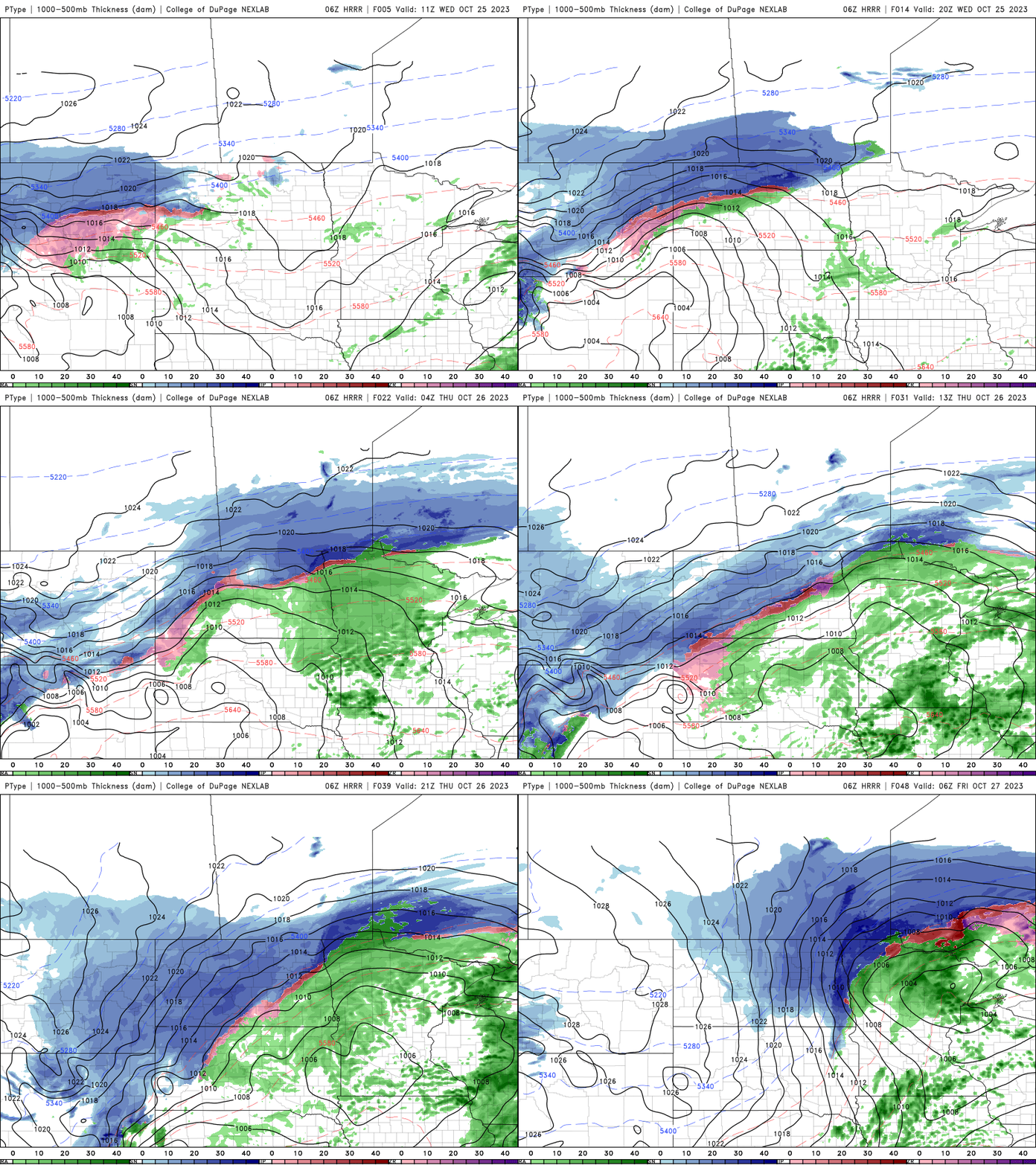
That precipitation will be turning into snow in northwest Minnesota. Snowfall accumulation can be expected there into early Friday.

Much colder air will continue to sweep through Minnesota slowly from Wednesday into Friday. By the weekend we’ll see subfreezing highs in northwest Minnesota to just around 40 in far southern Minnesota. Snow showers will be visible as well statewide Saturday.
Turn Up Your Support
MPR News helps you turn down the noise and build shared understanding. Turn up your support for this public resource and keep trusted journalism accessible to all.

