
Cold and windy statewide Friday; snow showers Saturday
Temps well below normal persist into next week

Go Deeper.
Create an account or log in to save stories.
Like this?
Thanks for liking this story! We have added it to a list of your favorite stories.


Blustery northwest winds usher in much colder air with falling temps through the day Friday. We’ll see rain and snow showers into northern Minnesota. Snow showers develop south on Saturday.
Here comes a taste of winter!
Winds are howling as the coldest air of autumn so far blows across Minnesota. Northwest winds will be 15-25 mph with higher gusts up to 40 mph.
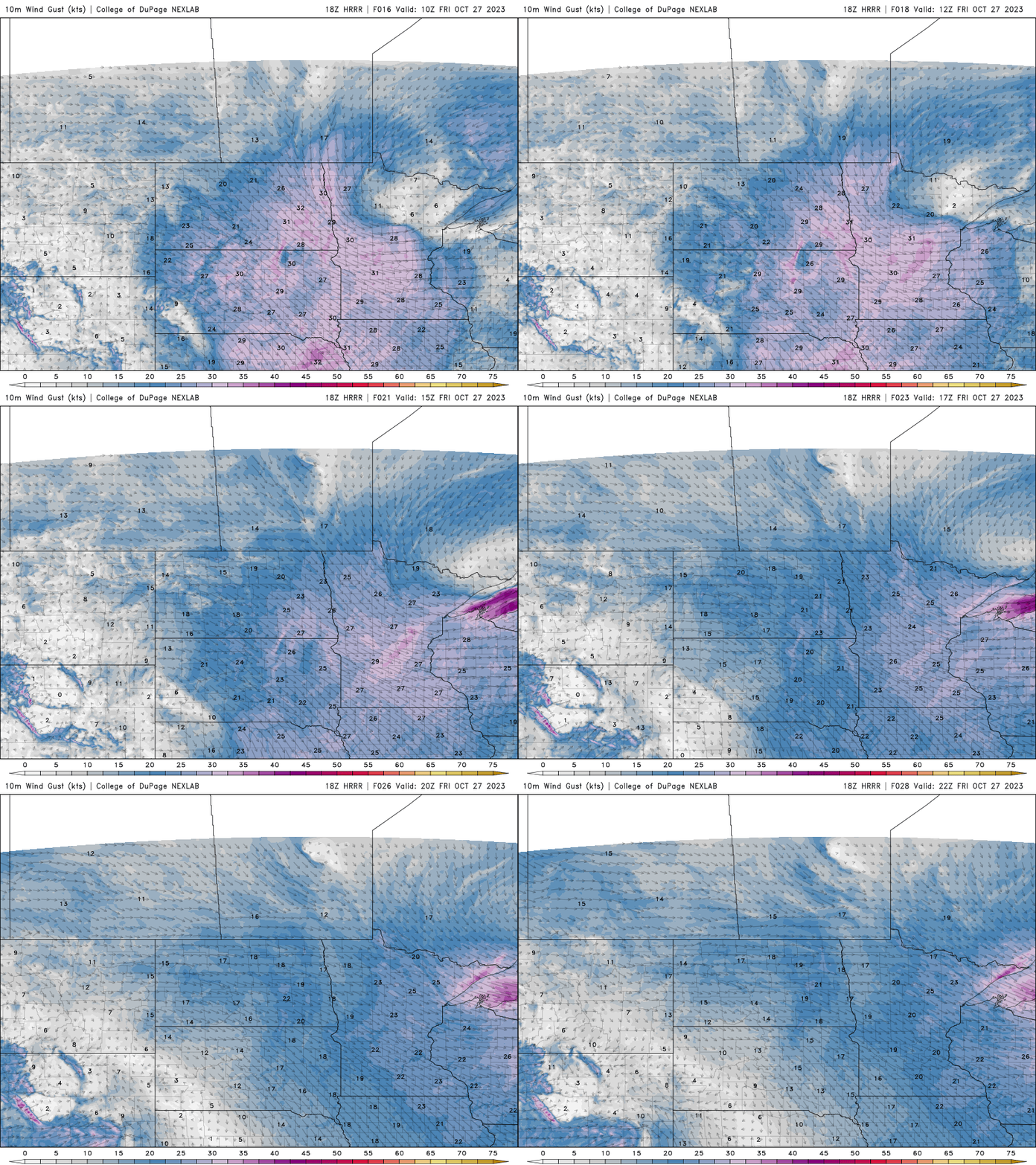
The high temperature of the day is behind us. Most of Minnesota will see temperatures steady or fall into the 30s by the afternoon, with 20s in the northwest.

Look for lingering scattered rain and snow showers for northern Minnesota and clouds elsewhere through Friday.
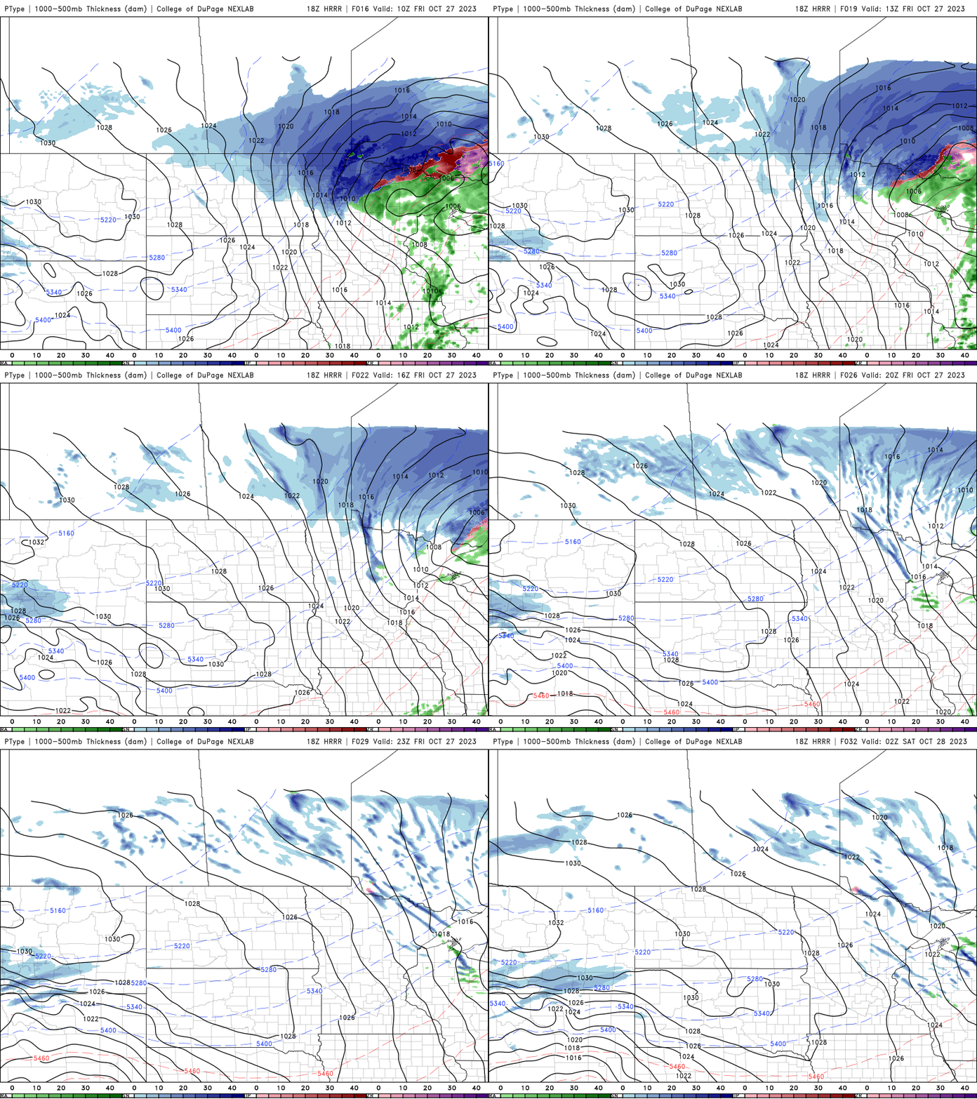
Another system is poised to affect the southern half of Minnesota Saturday that will bring snow showers. Light accumulations are possible, especially on grassy surfaces.

It will also be cold Saturday and Sunday with highs only in the 20s and 30s. Overnight lows will be in the 20s south to teens north. Northwestern Minnesota could see single-digit lows overnight Saturday into Sunday. We remain colder than normal into most of next week.
Turn Up Your Support
MPR News helps you turn down the noise and build shared understanding. Turn up your support for this public resource and keep trusted journalism accessible to all.

