
Colder weather lingers; warmer, seasonal temps return Friday
Some rain and snow chances this weekend as well

Go Deeper.
Create an account or log in to save stories.
Like this?
Thanks for liking this story! We have added it to a list of your favorite stories.


Wednesday will yield below normal-temperatures still but by Friday we’ll see readings closer to normal, in the 40s. Rain and snow chances return for the weekend.
Still chilly Wednesday, Thursday
Clouds are racing back into the region Wednesday and cold air still lingers. Highs will be in the 30s for most but colder pockets will persist into northwestern Minnesota while parts of southwestern Minnesota could reach 40 degrees.

Overnight Wednesday into Thursday we’ll see partly cloudy skies and temperatures back below freezing statewide with lows in the 20s south and teens north.

Thursday should see more sunshine across southern Minnesota and temperatures will be slightly warmer there as a result.
Turn Up Your Support
MPR News helps you turn down the noise and build shared understanding. Turn up your support for this public resource and keep trusted journalism accessible to all.

Weekend’s warmer with possible precipitation
We’re finally back toward normal temperatures Friday after what’s been a rather cold several days. Highs will be in the 40s to even near 50 across southern Minnesota.

We also have a few different upper-level waves, disturbances moving through that will touch off some rain and snow chances over the weekend into Monday.
Whether precipitation falls as rain or snow and where will depend on timing. Overnight timing will likely yield some snow while daytime precipitation will be mostly rain.
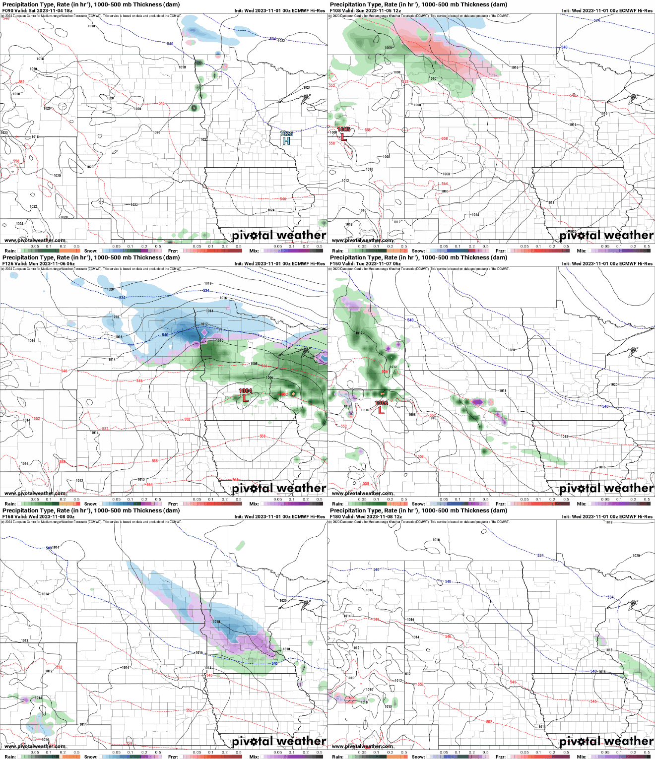
Neither of these systems will have a lot of rainfall, but over the course of a few days we could see up to one-half inch of rainfall in southern Minnesota.

Where snow will fall through Monday is still very much up in the air with various possibilities based on timing and storm tracks.


