
Quiet Sunday weather; recap of Saturday wind and snow
Much lighter winds today
Go Deeper.
Create an account or log in to save stories.
Like this?
Thanks for liking this story! We have added it to a list of your favorite stories.


We had some window-rattling wind gusts on Saturday, but snow amounts were fairly light in much of Minnesota, with the exception of the northwest.
The peak Saturday wind gust at Minneapolis-St. Paul International Airport was 39 mph. The NWS posted a list of some much higher gusts from elsewhere in Minnesota:

Brainerd reported a gust of 45 mph, Detroit Lakes had 44 mph gust and Duluth reported a peak gust of 41 mph. Just over the border, Grand Forks, North Dakota had a Saturday wind gust of 63 mph and Fargo had a gust of 61 mph.
Snow totals
Many observers take their snow measurements in the morning and it takes a while for those snow tallies to get onto all the maps.
Turn Up Your Support
MPR News helps you turn down the noise and build shared understanding. Turn up your support for this public resource and keep trusted journalism accessible to all.
Parts of northwestern Minnesota saw several inches of snow Friday evening into Saturday morning. Thief River Falls reported six inches of new snow, as did Middle River, in Marshall County. There was a report of 5.4 inches in Crookston, which is in Polk County of northwestern Minnesota. Lighter snow totals occurred in eastern Minnesota and western Wisconsin.
Additional snow reports will be found here as they are posted by the National Weather Service. You can pan and zoom the linked map to see snow totals plus the date and time of the measurement. Here’s how the snow report map looked at 8 a.m. Sunday:

The snow data from the Twin Cities metro area hadn’t yet appeared on the NWS map above, but we have snow info from the Community Collaborative Rain, Hail and Snow Network, also known as CoCoRaHS:

Saturday/Saturday night snow totals were generally around one-half inch in the metro area with 2 inches at Lindstrom, in Chisago County.
MSP airport had 0.4 (four-tenths of an inch) of snow Saturday. I tallied 0.6 of an inch in St. Paul.
Quiet Sunday weather
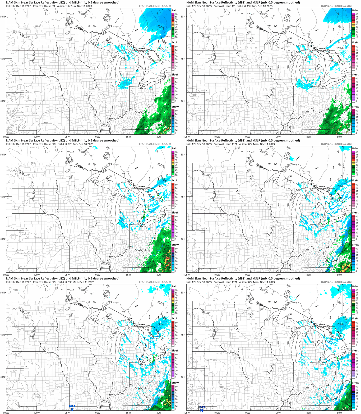
Measurable snow isn’t expected in Minnesota or western Wisconsin Sunday or Sunday evening. Parts of northeastern Minnesota could see a few flurries at times.
The National Oceanic and Atmospheric Administration’s North American Mesoscale forecast model shows the potential precipitation pattern from 10 a.m. to 11 p.m. this Sunday:
Sunday highs will be in the 20s across much of northern Minnesota, with mostly lower 30s elsewhere in Minnesota and in western Wisconsin:

Metro area highs are expected to be very close to the average Dec. 10 Twin Cities high temp of 31 degrees
Programming note
You can hear my live weather updates on MPR News at 7:35 a.m., 9:35 a.m. and 4:39 p.m. each Saturday and Sunday

