
A bit brighter and warmer Thursday. More precipitation arrives Sunday
Some clouds will linger in eastern Minnesota yet Thursday

Go Deeper.
Create an account or log in to save stories.
Like this?
Thanks for liking this story! We have added it to a list of your favorite stories.


Updated 9 a.m.
We’ll still have some lingering clouds east on Thursday as that storm system is slow to move on. Temperatures will be a little warmer, especially Friday. More rain and possibly snow arrives Sunday.
Latest drought monitor is unchanged
The latest drought monitor is out and it is unchanged from last week. The data does not include precipitation in southeastern Minnesota that occurred after 7 a.m. Tuesday.

Many drought-stricken areas saw one-half inch to as much as an inch and a half of liquid equivalent precipitation the last couple of days.

Still breezy but slightly warmer Thursday and especially Friday
Look for a still breezy Thursday. Winds will be 10-20 mph from the north, although lighter than Wednesday.
Turn Up Your Support
MPR News helps you turn down the noise and build shared understanding. Turn up your support for this public resource and keep trusted journalism accessible to all.
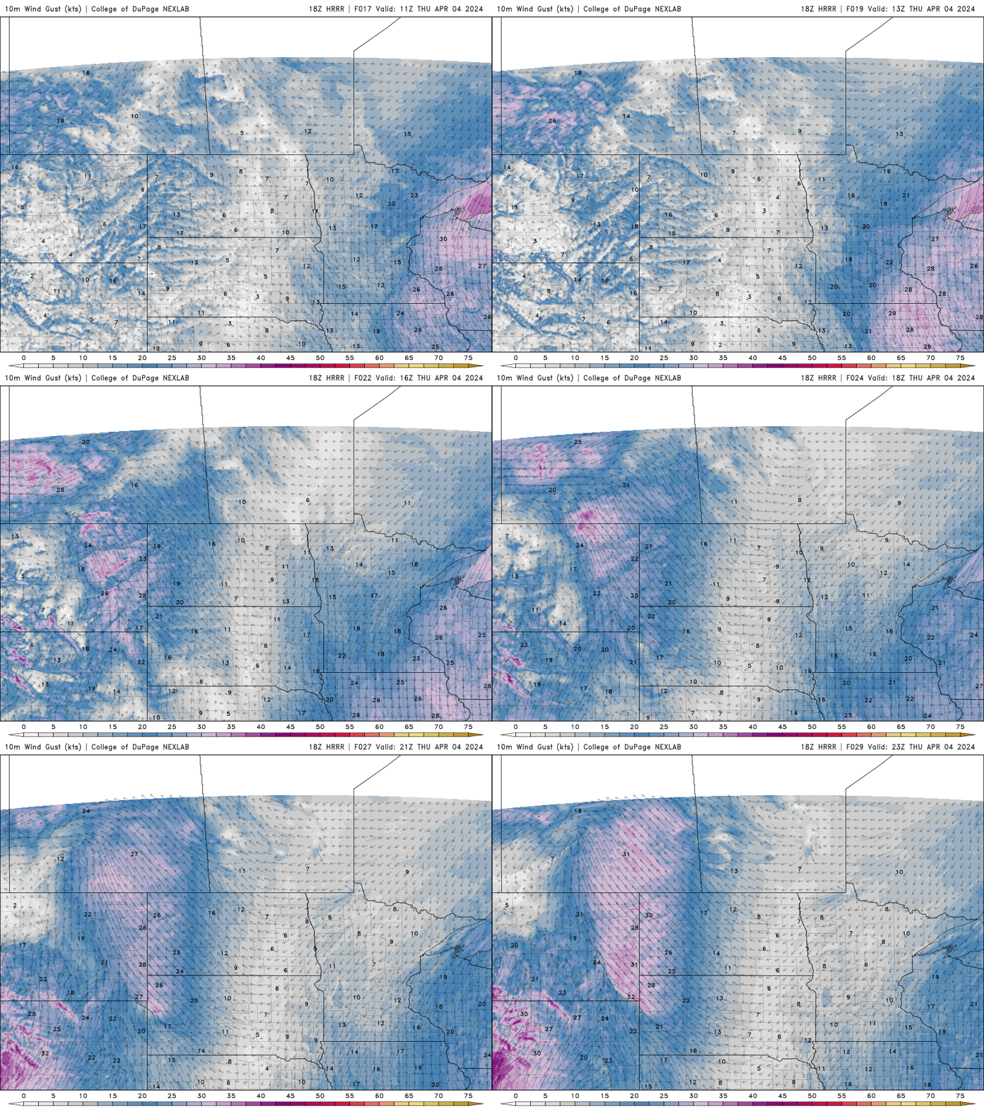
High temperatures should be a bit warmer too, closer to 50 degrees in the Twin Cities as we see a little more sunshine.
Clouds will still linger some into eastern Minnesota, the result of that storm to our east that is slow to move on.
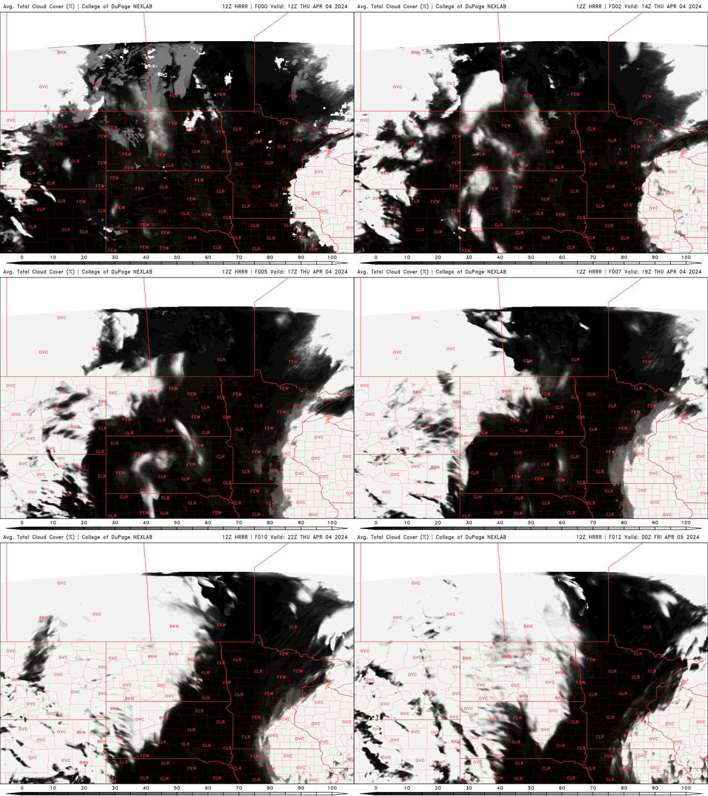
Friday should be warmer and brighter with sunshine across most of the state. Highs will be well into the 40s and 50s.

Saturday will be more of the same.
Next system brings rain and snow Sunday
Enjoy those couple warmer and brighter days, the next storm system will bring rain and potentially snow showers to Minnesota again Sunday into Monday.
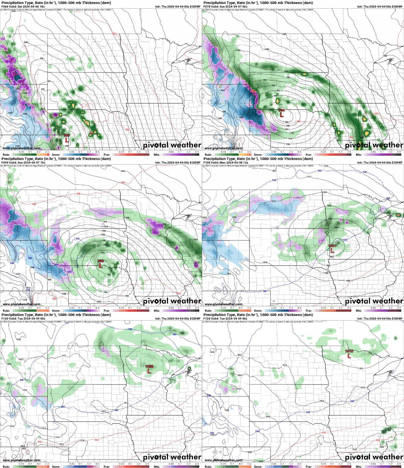
Forecast models continue to hint at the possibility of some slushy snowfall Sunday.

Temperatures look warmer next week, eventually. Highs should be in the 60s across southern Minnesota by midweek, though the models have kept delaying this trend.
Lots of clouds for the solar eclipse Monday
Eclipse viewers beware. In Minnesota, it will be a partial eclipse and, sadly, it looks mostly cloudy.

For those looking to see the total eclipse, the best chances of clearer skies are in northern Arkansas to southern Missouri, Illinois into Indiana and then in the northeast across eastern New York into Vermont, New Hampshire and Maine.


