
Another mild day ahead before arctic air slams in Friday afternoon
Winds increase and gusts over 40 mph

Go Deeper.
Create an account or log in to save stories.
Like this?
Thanks for liking this story! We have added it to a list of your favorite stories.


Our January thaw continues with one more mild day of above-freezing temperatures. Winds will pick up as a strong arctic front moves through, with gusts reaching 30-40 mph. This next surge of arctic air will bring dangerously cold wind chills, ranging from 30 to 40 below zero.
Another mild day
A brief respite from the cold as Friday’s highs warm into the 30s and 40s. On Thursday, southwestern and western Minnesota saw temperatures around 43 degrees in Madison and 42 in Canby. Our record high temperature for this date is 44 degrees, dating back to 1894.

Weather conditions will change quite dramatically as our arctic front slams into the region. Winds will increase out of the northwest and gusts over 30 to 40 mph.
Temperatures will continue to drop across the state through Friday afternoon and into the evening hours.
Turn Up Your Support
MPR News helps you turn down the noise and build shared understanding. Turn up your support for this public resource and keep trusted journalism accessible to all.
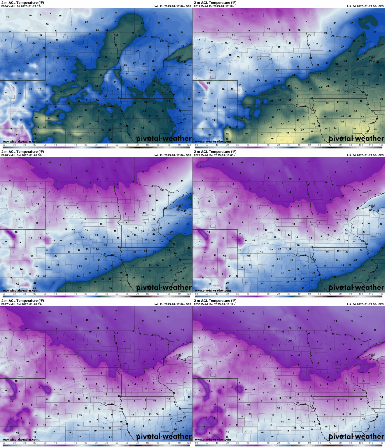
Light snow will accompany the front, bringing an inch or less to northern Minnesota. With the snow and breezy winds, a winter weather advisory has been issued for northwestern Minnesota.


The heart of the arctic air won't settle in until Saturday night through Tuesday, but temperatures will begin to drop significantly on Saturday. Single-digit highs, both above and below zero, are expected across the state.

Dangerously cold wind chills are expected as temperatures plummet to subzero highs on Sunday and Monday. Wind chills between 20 and 40 below zero will be widespread.

Extreme cold watches and warnings will likely be issued in response to this frigid forecast.


