
Foggy start with 40s in the forecast; snow arrives tonight
Some areas may receive up to half a foot of snow by Monday morning

Go Deeper.
Create an account or log in to save stories.
Like this?
Thanks for liking this story! We have added it to a list of your favorite stories.


A mild, foggy start with temperatures in the 30s Sunday morning. Fog will clear as northwesterly winds move in, gradually cooling temperatures in the late afternoon after reaching the low 40s. Our next weather system will move through overnight into Monday morning, bringing a swath of snow with totals possibly reaching up to half a foot.
Mild and foggy
Temperatures will climb into the 40s for the metro area with even mid-40s expected in southern Minnesota. Northwestern Minnesota staying cooler with highs in the teens and 20s and breezy northwest winds.

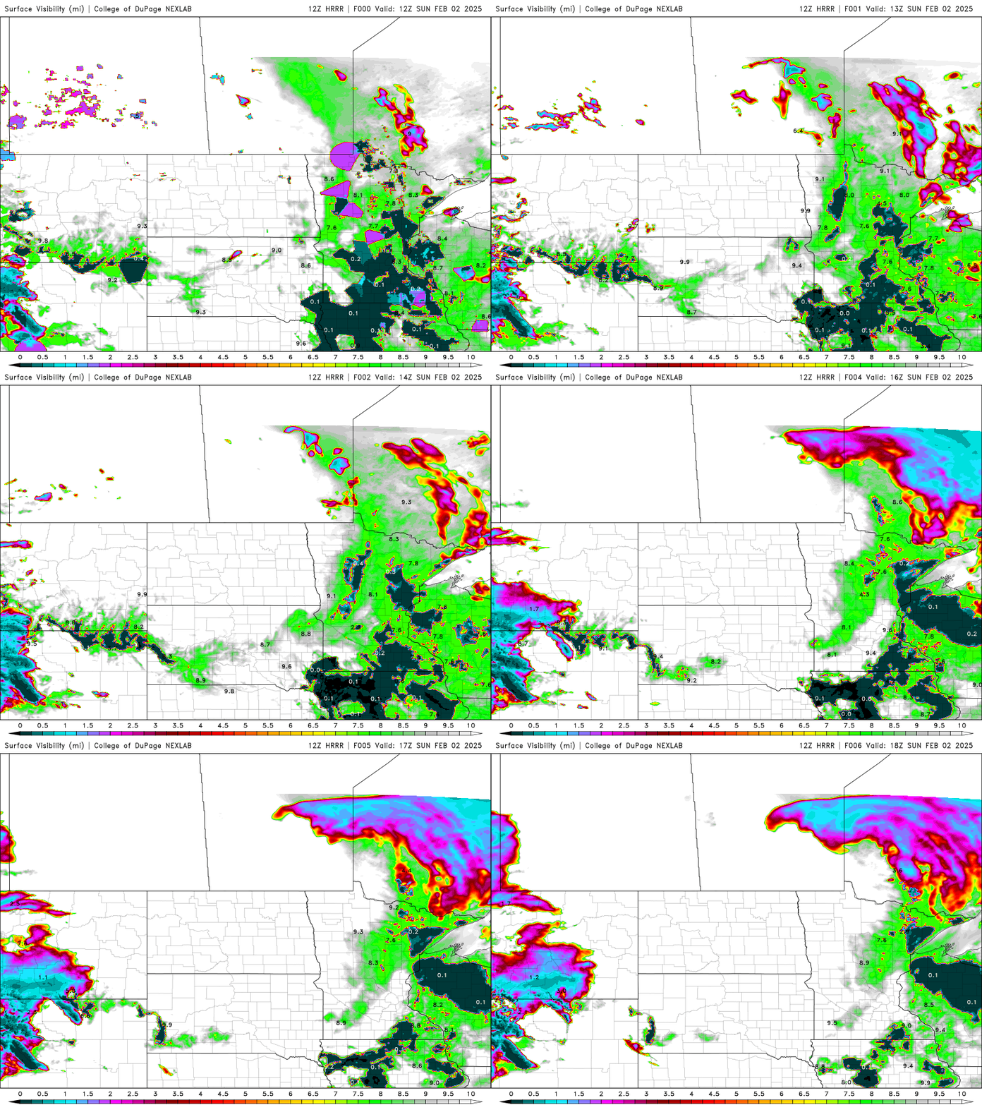
The northwest winds will help clear the fog, gradually lowering temperatures a bit through the early afternoon. Surface visibility maps indicate the fog should be gone by noon on Sunday.
Turn Up Your Support
MPR News helps you turn down the noise and build shared understanding. Turn up your support for this public resource and keep trusted journalism accessible to all.
Winter weather advisory
Our next weather system will move in quickly from Sunday night to Monday morning, bringing 2-4 inches of snow, with some areas seeing up to half a foot!
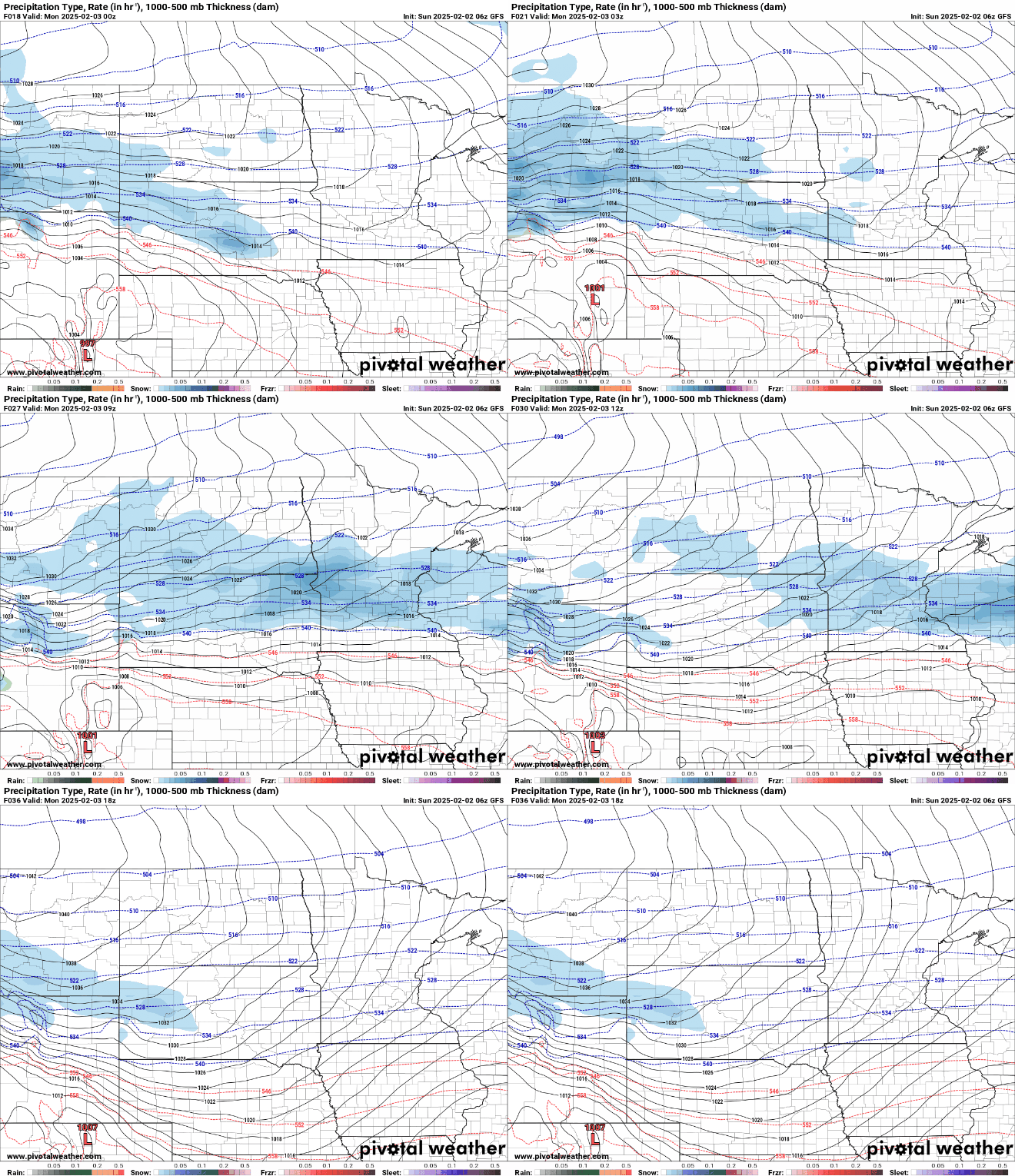
Winter weather advisories will go into effect at 9 p.m. Sunday, covering a stretch from border to border, including areas from Traverse and Big Stone counties eastward to Isanti and Chisago counties. Currently, the metro area is just south of the main snow band, but that could shift before the system arrives.
There will be a sharp cut-off in snow amounts on both the northern and southern edges of the snow band. This will be the kind of event where you might see no snow at all, but just 10 miles north or south, there could be 4 plus inches.

As it stands, the metro area could see anywhere from 1-4 inches of snow, depending on where the snow band sets up. Higher amounts are expected to be concentrated near the Fergus Falls and Alexandria areas.

There will be a stark difference in low temperatures across the state Sunday night. Northern Minnesota will dip into the single digits below zero, while southeastern areas will see lows in the upper 20s to low 30s.

Cooler temperatures with an active weather pattern
Temperatures will fluctuate next week, with highs bouncing between the 20s and teens. Our average high for next week is in the mid-20s.
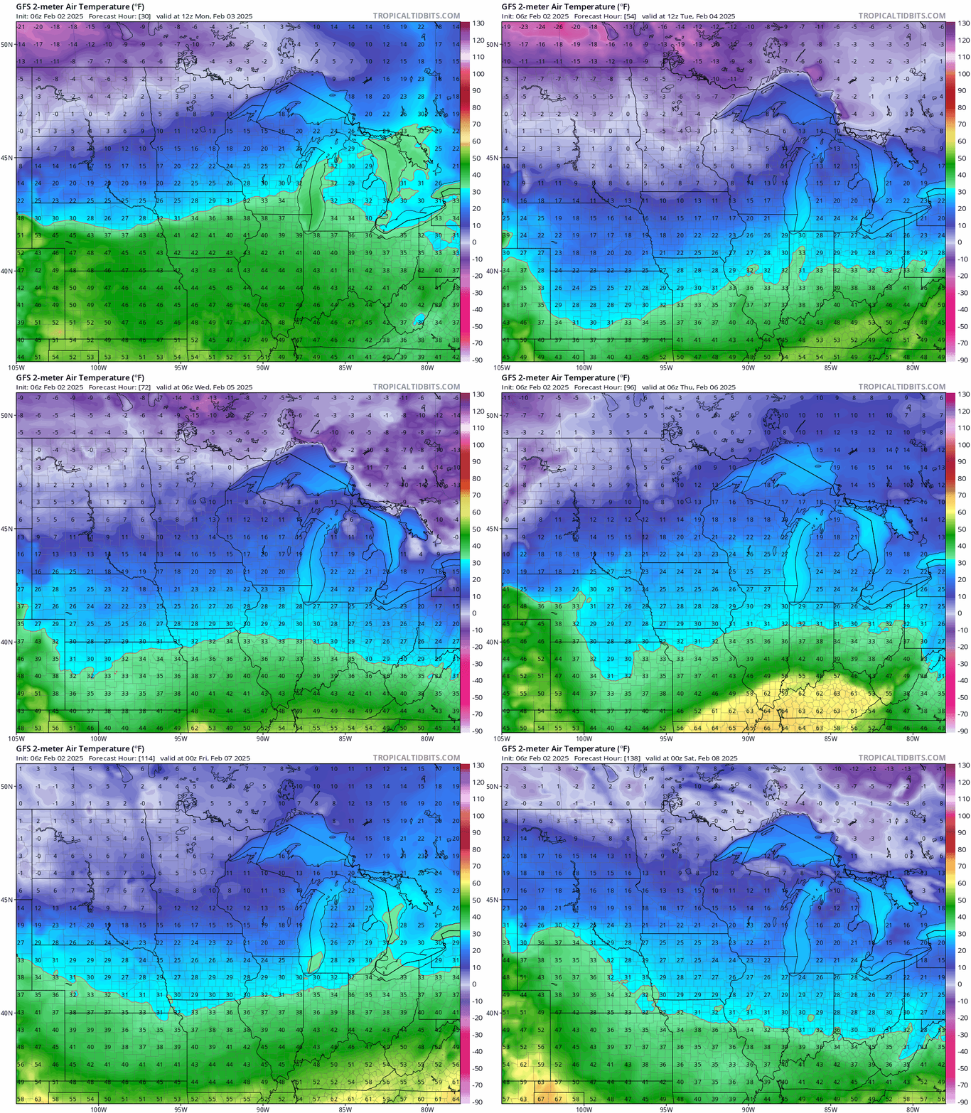
We have two chances for snow next week. The first will arrive late Wednesday into Thursday, followed by another system Friday night into Saturday. We’ll keep an eye on both, but by the end of next weekend, some areas could see snow totals in the double digits!

