
Moderate risk of severe weather Monday for Minnesota
Morning storms will be followed by a stronger, second round in the afternoon

Go Deeper.
Create an account or log in to save stories.
Like this?
Thanks for liking this story! We have added it to a list of your favorite stories.


Monday brings a moderate risk of severe weather with a significant threat of tornadoes, large hail, damaging winds and heavy rain. Expect multiple rounds of storms as warm temperatures in the 70s and 80s combine with dewpoints in the 60s, creating favorable conditions for severe weather to develop throughout the day.
Severe weather threat
Central, southern and southeastern Minnesota are under a level 4 out of 5 moderate risk for severe weather on Monday, with some areas of the state also in an enhanced risk (level 3 out of 5).
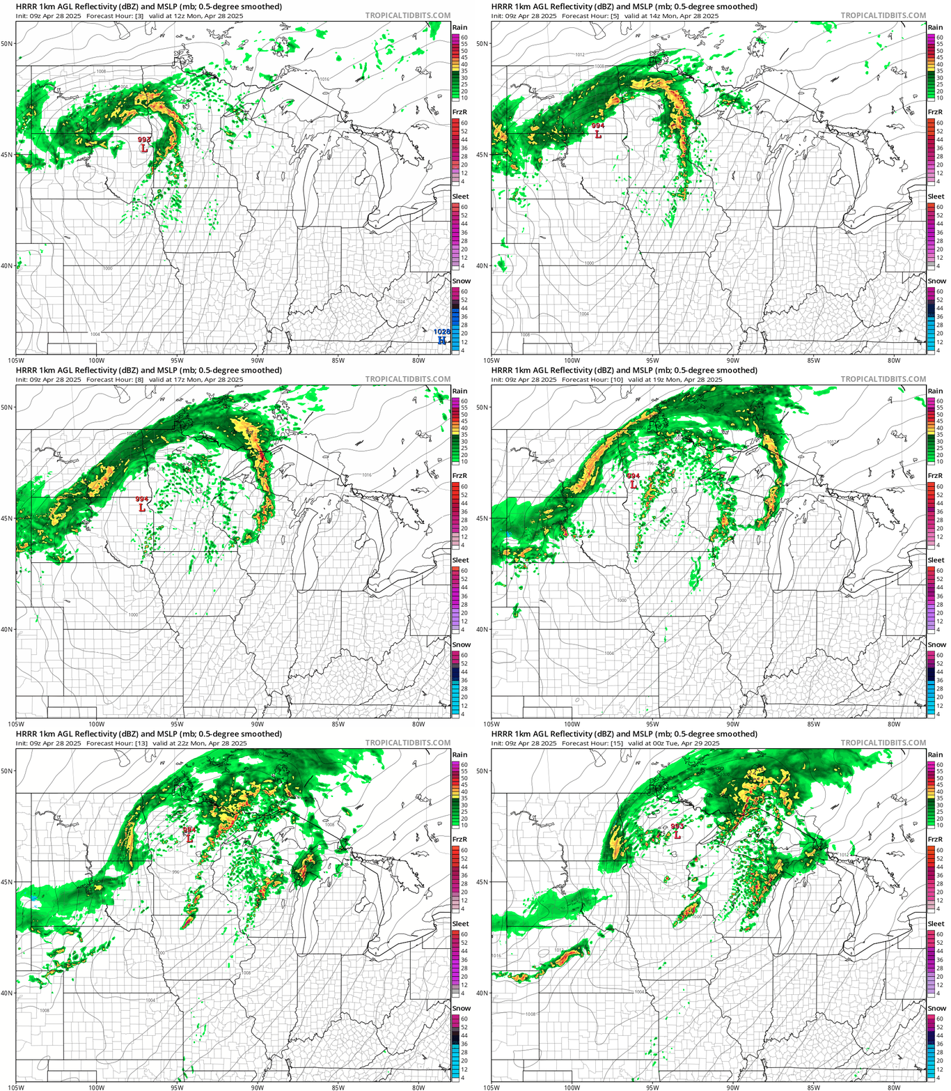
Our first wave of storms is expected to move into the Willmar, Litchfield and Mankato areas by 7 a.m. and reach the Twin Cities by 8 a.m. — just in time for the morning commute. This line of storms could bring large hail with a secondary threat of strong winds.
The warmest temperatures of the year are expected Monday, with highs reaching the upper 70s to near 80 degrees in southwest Minnesota. A 30-degree temperature spread will be seen across the state with cooler 50s in the northern parts of Minnesota.
Turn Up Your Support
MPR News helps you turn down the noise and build shared understanding. Turn up your support for this public resource and keep trusted journalism accessible to all.

Moisture from the Gulf of Mexico will be surging northward, bringing with it dewpoints in the 50s and 60s. This added humidity will help fuel the development of severe storms later in the day.
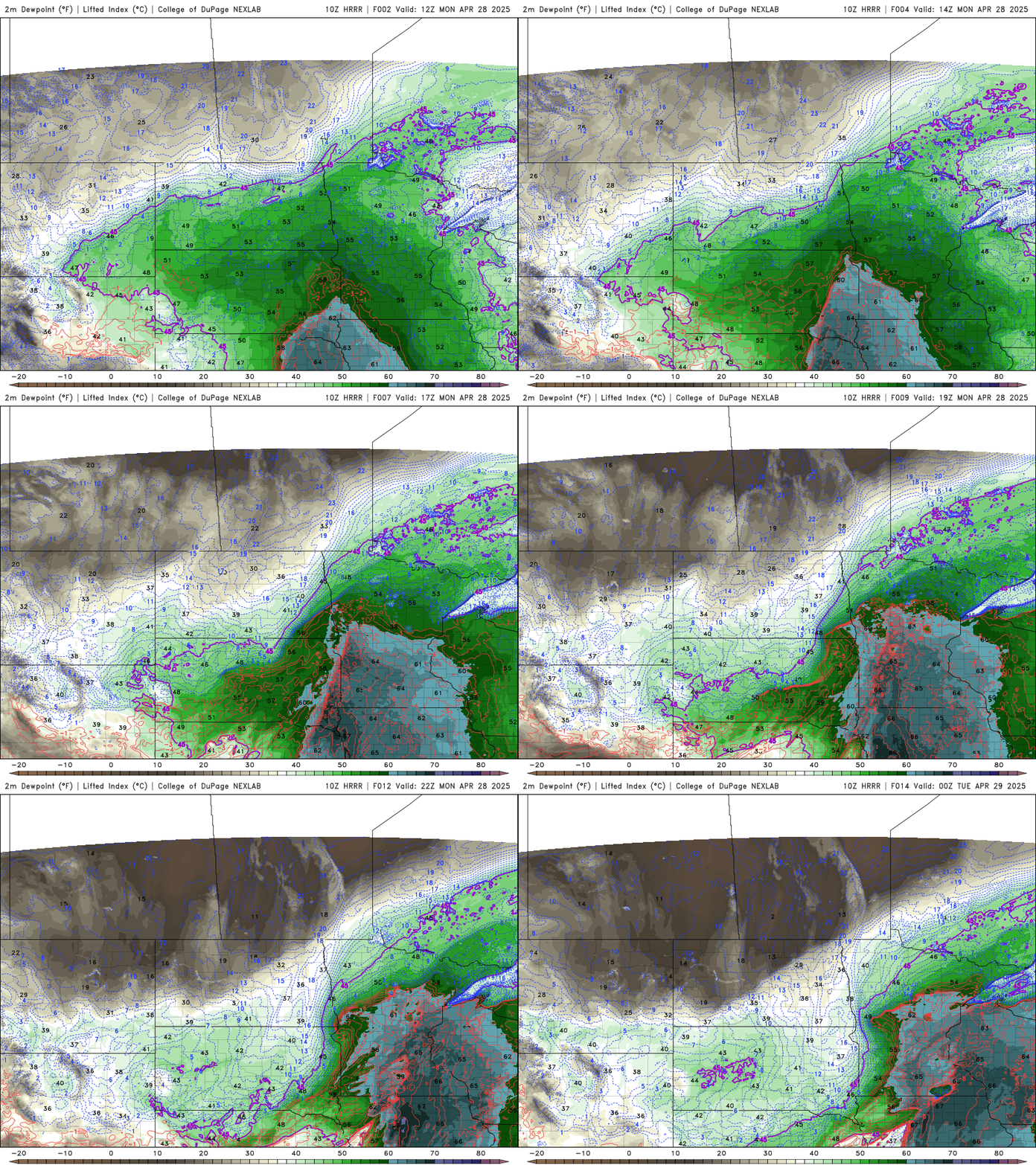
There will be a break between the morning storms and the afternoon storms, creating a "calm before the storm" scenario that we're watching closely. This will give the atmosphere plenty of time to recharge, setting the stage for a stronger round of showers and storms later in the day.
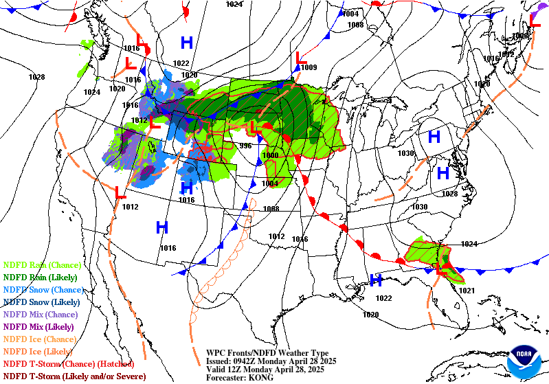
The moderate risk applies to the second round of storms, which has the potential for large hail, damaging winds and even strong tornadoes.
As the cold front moves through Monday night, a line of storms will develop in western Minnesota and move eastward. Ahead of this cold front, a warm front lifting from the south could spark the development of supercells. These supercells are the most likely places to see stronger, more dangerous tornadoes.
No matter what type of storms we experience, it's crucial to be prepared and stay vigilant.
The weather team at MPR News will keep you updated with the latest information on the Updraft blog and on MPR News.

