
Pleasant Thursday with spotty showers north and west
Spotty shower chances develop into the weekend

Go Deeper.
Create an account or log in to save stories.
Like this?
Thanks for liking this story! We have added it to a list of your favorite stories.


We’ll have partly cloudy skies and temperatures in the 70s again Thursday. There will be some spotty showers developing primarily north and west. More unsettled weather develops this weekend.
Pleasant Thursday, but some unsettled weather develops into the weekend
We’ll have another pleasant day most of the day and for most of the state. Look for partly cloudy skies with increasing afternoon clouds. Afternoon highs will be mainly in the 70s.

There will be some instability developing with spotty showers or even a thunderstorm popping up by Thursday afternoon and evening in primarily northern and western Minnesota.
A more organized area of rain will be moving east overnight Thursday night into Friday morning, the first of several disturbances heading into the weekend.
Turn Up Your Support
MPR News helps you turn down the noise and build shared understanding. Turn up your support for this public resource and keep trusted journalism accessible to all.
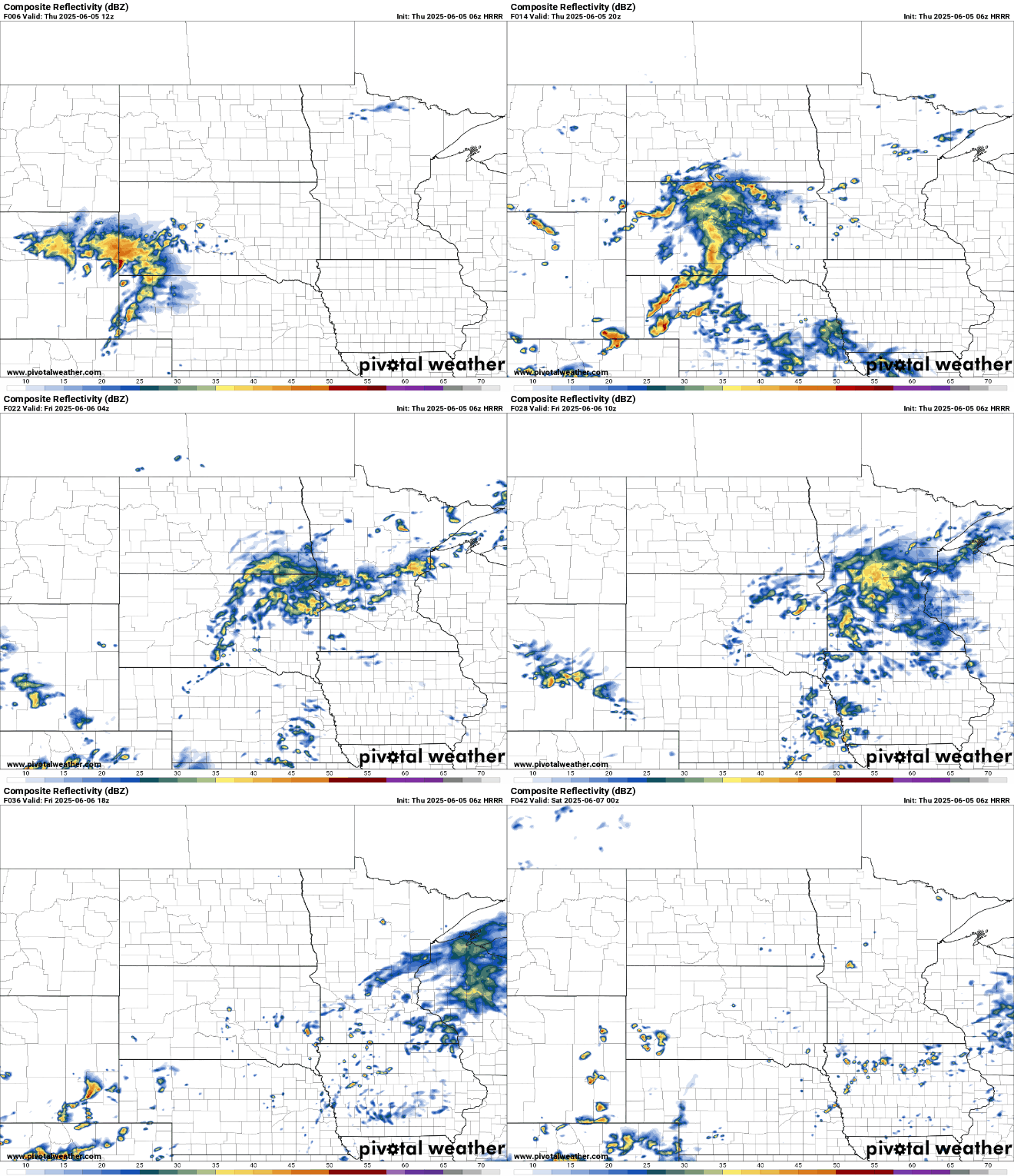
Highs Friday will be cooler with the morning clouds and scattered showers. Clouds should decrease with some afternoon sun. Most will see highs in the 70s with some upper 60s in portions of central and northeastern Minnesota.

More upper-level disturbances will touch off spotty shower chances into the weekend. We’ll have isolated to spotty showers Saturday with a more widespread chance of showers Saturday night into early Sunday ahead of a cool front.
Showers will then be more isolated Sunday afternoon and Monday.
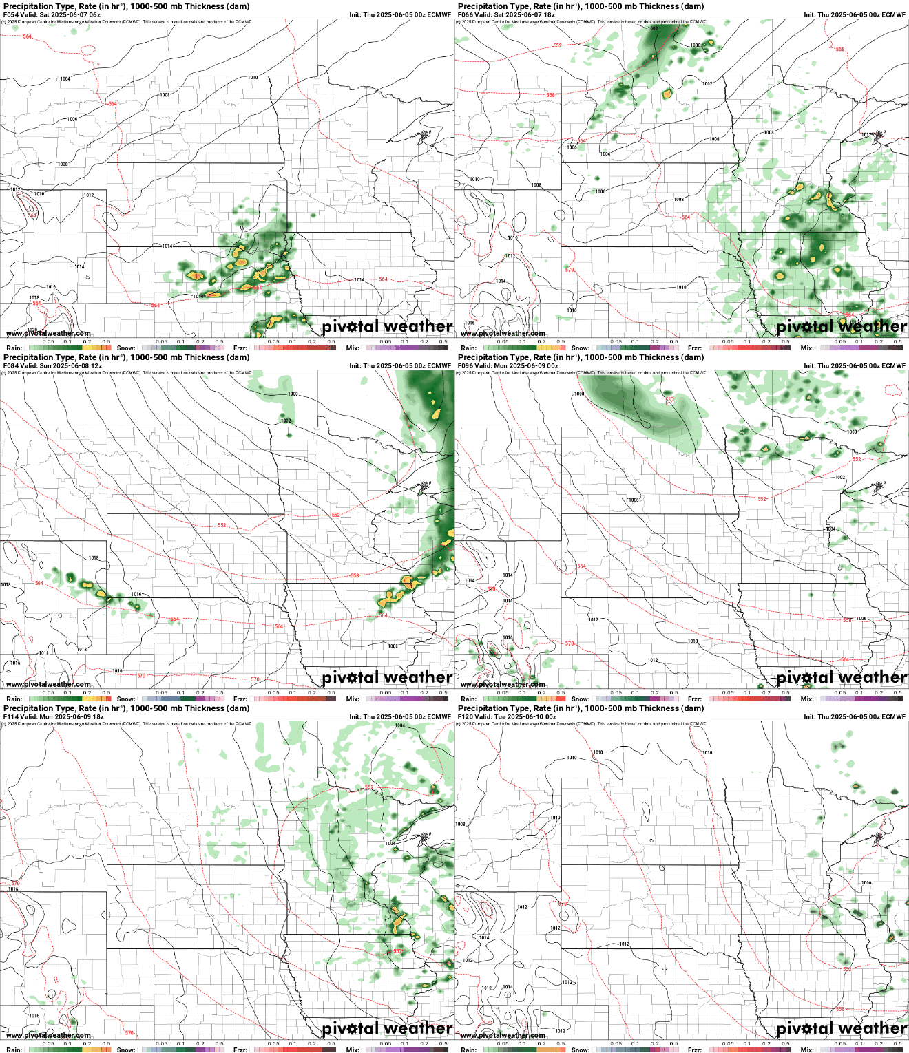
No one day looks to be a soaker. In fact, total rainfall over the next several days will be relatively modest considering it’s summer and rain can add up fast sometimes.
Importantly, it looks as though northern Minnesota could see the most rainfall. Northeastern Minnesota in particular has seen much less rain than other parts of the state in recent weeks.
Temperatures will remain near or slightly below normal mostly in the 70s this weekend due to the occasional clouds and spotty rain showers.

Temperatures will warm up to above-normal readings by midweek as an upper-level ridge builds in again, bringing stable weather and warmer air. By Wednesday, highs return to the 80s for much of Minnesota into next weekend. That’s about 5 to 15 degrees above normal.


