
Weather whiplash: Big temperature swings, soaking rains and stormy days ahead
Wet and active pattern takes over later this week

Go Deeper.
Create an account or log in to save stories.
Like this?
Thanks for liking this story! We have added it to a list of your favorite stories.


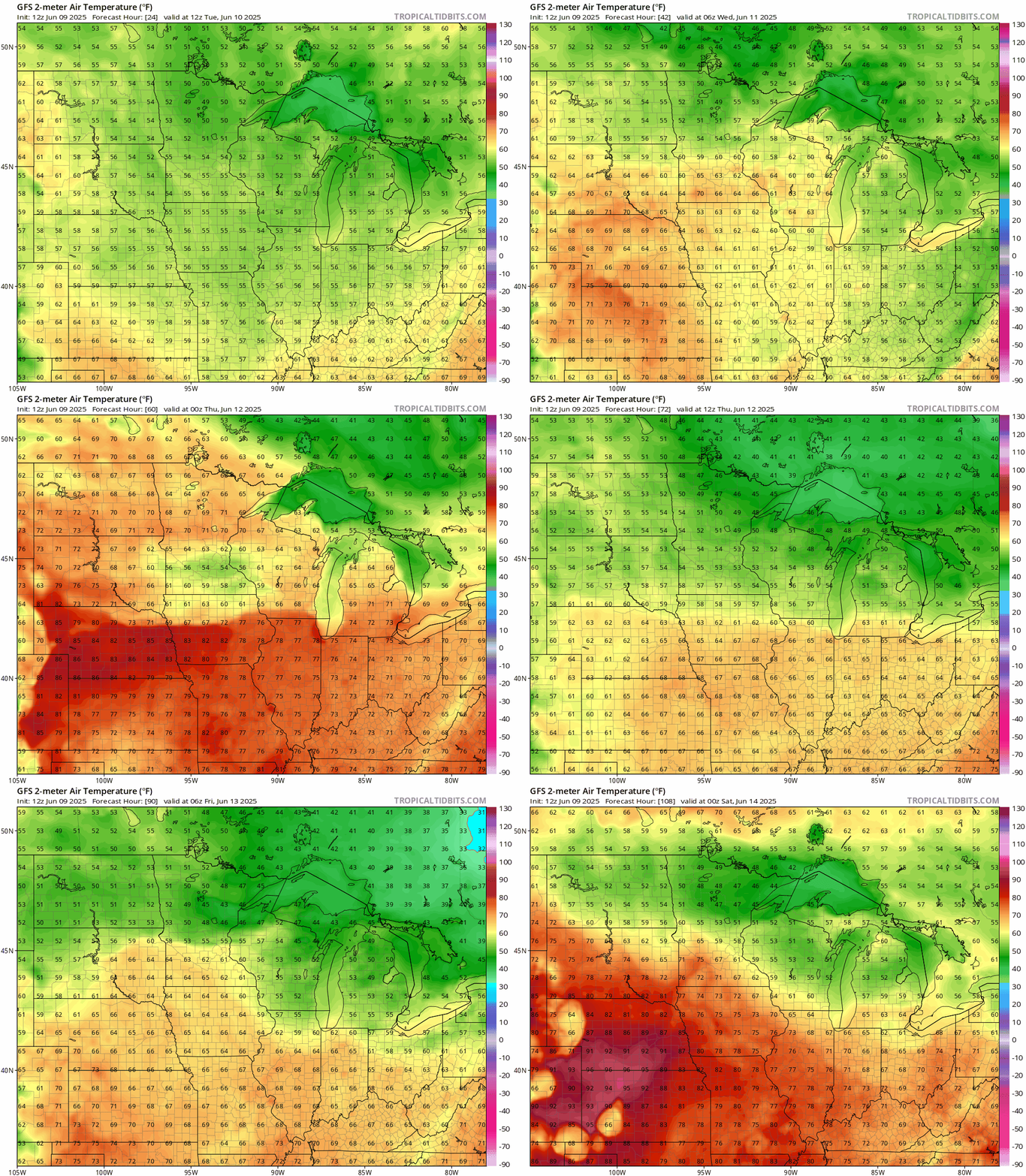
After a chilly start to the week on Monday, temperatures will warm up quickly with Tuesday bringing the warmest day of the week and pushing close to 90 in some areas. A wet and active pattern will take over later in the week with several inches of rain possible by the weekend.
Temperature roller coaster
After checking Monday’s current temperatures, I had to double-check the calendar to make sure it really was early June. It’s a very chilly start to our work week with highs in the 50s and 60s and a brisk northwest wind. Thankfully, this cool spell won’t last long.
We’ll return to more summerlike weather on Tuesday, with areas near the Buffalo Ridge in southwest Minnesota making a run at 90 degrees. Highs in the 70s and 80s are expected elsewhere across the state.

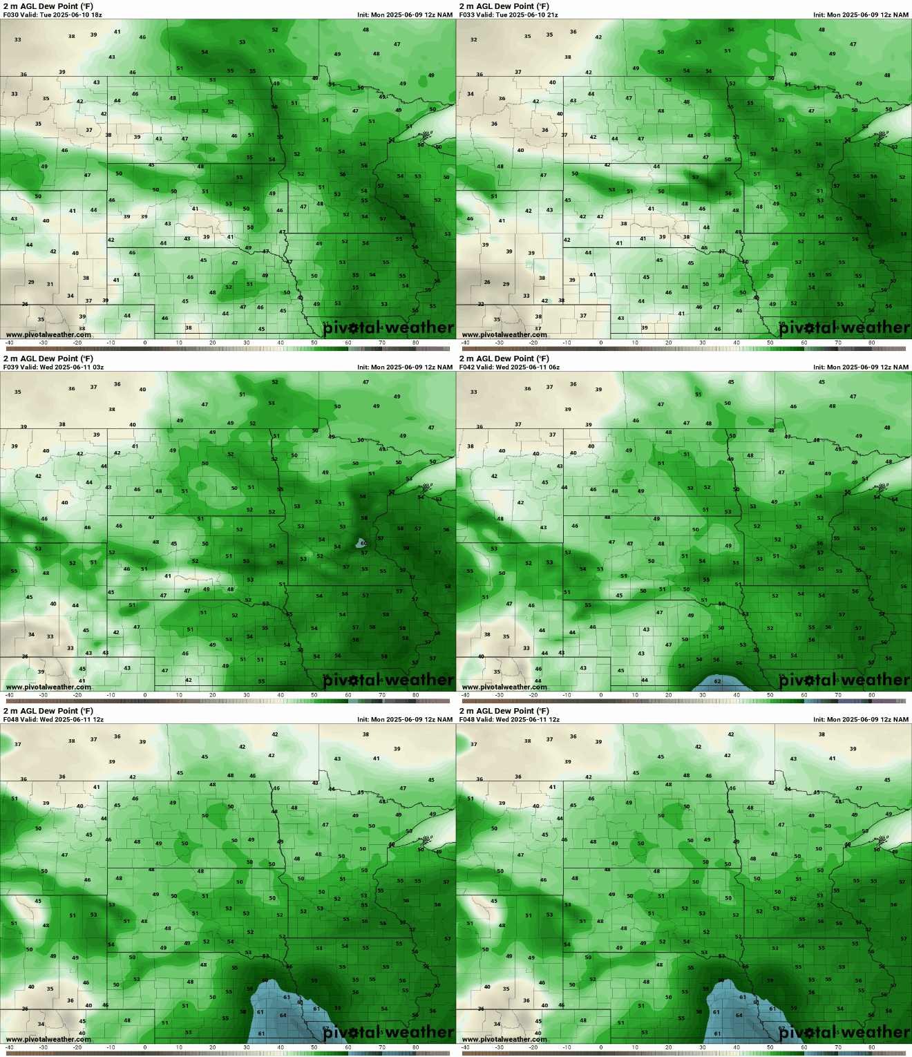
A weak system will slide through Minnesota Tuesday night, but don’t expect much rain. Northwest winds will usher in drier air with dewpoints in the 40s across northern Minnesota, keeping conditions near the surface quite dry. While radar may show showers, much of the moisture will evaporate before reaching the ground.
Turn Up Your Support
MPR News helps you turn down the noise and build shared understanding. Turn up your support for this public resource and keep trusted journalism accessible to all.
A brief warmup is expected Tuesday and Wednesday before temperatures dip below average again Thursday into Friday, falling back into the 60s and low 70s.
Wet and active period ahead
Starting Wednesday, we’ll enter an active stretch of weather across the Upper Midwest, with multiple chances for heavy rain and the possibility of a few stronger storms.
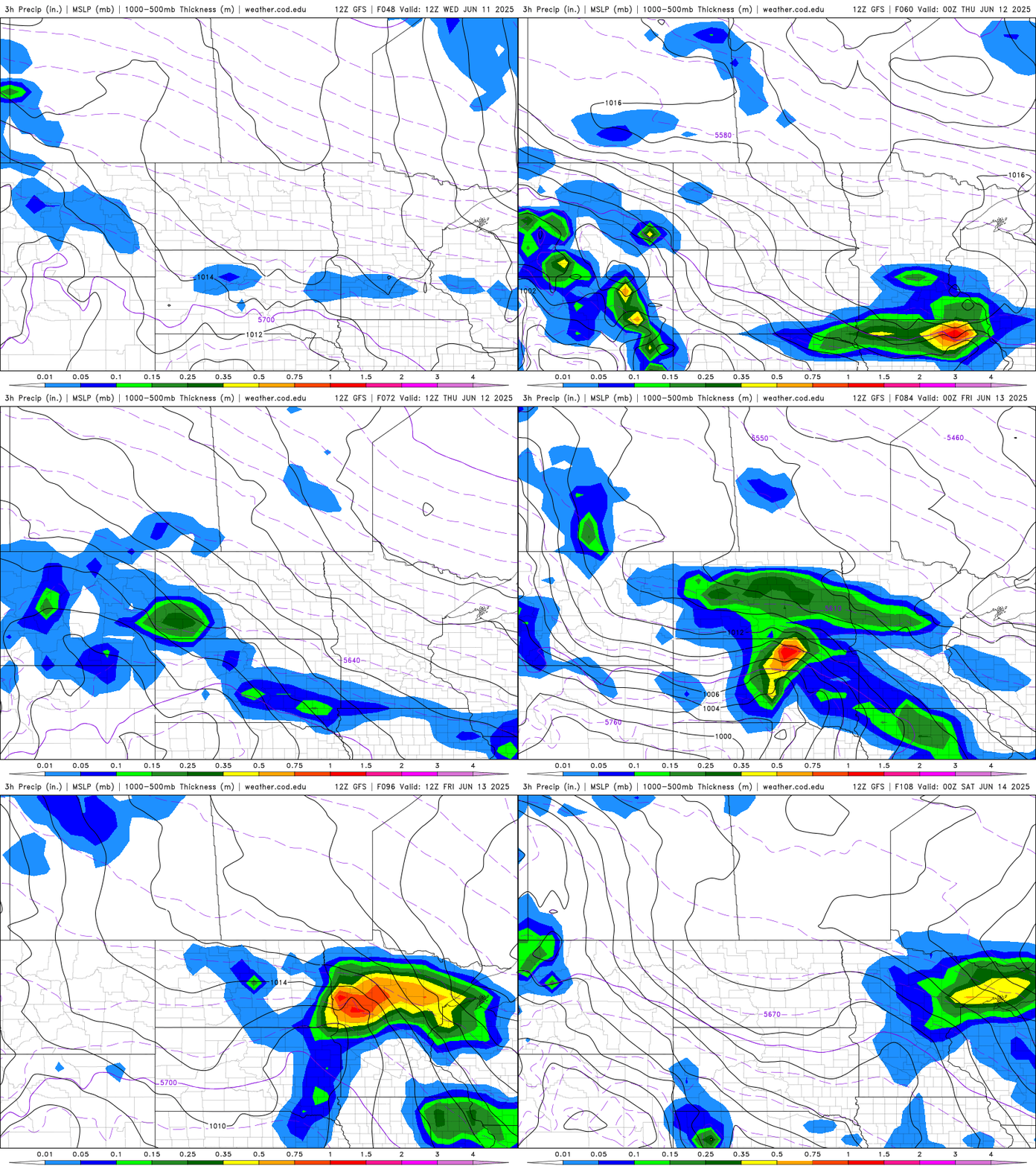
A warm front will lift north into Iowa and stall near the Minnesota-Iowa border Wednesday afternoon. Precipitation amounts could exceed 1 inch across southern Minnesota during this time.
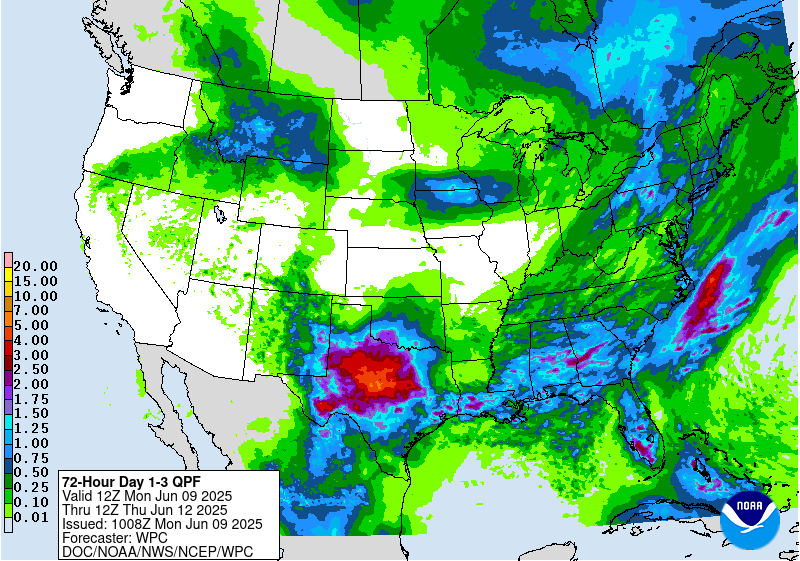
From Thursday into Friday morning, widespread rain showers are possible with an additional 1 to 2 inches of rain before the system moves out. Over the full 5-day period, rainfall totals could exceed 2 to 3 inches across southern Minnesota.
There is still some uncertainty about the exact placement of this front, which will significantly impact where the heaviest rainfall totals occur.


