
Much warmer with increasing sunshine Tuesday. Stormy weather ahead
A couple rounds of thunderstorms develop mid to late week

Go Deeper.
Create an account or log in to save stories.
Like this?
Thanks for liking this story! We have added it to a list of your favorite stories.


Sunshine will really warm temperatures Tuesday. Clouds increase Wednesday with the first of a few rounds of storms developing later in the day. The pattern is active through Friday.
Sun, warmth Tuesday; active weather late Wednesday
Get out and enjoy some sun if you can Tuesday — there won’t be a lot of it for the next few days.
Early morning clouds will decrease, giving way to partly cloudy skies. Temperatures will warm into the 80s across southern Minnesota to even near 90 degrees in southwestern Minnesota. An isolated shower or two is possible in northeast Minnesota.

Wednesday will still be warm but clouds will increase. Afternoon highs will be mostly in the 70s.
Turn Up Your Support
MPR News helps you turn down the noise and build shared understanding. Turn up your support for this public resource and keep trusted journalism accessible to all.

The first of potentially multiple rounds of storms develops Wednesday afternoon and evening along and north of a nearly stationary warm front.
There may be some showers in southern Minnesota as early as late Tuesday night and Wednesday morning, but the bulk of activity will develop along and north of the front later in the afternoon and evening Wednesday.
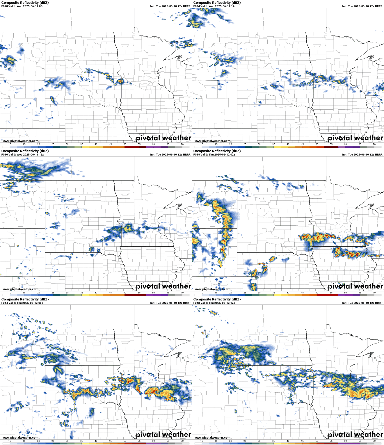
Another round of storms with heavy rain potential is likely late Thursday into Friday. An upper-level disturbance will move in from the west along with an accelerating low-level jet stream (winds at about 4,000 feet above the ground).
This is an efficient setup for excessive rainfall potential.
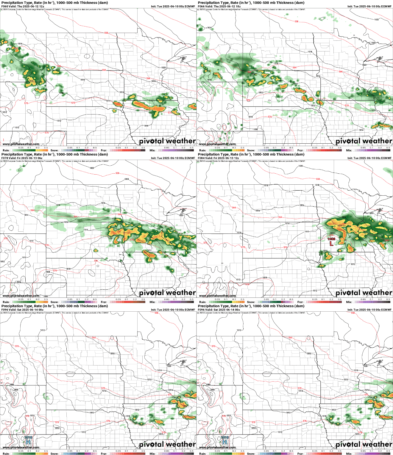
The official forecast calls for a widespread 1 to 3 inches of rain in total from Wednesday through Friday:
We’ll need to watch for locally higher amounts and also where these heavy rain bands set up. The models differ some on how far north or south this heavy rain will occur.
The map below shows of one of the higher end rainfall amounts with a track a bit more north. It is entirely possible we could see some isolated 6-inch rainfall amounts somewhere in central or southern Minnesota.

The weekend should be dry, but clouds will linger Saturday before things get a bit brighter Sunday. Temperatures are forecast to be above normal heading into early next week.

