
Storms clear out; seasonal temps and muggy air remain
Tornado and wind damage reported in west metro

Go Deeper.
Create an account or log in to save stories.
Like this?
Thanks for liking this story! We have added it to a list of your favorite stories.


Saturday night’s storms brought heavy rain, strong winds, and multiple tornado reports across the region. Sunday brings seasonal temperatures with muggy conditions ahead of a severe weather threat for southeastern Minnesota.
Strong storms across the state
As expected, strong storms developed in northwestern Minnesota around 5 p.m. Saturday, but the main event began with storms forming in western Minnesota around 6 p.m., then moving eastward to reach the metro area between midnight and 2 a.m. Sunday.
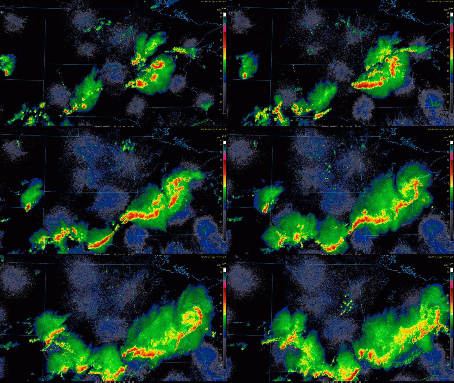
These are some of the areas where storm damage was reported:
Turn Up Your Support
MPR News helps you turn down the noise and build shared understanding. Turn up your support for this public resource and keep trusted journalism accessible to all.
Canby—74 mph wind gust
Redwood Falls—68 mph wind gust
Hanley Falls—64 mph wind gust
Lancaster—1.50 inch hail
Norwood Young America—1.25 inch hail
There were several tornado reports for Marietta, Canby, Holloway, Waconia, Cologne, Victoria, and Danvers.
Heavy rainfall from the storms also led to flooding in the northwest metro, with Buffalo and Saint Michael receiving 3.61 inches of rain, and Corcoran picking up 3.35 inches.

Sunday brings a slight risk of severe weather, mainly focused on the southeastern corner of the state. Storms are expected across southern Minnesota this afternoon and evening, though isolated strong storms can’t be ruled out further north into central Minnesota and the metro area. The main threats will be damaging wind and large hail.

Seasonal temperatures take hold Sunday, with highs in the low to mid-80s. Dew points will remain sticky across much of the state, ranging from the 60s to low 70s, while northwestern Minnesota will enjoy more comfortable conditions with dew points in the 50s.

Dew points will begin to drop as a cold front pushes through Sunday night, bringing clearer skies in its wake.
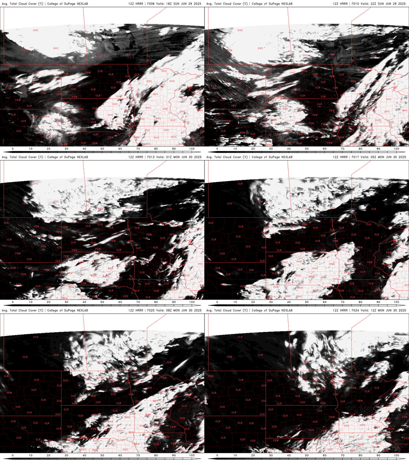
Monday will bring more sunshine, with highs in the upper 70s to near 80 degrees.

Most areas will stay dry, but there is a slight chance for a few afternoon, diurnally driven showers in northern Minnesota, according to the latest model guidance. There's also a chance for a few early storms to fire along the cold front in southern Minnesota.
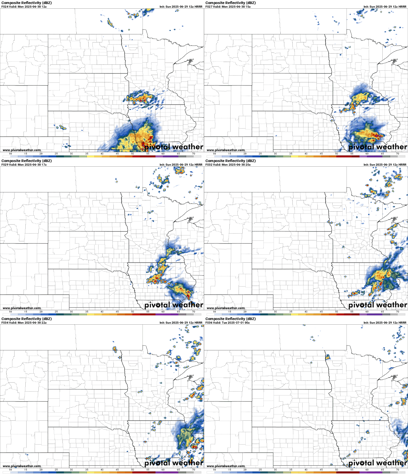
Tuesday through Thursday are looking pleasant, with seasonal temperatures and high pressure in place. The only weather concern will be the slight chance of a few afternoon, diurnally driven showers.
Our attention then turns to the 4th of July forecast. As of now, hot and humid conditions are expected to return, with the potential for a front to move through during the holiday. We'll have more details as the forecast comes into focus.

