
Temperatures and dew points rise with storms late Friday
Cooler and drier air moves in for Sunday

Go Deeper.
Create an account or log in to save stories.
Like this?
Thanks for liking this story! We have added it to a list of your favorite stories.


It’ll be another warmer-than-normal day Thursday with highs near 90 across southern Minnesota. Friday will be hot and very humid. Storms develop late Friday into Friday night and Saturday.
Temperatures, dew points rising; storms Friday night
Temperatures will once again be very warm Thursday with highs near 90 degrees across southern Minnesota and well into the 80s north. Temperatures near Lake Superior will be cooler. Afternoon highs will be 5 to 15 degrees above normal for July 3.

Heat index values will be into the 90s across southern Minnesota with potentially 100-degree heat indices in western Minnesota.

A heat advisory is in effect for Yellow Medicine and Lac qui Parle counties in western Minnesota Thursday afternoon and evening. For the Twin Cities area and northeastern Minnesota, heat advisories take effect Friday afternoon and evening.
Turn Up Your Support
MPR News helps you turn down the noise and build shared understanding. Turn up your support for this public resource and keep trusted journalism accessible to all.
We’ll have a chance for isolated thunderstorms for mostly southeastern Minnesota and western Wisconsin. Otherwise, look for lots of sun again with a few afternoon clouds.
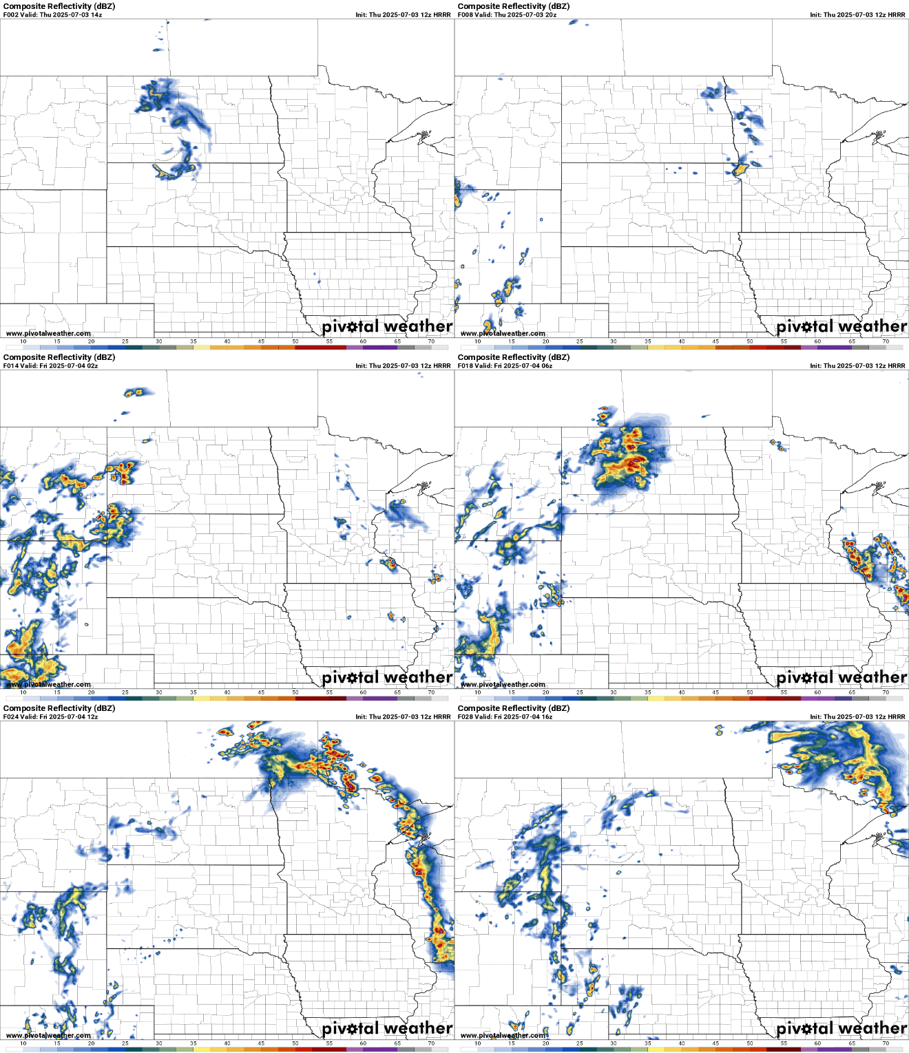
Late Thursday night into early Friday we’ll also see showers and some thunderstorms track across far northern Minnesota.
There’s a marginal risk (level 1 of 5) of one or two severe storms that may produce some large hail in southeastern Minnesota and western Wisconsin.
Late Thursday night into early Friday there’s a marginal risk (level 1 of 5) for severe storms for northern Minnesota and a slight risk (level 2 of 5) mainly in North Dakota and the northwestern-most corner of Minnesota for severe storms.

Highs Friday will be in the 90s for much of the state, including up to the international border. Temperatures will be cooler near Lake Superior only.

Dew points will also be very humid, in the low 70s for much of central and southern Minnesota. That combination will lead to afternoon heat indices well into the 90s if not near 100 degrees for some.

A heat advisory is posted for portions of Minnesota including the Twin Cities area for Friday afternoon and evening.
Besides the heat, we’ll be monitoring weekend storm chances. A cool front and upper-level disturbance will bring showers and storms Friday afternoon in northwestern Minnesota that will then track slowly south and east into Friday night with more storms developing Saturday.
The good news is that the timing of storms has slowed, so it looks like fireworks displays should be good to go across eastern, central, and southern Minnesota before storms move in later Friday night.
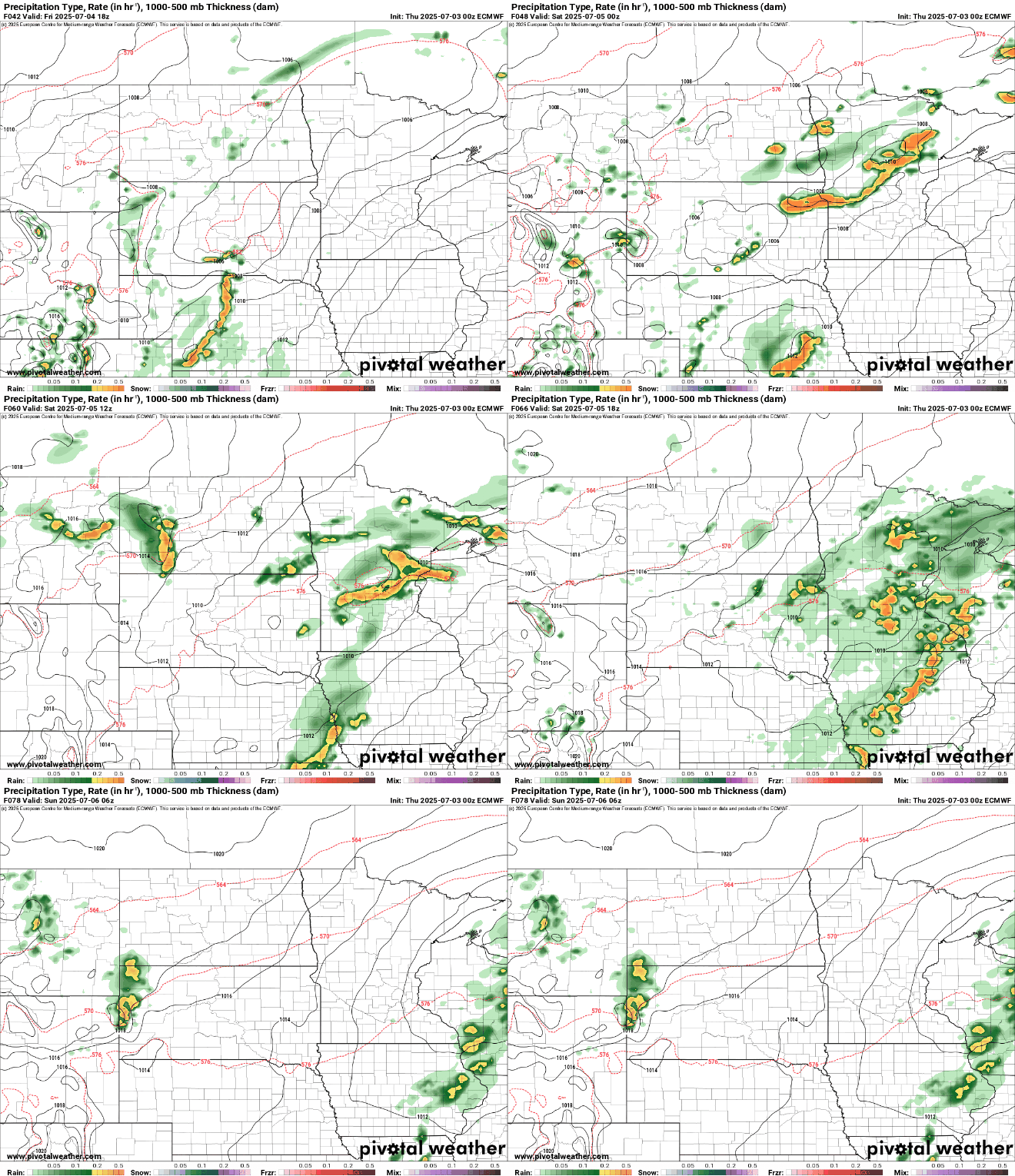
The risk of severe storms looks relatively low. There’s a marginal risk (level 1 of 5) of severe storms late Friday and Friday night. We’ll mostly see a threat of heavy rain in northern Minnesota.

Cooler and less humid air will move in for Sunday and Monday and that will bring back sunshine and more stable, dry weather.

