
Pleasant weather as high pressure moves in for midweek
More storms develop Thursday night and Friday

Go Deeper.
Create an account or log in to save stories.
Like this?
Thanks for liking this story! We have added it to a list of your favorite stories.


High pressure will bring a few days of dry weather. Isolated showers are possible in northeast and southeast Minnesota Tuesday. Widespread storms return Friday.
High pressure moves in, bringing a few days of dry weather
Clouds will decrease in the wake of Monday night’s showers and storms as high pressure moves into the state Tuesday. Afternoon highs will range from the mid-80s south to the mid-70s north.

Wednesday will be more of the same with lots of sunshine and seasonable temperatures in the 80s and 70s. You can mostly copy and paste that forecast for Thursday. Dew points will be relatively comfortable in the 50s and low 60s, but dew points will increase Thursday ahead of the next storm system.

The next system will develop widespread, scattered showers and thunderstorms Thursday night into Friday and Friday night. Portions of western Minnesota may see storms as early as Thursday. There could be some lingering spotty activity in northern Minnesota yet Saturday.
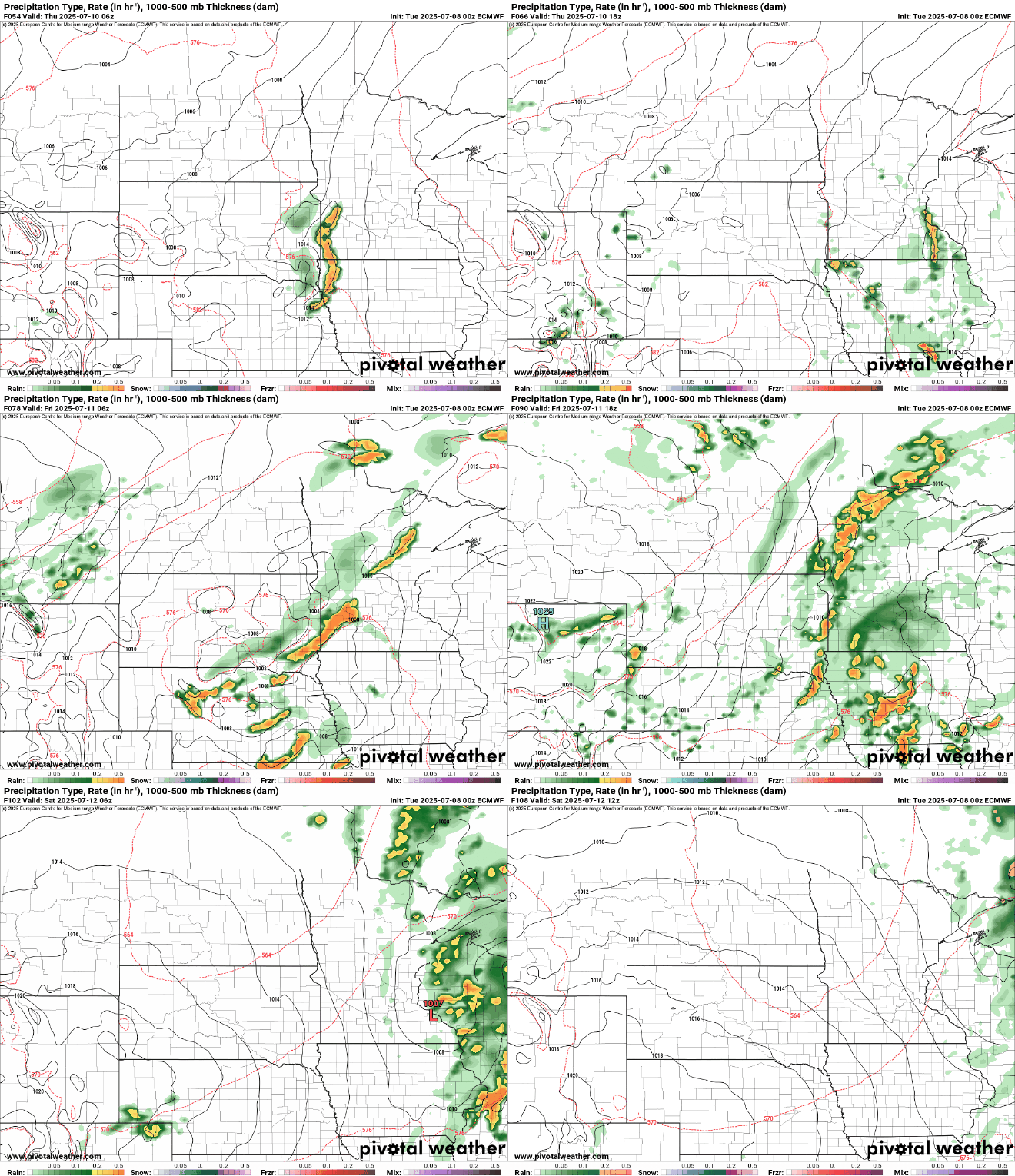
Much of the state could see a widespread soaking of rainfall Friday with anywhere from 0.50 to 1.50 inches of additional rainfall totals with locally higher amounts.

The system looks to largely move out in time for most of the state for most of the weekend, except far northern Minnesota Saturday.
Temperatures will be a bit cooler, mostly in the 70s Saturday with a drop pin dew points before temperatures warm back into the 80s for most Sunday afternoon.
Turn Up Your Support
MPR News helps you turn down the noise and build shared understanding. Turn up your support for this public resource and keep trusted journalism accessible to all.

