
Tracking smoke, storm chances, and a warm start to the week

Go Deeper.
Create an account or log in to save stories.
Like this?
Thanks for liking this story! We have added it to a list of your favorite stories.


Those of us who have had a tough time with the smoke lately will start to feel a difference today. Air quality is the worst this morning. Smoke is expected to clear from west to east through the day, then an additional plume of smoke could enter Northwest Minnesota tonight and gradually spread south into tomorrow morning.
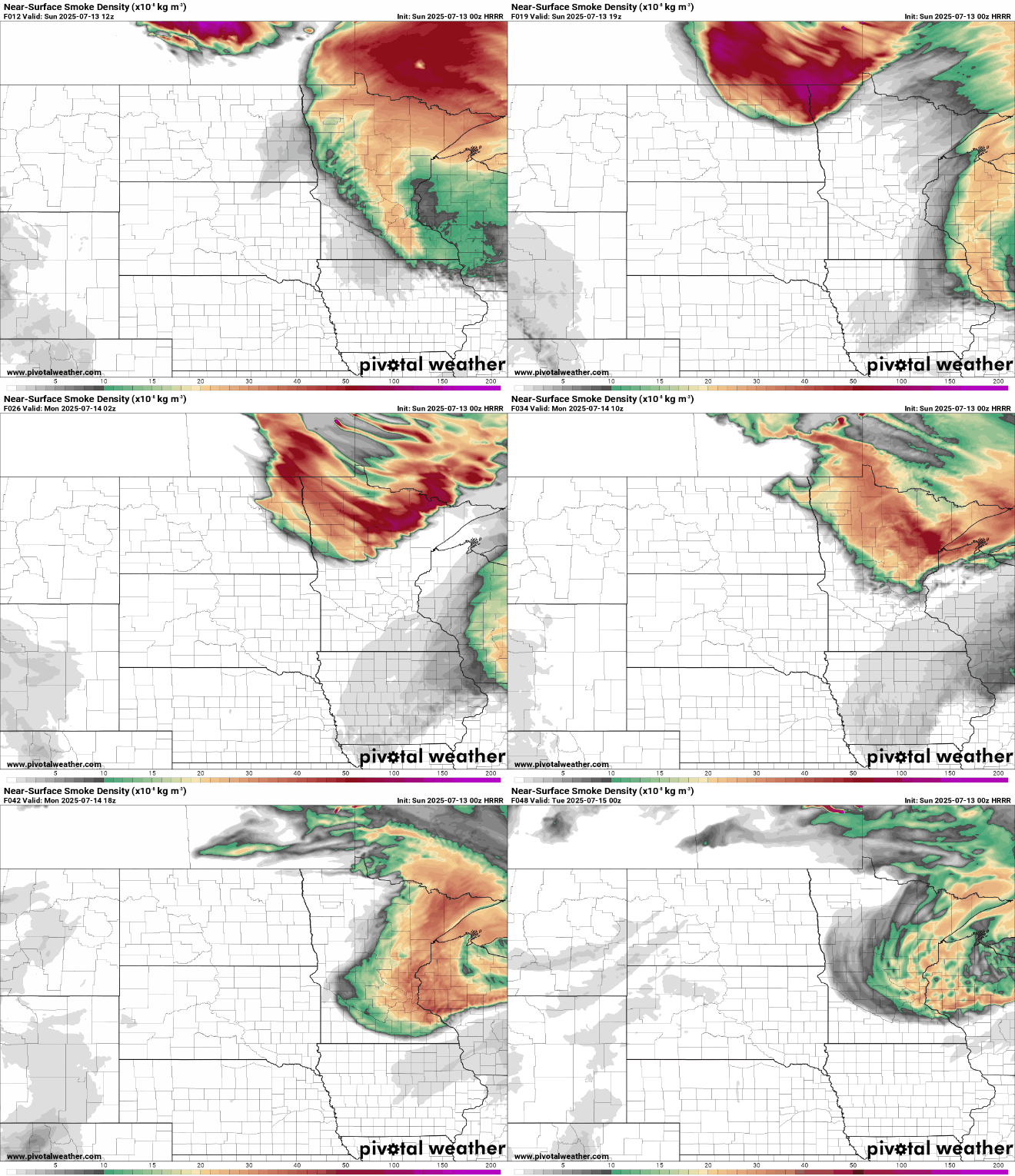
The Air Quality Alert remains in effect until 9 am Monday in Minnesota and until noon Monday in Wisconsin.
The passing front that brings relief from the smoke is also the trigger point for a low chance for thunderstorms this evening. A broken line may develop from Southwest Minnesota across central communities and into the Arrowhead.
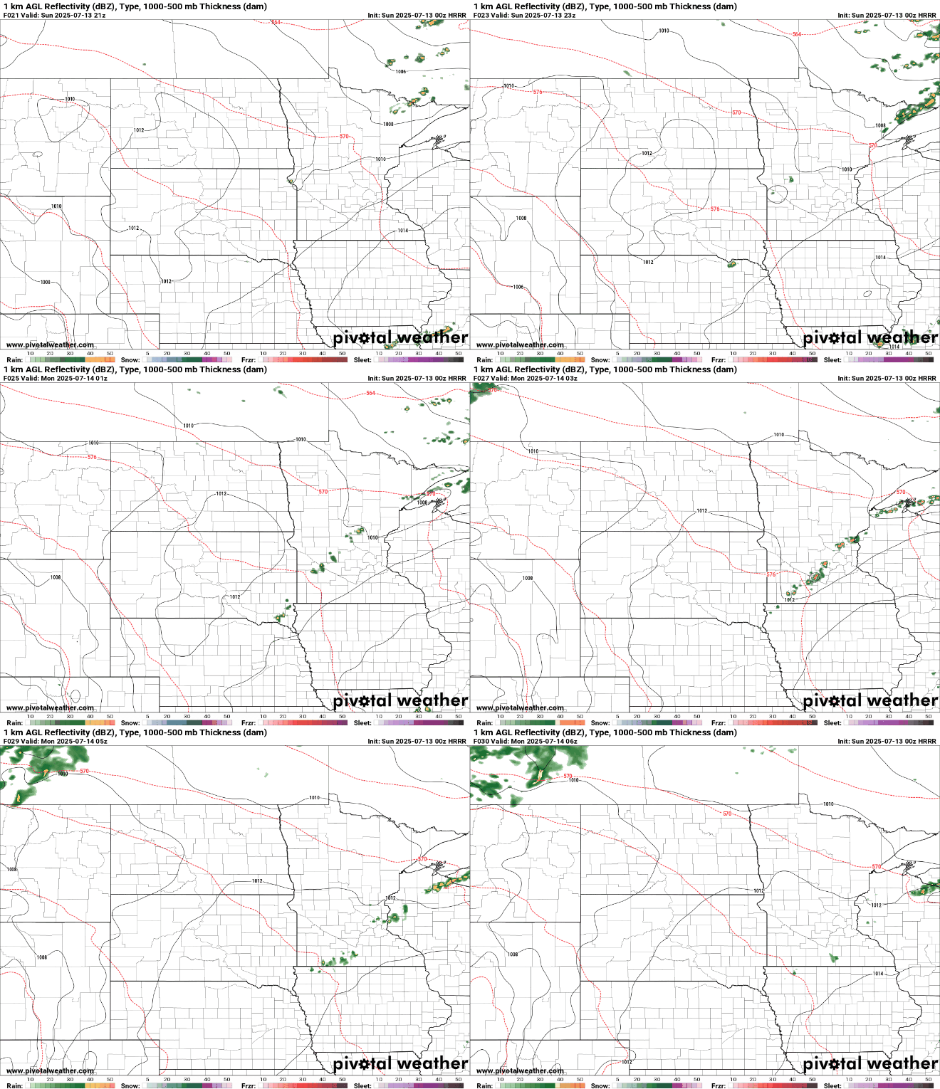
An isolated storm may produce large hail and damaging winds. The marginal severe risk grazes the Twin Cities with storm chances fizzling out looking southeast after sundown.
Turn Up Your Support
MPR News helps you turn down the noise and build shared understanding. Turn up your support for this public resource and keep trusted journalism accessible to all.

There will be an opportunity for a good soak this week. Northwest Minnesota gets rain chances first Monday night with much of the state seeing rain Tuesday and Wednesday.
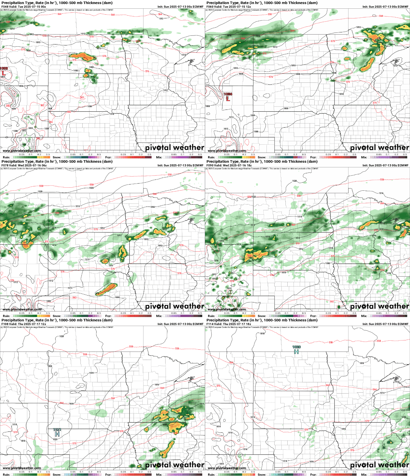
This period will include waves of showers and thunderstorms that could provide excessive rainfall. The severe risk would be Tuesday afternoon when the atmosphere will be its most unstable with high temperatures and dew points.
Ahead of this system, heat and humidity will gradually ramp up. It will be warm today with highs in the 80s.
Monday will be a touch hotter with the Twin Cities approaching 90.

Tuesday will be another toasty day in Central and Southern Minnesota while northern communities stay cooler in the rain.

That system will leave us with below average temperatures Wednesday through the end of the week as highs stay generally in the 70s.

