Latest drought monitor shows widespread recovery across Minnesota
Northwestern Minnesota is still behind on rainfall
Go Deeper.
Create an account or log in to save stories.
Like this?
Thanks for liking this story! We have added it to a list of your favorite stories.
Drought conditions across Minnesota are minimal heading into the second half of summer, thanks to recent rainfall. However, we’re not in the clear yet — forecast models point to a warmer pattern for the rest of July, which could quickly reverse those gains.
Soggy summer
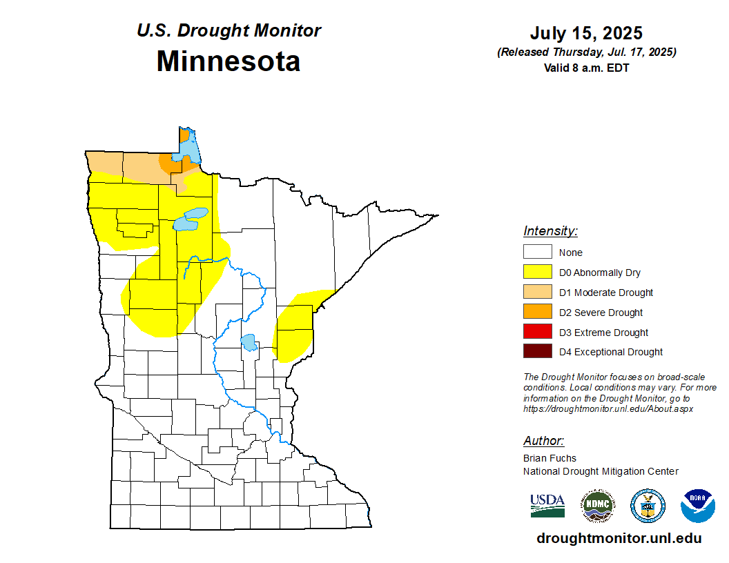
Our soggy summer has led to major improvements in the latest Minnesota drought monitor. Three-quarters of the state is now drought-free, while the remaining quarter is only seeing abnormally dry conditions. The main area of concern now is in extreme northwestern Minnesota, where Kittson, Roseau, and Lake of the Woods counties are still reporting moderate to severe drought conditions.

Compared to about a month ago, the current Drought Monitor shows just how much conditions have improved across Minnesota.

If we take a look at the past 30 days of rainfall, it’s no surprise we’ve made the progress we have. Some areas of the state, particularly near Willmar and southwestern Minnesota, have reported more than 10 to 15 inches of rain. Meanwhile, parts of northwestern Minnesota have received less than 5 inches in that same period, contributing to ongoing drought concerns.

We can’t breathe a sigh of relief just yet, as forecast models point toward a warmer temperature pattern, which could dry things out quickly.

The good news is that several chances for showers and thunderstorms are expected next week, thanks to a classic “ring of fire” weather pattern setting up.
Turn Up Your Support
MPR News helps you turn down the noise and build shared understanding. Turn up your support for this public resource and keep trusted journalism accessible to all.