
Hot and humid with more storm chances
Heat indices will be in the 90s to near 100 degrees Tuesday

Go Deeper.
Create an account or log in to save stories.
Like this?
Thanks for liking this story! We have added it to a list of your favorite stories.


Tuesday and Wednesday will be hot and humid across southern Minnesota. The steamy air will continue to generate storm chances through Wednesday night.
Steamy pattern with more chances of thunderstorms
Ongoing morning thunderstorms will continue to move across northern Minnesota with just isolated storm chances in southern Minnesota Tuesday. More storms will likely develop in north-central Minnesota again late Tuesday.
An isolated storm cannot be ruled out just about anywhere with the high dew points and instability, but most activity will be confined to the northern half of the state.
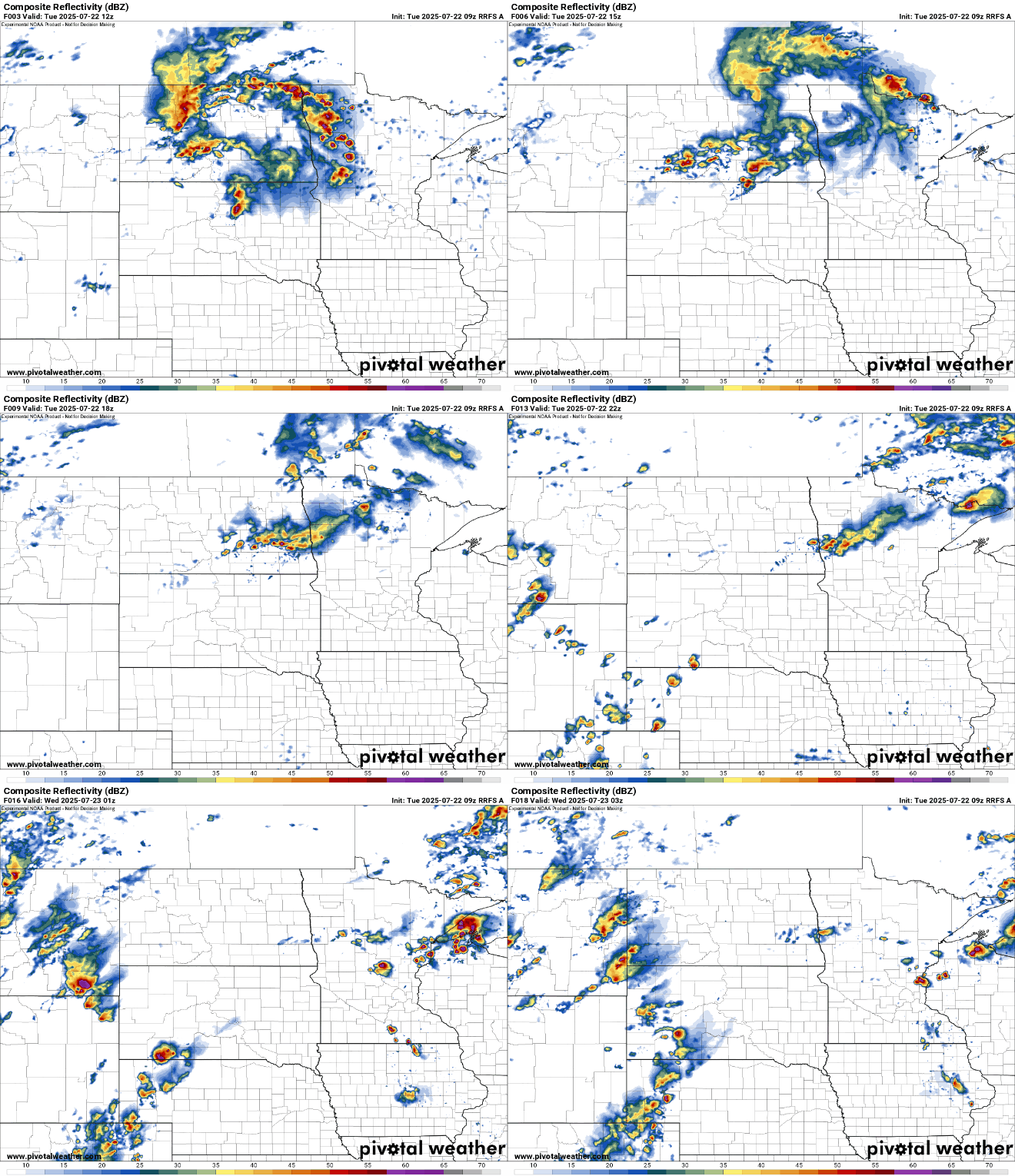
There’s a slight risk (level 2 of 5) for severe storms forecast for Tuesday into Tuesday night across central and northern Minnesota.
Turn Up Your Support
MPR News helps you turn down the noise and build shared understanding. Turn up your support for this public resource and keep trusted journalism accessible to all.

In southern Minnesota we’ll be steamy in areas that get missed by any morning and midday storms that pop up. Highs will be in the upper 80s to low 90s in southern Minnesota.

Dew points will continue to increase into the mid-70s by Tuesday afternoon, making for very humid conditions and combining with the temperature to create heat indices in the mid-90s to near 100 degrees Tuesday afternoon and Wednesday afternoon.

There’s a heat advisory Tuesday afternoon and evening for southern Minnesota, including the Twin Cities due to this heat and humidity combination.

We’ll have to monitor where the rains fall repeatedly for potential flooding concerns. A flash flood watch is posted for northeastern Minnesota and northwestern Wisconsin from 7 p.m. Tuesday through 7 a.m. Thursday.
Much of central Minnesota and Wisconsin will see 1 to 3 inches of rain over the next couple of days, but there will be isolated, locally higher amounts of potentially 5 or more inches.

A slowly moving cool front will be the focus for more storms to develop late Tuesday into Wednesday and Wednesday night before the front moves just south of Minnesota late Thursday and Friday.
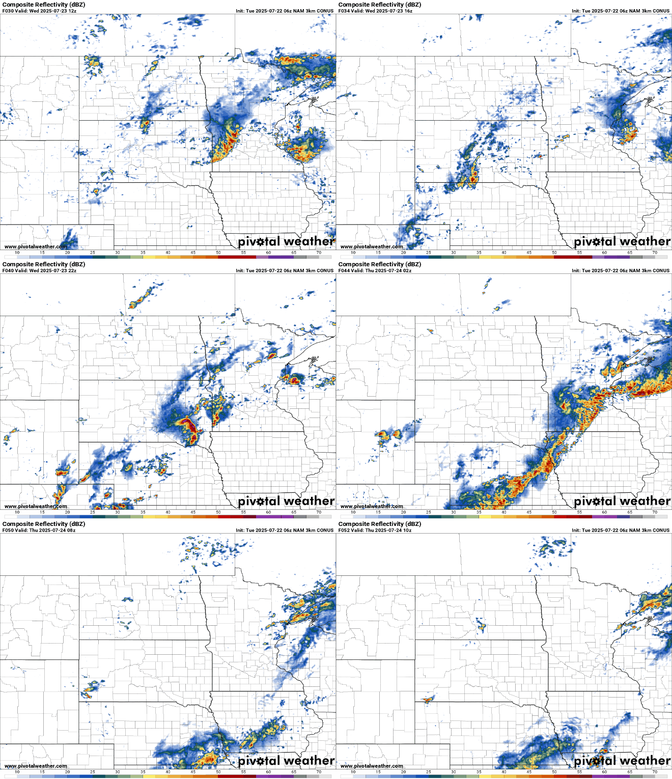
It’s possible there could be more severe storms Wednesday with another slight risk (level 2 of 5) forecast for much of southern, east-central Minnesota into western Wisconsin.

During the day Wednesday it will likely be another hot and humid day for southern and southeastern Minnesota. Highs will again be near 90 degrees for the Twin Cities and points south and southeast.

Thursday afternoon into Friday and most of Saturday should be mainly dry. Humid air will return Friday night into the weekend and we could see storms again Saturday night.

