
A potentially stormy Wednesday with more heat, humidity south
Dew points will drop slightly for Thursday and Friday

Go Deeper.
Create an account or log in to save stories.
Like this?
Thanks for liking this story! We have added it to a list of your favorite stories.


Scattered thunderstorms will move south and southeast near a slowly advancing cool front into Wednesday night. Some storms could be strong to severe with heavy rainfall.
Storms develop south with slowly advancing cool front
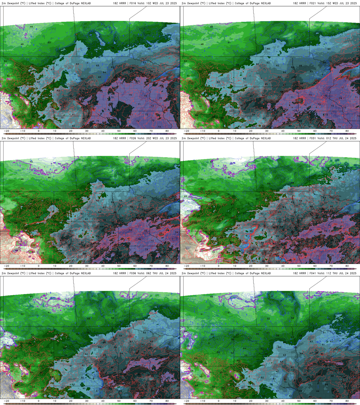
It will be another steamy day Wednesday from the Twin Cities and points south and southeast. Dew points will again be in the tropical 70s through the day Wednesday for southern Minnesota.

The afternoon heat index will reach triple digits at times for the Twin Cities and southeastern Minnesota Wednesday.

There’s a heat advisory again for the Twin Cities and southeastern Minnesota Wednesday afternoon and a flood watch through Wednesday night to the north.
Turn Up Your Support
MPR News helps you turn down the noise and build shared understanding. Turn up your support for this public resource and keep trusted journalism accessible to all.

The big north-to-south temperature divide and rainfall are the result of a slowly moving cool front. It’s the culprit for ongoing morning scattered storms in northern Minnesota and it will continue to reignite showers and storms along it through the day Wednesday as it moves slowly south and southeast.
There will be spotty storms in southern Minnesota with more storms firing up midafternoon into the evening and overnight.
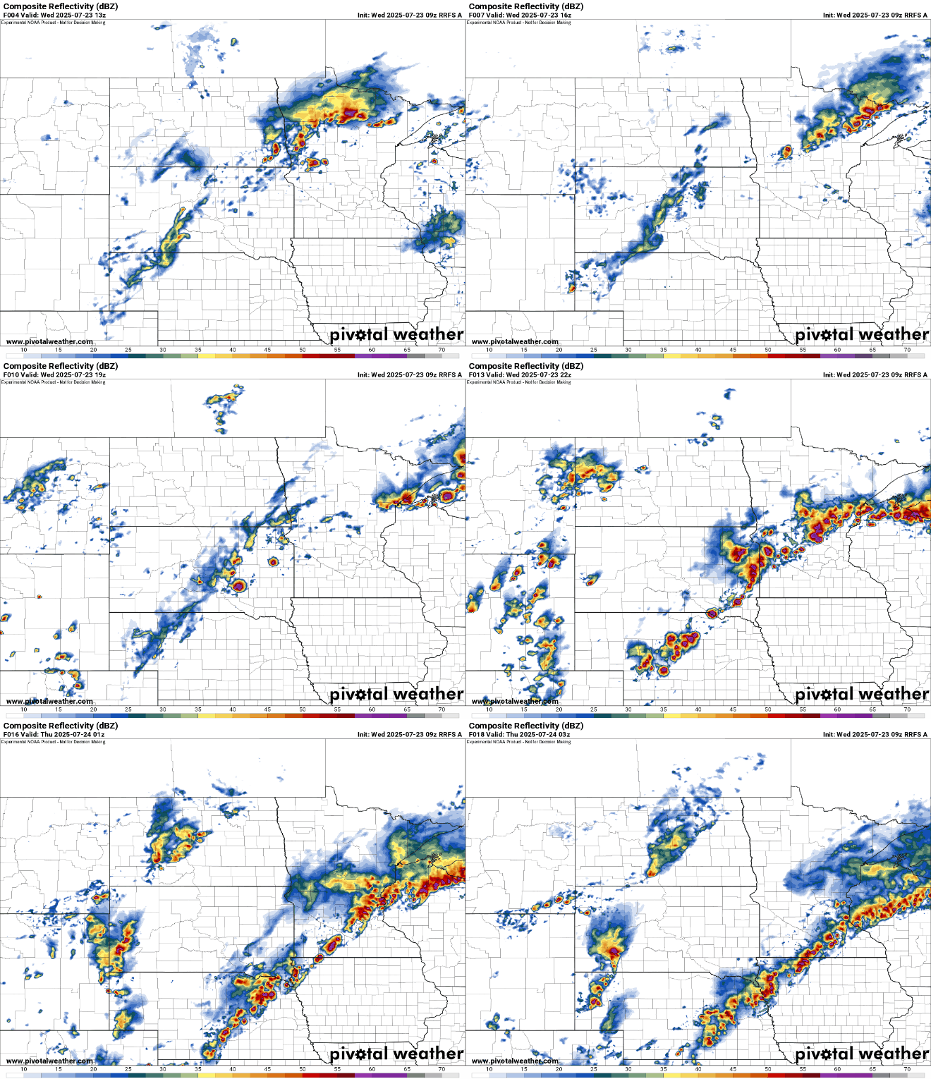
Storms that do develop Wednesday, especially in the late afternoon and evening with daytime heating, could be strong to severe. There’s a slight risk (level 2 of 5) for severe storms forecast for central and southern Minnesota into western Wisconsin.
The primary threats are from damaging wind gusts and large hail, but there could be isolated tornadoes as well.
There’s also an air quality alert for northwestern Minnesota Wednesday through Friday as Canadian wildfire smoke will occasionally be blowing in and out of portions of northern Minnesota.
Check the latest air quality conditions, alerts and forecasts here:
There will be lingering showers and storms Wednesday night for central and southern Minnesota. Southeastern Minnesota will likely see some lingering showers and thunder into Thursday morning.
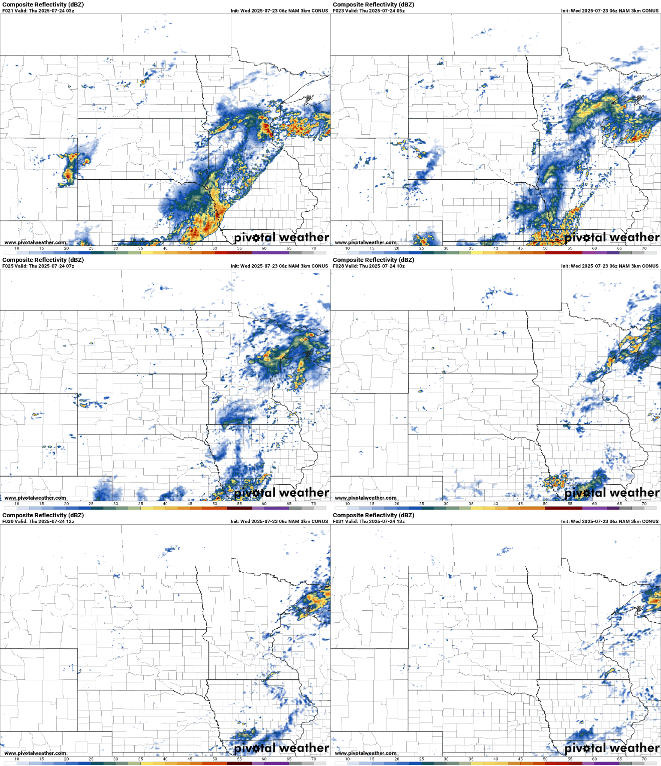
Total additional rainfall will be in the 1 to 2-inch range for most in central and southeastern Minnesota into western Wisconsin with some locally higher amounts possible.

On the other side of that weak cool front, temperatures will be slightly cooler for Thursday and Friday, but still well into the 80s for most of central and southern Minnesota.
It will also be a little less humid with dew points dropping from the tropical 70s Wednesday to the 60s by Thursday afternoon and Friday.
The heat and humidity look to return for the weekend, pushing high temperatures up close to 90 degrees again in southern Minnesota along with the return of those higher dew points.

