
Tracking storms and heat into the workweek

Go Deeper.
Create an account or log in to save stories.
Like this?
Thanks for liking this story! We have added it to a list of your favorite stories.


Potentially severe thunderstorms will impact portions of Minnesota Sunday evening and again Monday evening. A Severe Thunderstorm Watch is in effect for much of Central and Southern Minnesota until midnight.
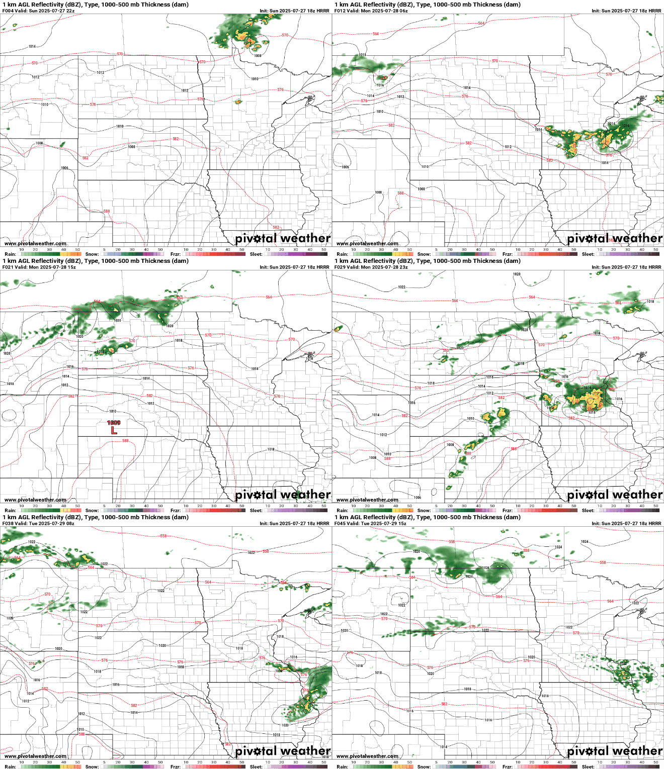
Damaging winds surpassing 60 mph are the main threat leading to the Storm Prediction Center's Enhanced Risk, which is 3 out of 5, Sunday. Large hail and a few tornadoes are also possible. The timeframe with the best chance of rain in the Twin Cities will be between 9 pm and 2 am.
Flash flooding is also a concern, having already begun in West Central Minnesota where storms have been training. Additional flooding concerns could develop in areas where storms form in a line that continue to pass over the same communities. We're still looking to Northeast Minnesota for a Flood Watch, now in effect from 7 pm until 4 am due to heavy rain on top of saturated ground.
Monday evening and night will bring additional thunderstorms that could be severe. Central and Southern Minnesota have a Slight Risk from the SPC, so a 2 out of 5. Similar to today, wind is the primary threat with large hail and a stray tornado also possible. Heavy rain may bring some flash flooding concerns.

We look south on Tuesday where isolated thunderstorm chances linger. All said and done, today through Monday night is expected to bring a general 1 to 2" of rain to a large swath of Central and Southern Minnesota, Twin Cities included, with locally higher amounts possible.

An additional Heat Advisory could be issued tomorrow with heat indices back in the 90s, and southern communities have the best chance of returning to triple digits on the heat index.

High pressure starts to build into the region after that, bringing a drier and more comfortable stretch for much of the rest of the week. We may even see the warm spots stay in the 70s by Wednesday.

Turn Up Your Support
MPR News helps you turn down the noise and build shared understanding. Turn up your support for this public resource and keep trusted journalism accessible to all.

