
Hot, humid Monday with more severe storms developing
Cooler, drier air arrives midweek

Go Deeper.
Create an account or log in to save stories.
Like this?
Thanks for liking this story! We have added it to a list of your favorite stories.


Monday will be another hot, humid day for southern Minnesota. Severe storms develop late Monday into Monday night. Cooler and drier air slowly builds in Tuesday into Wednesday.
Hot, humid Monday with more storms developing; cooler break coming
After a stormy night for many, we’ll see the sun break out Monday. Expect another steamy day across southern Minnesota. Highs will be near 90 degrees with upper 70s to low 80s far north.

Dew points will remain in the 70s, making for heat indices of 95 to 105 degrees in far southern Minnesota.

There are heat advisories and extreme heat warnings posted for far southern Minnesota Monday afternoon and evening.
Turn Up Your Support
MPR News helps you turn down the noise and build shared understanding. Turn up your support for this public resource and keep trusted journalism accessible to all.

The frontal boundary that moved through overnight is lingering in the region and another upper-level disturbance will take advantage of that front and muggy air to produce more storms later Monday afternoon and evening in South Dakota, western and central Minnesota.
Those storms will then track east and southeast through the evening and overnight into a potential derecho, a long-lived squall line of storms that produce severe wind gusts.
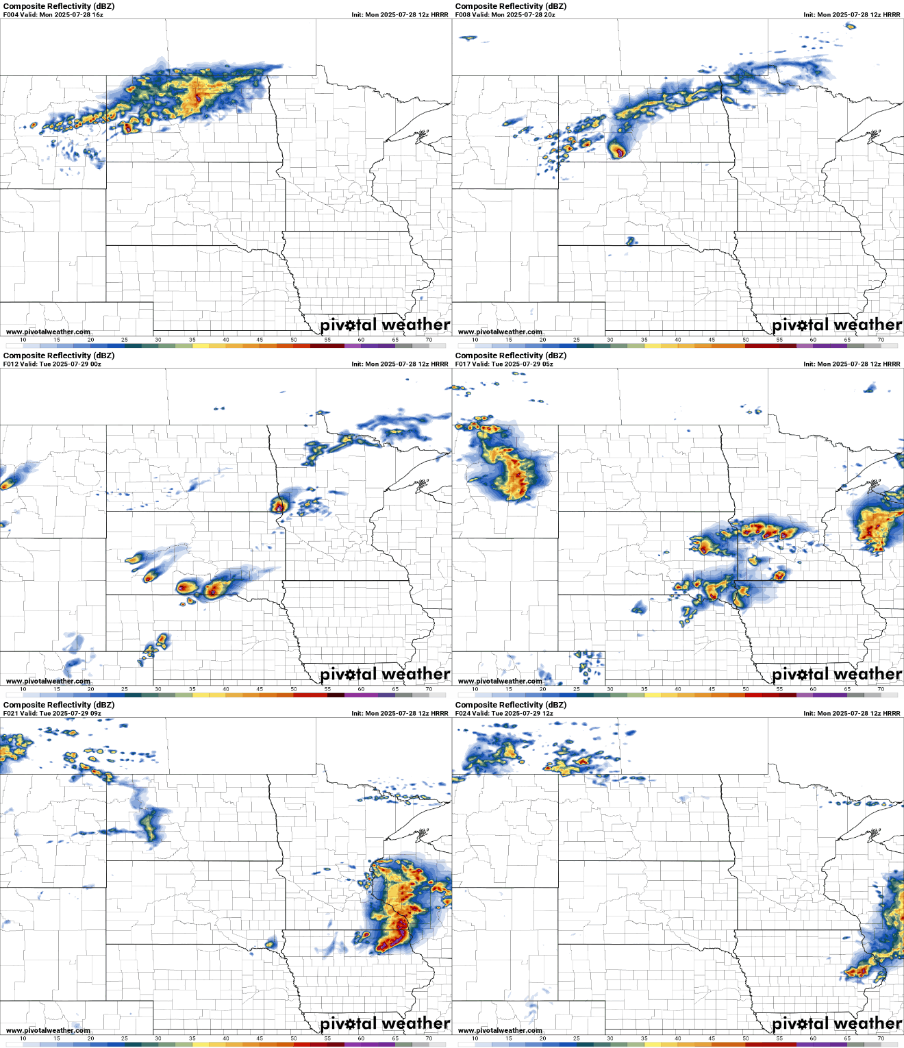
There’s a moderate risk (level 4 of 5) for severe storms for portions of southwestern and west-central Minnesota Monday afternoon and evening. An an enhanced (level 3 of 5) and slight risk (2 of 5) is possible elsewhere in southern Minnesota into western Wisconsin.

High wind gusts are of particular concern and large hail along with isolated tornadoes are possible.

Heavy rainfall will be a potential concern also across central and southern Minnesota.
Tuesday will bring a few lingering showers with some spotty storms again later in the day. It will be a bit cooler, in the 80s but still muggy.
Drier and cooler air slowly builds into the state Wednesday through the weekend, giving us a reprieve from the steamy conditions. High temperatures will be mostly in the 70s Wednesday through Saturday across Minnesota.

