
Still muggy Tuesday, but drier and cooler air is coming
We’re in for several settled days mid to late week
Go Deeper.
Create an account or log in to save stories.
Like this?
Thanks for liking this story! We have added it to a list of your favorite stories.


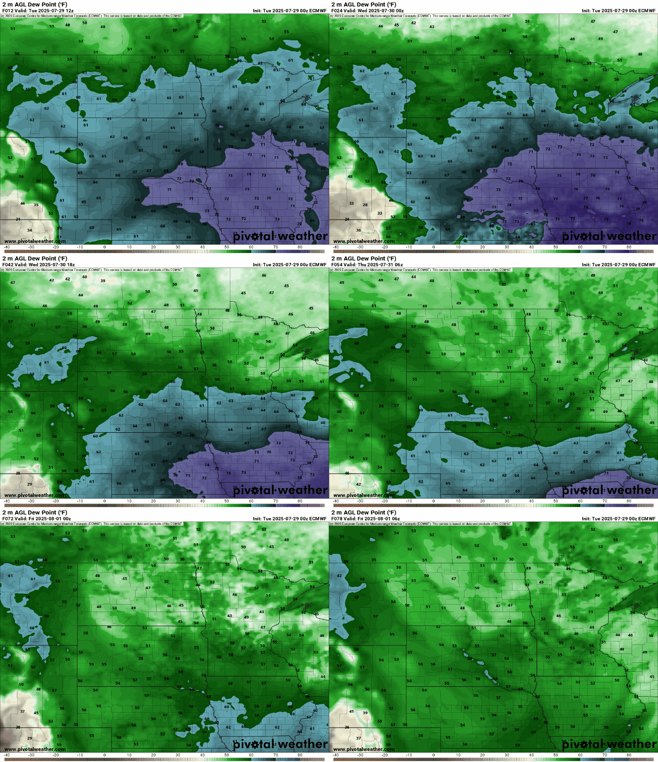
It’ll still be muggy Tuesday but dew points will drop overnight into Wednesday. We’ll have several consecutive days of cooler temperatures and lower dew points.
Stormy past 24 hours
It was a stormy 24 hours. There were numerous severe wind gust reports.
The highest wind gust reports in Minnesota were 76 mph in Stewartville (Olmsted County), 74 mph in Kasson (Dodge County), 70 mph in Owatonna (Steele County), 68 mph in Lake City (Wabasha County), and 65 mph in Shakopee (Scott County).
Minneapolis-St. Paul International Airport reported a 60 mph gust.
Turn Up Your Support
MPR News helps you turn down the noise and build shared understanding. Turn up your support for this public resource and keep trusted journalism accessible to all.
Northern Iowa saw winds of 80 to 99 mph along U.S. Highway 18. While that storm likely qualified as a derecho, the Minnesota storm may not have had a long enough path length.

There was additional rainfall of mostly 1 to 2 inches across central and southern Minnesota, but when added to Sunday night’s totals, parts of far west-central Minnesota have seen 6 to 8 inches of rain!
In Stevens County, Chokio saw 6.19 inches Sunday night and an additional 2.02 inches Monday, making for a two-day rain total of 8.21 inches.

Humid air begins to retreat Tuesday night, making for pleasant days ahead
It’ll still be warm and muggy Tuesday with highs in the 80s across southern Minnesota and dew points in the 60s to near 70 degrees at times, but not as hot as the last couple of days. Dew points will be more comfortable north, in the 50s.

There will be a few lingering thunderstorms early Tuesday in southern Minnesota and the possibility of some isolated, pop-up thunder later in the day.
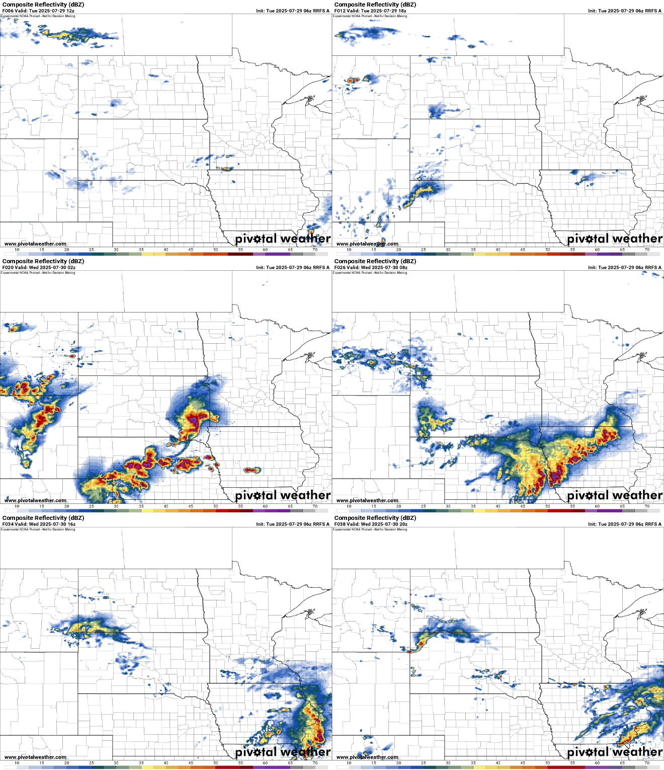
Another disturbance will develop more showers and storms across far southern Minnesota overnight Tuesday into early Wednesday. Some places along Interstate 90 could see up to 1 to 2 inches of additional rainfall.
An air quality alert also is in effect for the northern half of Minnesota Tuesday into Wednesday due to the return of wildfire smoke from Canada.
Check the latest air quality conditions, alerts and forecasts here:
Cooler and drier air finally arrives by Wednesday. Dew points will drop from the 70s and 60s into the 50s and even 40s in northern Minnesota. That dry air will stick around into the weekend.
Highs Wednesday will be mostly in the 70s across the state with a mix of clouds and sun. Sunny skies develop for Thursday into Saturday.

There’s no sign of a return to 90-degree temperatures for the time being.

