
One more comfortable day before sultry weather rolls in
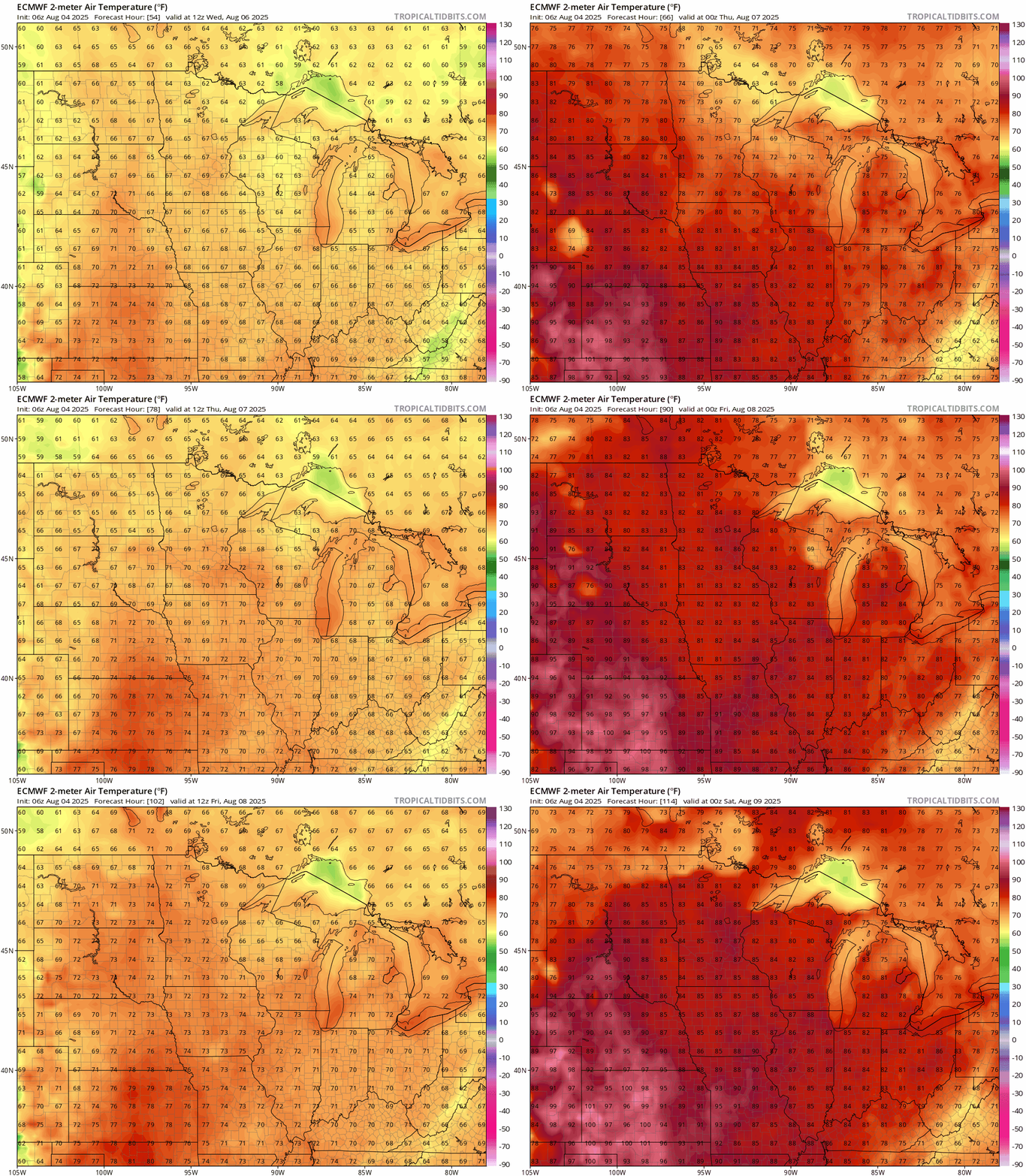
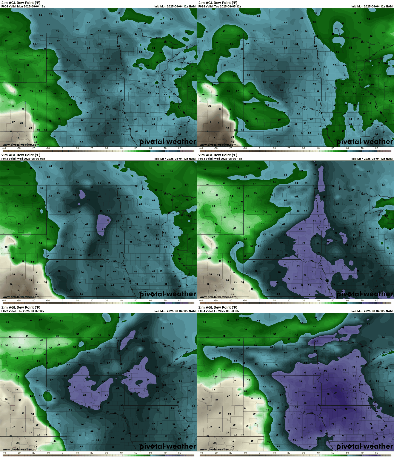
Dew points and temperatures crank up by midweek
Go Deeper.
Create an account or log in to save stories.
Like this?
Thanks for liking this story! We have added it to a list of your favorite stories.


We’ve been enjoying a nice break from the heat and humidity, but that comfort won’t last much longer. By midweek, sultry summer weather makes a return — and with it, better chances for scattered thunderstorms.
We finally catch a break with better air quality and a breath of fresh air, but the return of thick, humid air isn’t far behind.
Temperatures for Monday and Tuesday will once again be in the upper 70s to low 80s, continuing our comfortable stretch of weather.


Once midweek rolls around we will notice the increase in dew points and gradual warming of temperatures.
Turn Up Your Support
MPR News helps you turn down the noise and build shared understanding. Turn up your support for this public resource and keep trusted journalism accessible to all.
Dew points will once again climb into the sticky upper 60s and 70s as another heat dome builds over the Desert Southwest. Strengthening southwesterly winds will help funnel that heat and humidity straight into the Midwest, making conditions feel noticeably more uncomfortable in the days ahead.
Another surge of summer-like temperatures will arrive as we head toward the end of the workweek, with highs climbing through the 80s and even reaching into the 90s in some spots.
With heat and humidity building, the atmosphere will have plenty of instability to work with. As a result, scattered showers and thunderstorms will be possible each afternoon and evening.
There is a chance for some stronger to severe weather from Friday into Saturday, which we will continue to monitor.

