Showers mainly north and west Monday with muggy air returning
Temperatures will be heating up this week also
Go Deeper.
Create an account or log in to save stories.
Like this?
Thanks for liking this story! We have added it to a list of your favorite stories.


Showers will be possible north and west mainly Monday as muggier air makes a return. Temperatures, dew points and thunder chances increase mid to late week.
Showers mostly north and west Monday with warmer, more humid air returning this week
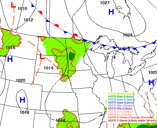
An upper level disturbance will continue to touch off some scattered showers and even a couple thunderstorms in mainly northern and western Minnesota Monday. A few isolated showers will reach eastern Minnesota.
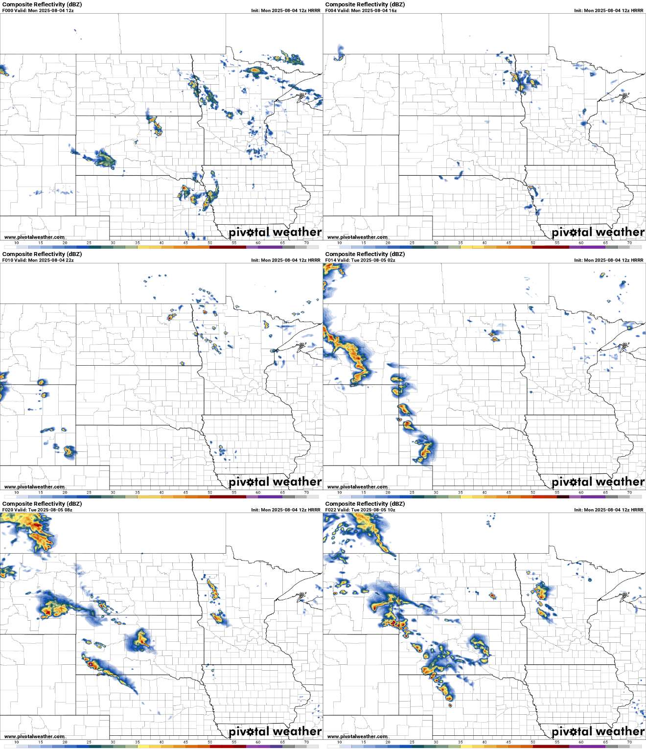
Monday will be the last cooler day with highs mostly in the 70s across the state. Where the clouds and showers are more prevalent Monday, temperatures will be just around 70 degrees.

Air quality should continue to improve Monday with southerly winds pushing most surface smoke back north. The air quality alert, which lasted six days, was the longest on record for the state. Twin Cities air quality spent a whopping 68 to 72 hours, consecutively, in the ‘red’ category which is unhealthy for everyone.
Turn Up Your Support
MPR News helps you turn down the noise and build shared understanding. Turn up your support for this public resource and keep trusted journalism accessible to all.
Check the latest air quality conditions, alerts and forecasts here:
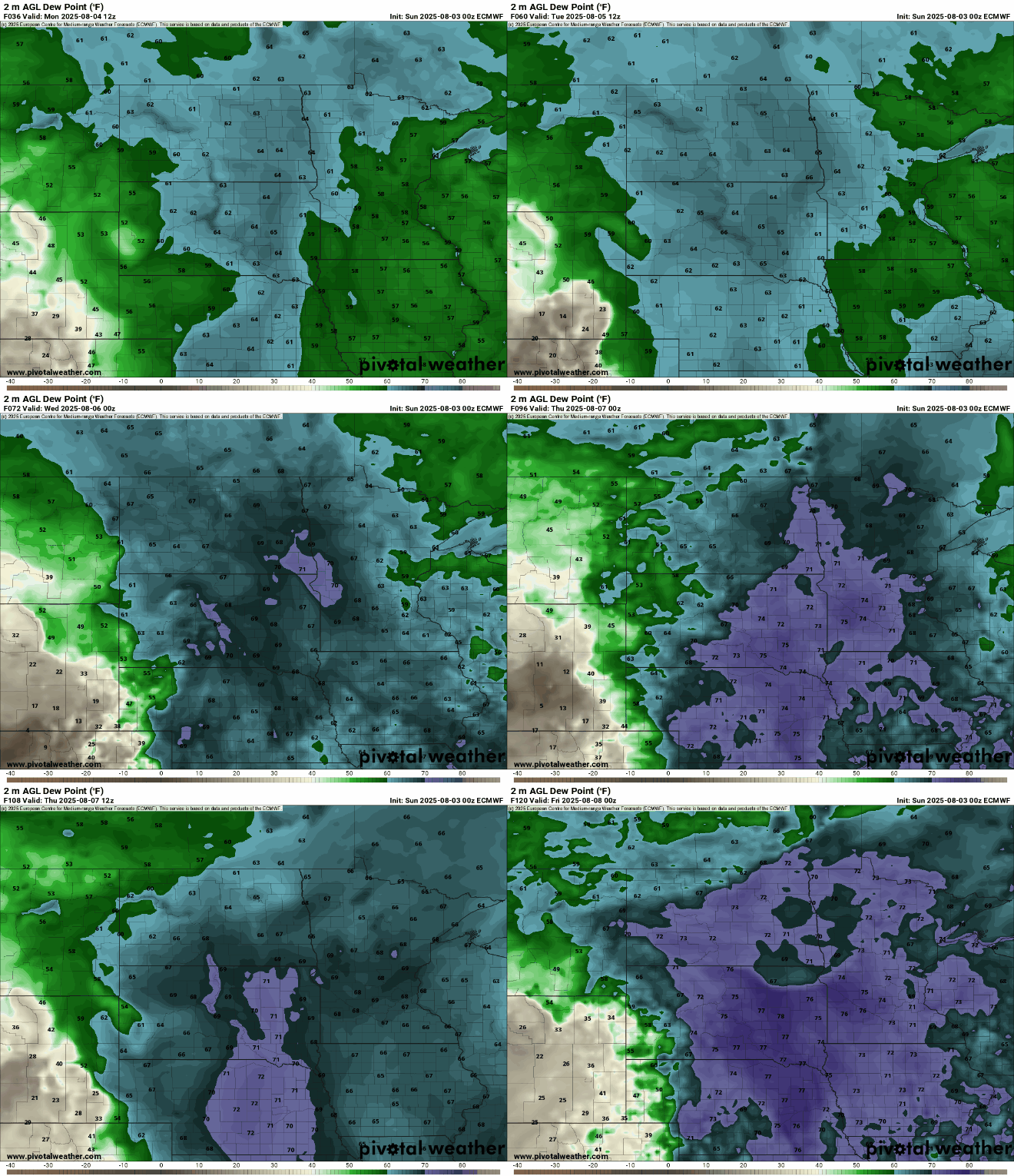
Tuesday will be warmer, with 80s returning to much of the state along with stickier dew points in the low to mid-60s.

High temperatures could hit 90 degrees again too for southern Minnesota by Thursday and Friday. Humid air will also be back so heat indices could be quite high, requiring potential heat advisories.

Dew points will continue to increase to more humid levels mid to late week. That means dew points near 70 degrees again or higher for southern and western Minnesota into the weekend.
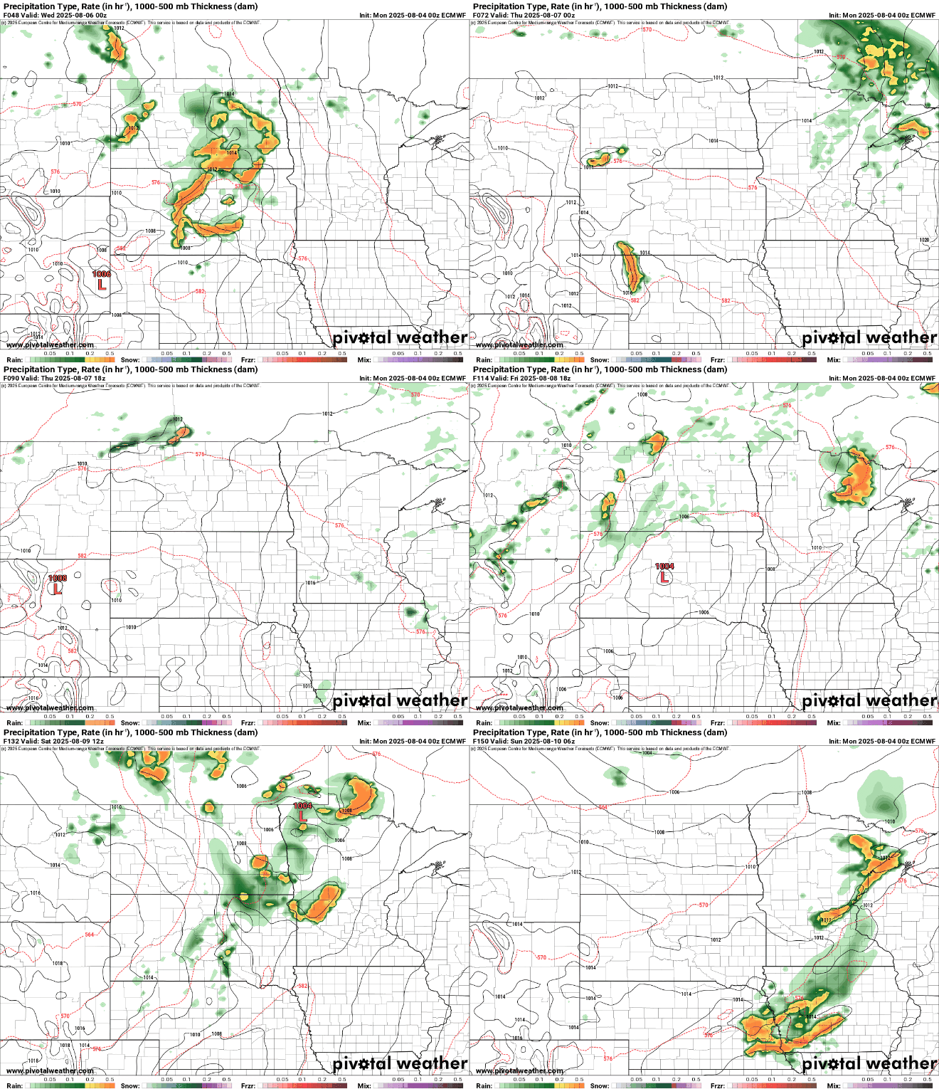
We’ll be in a more unsettled pattern with several upper level disturbances touching off at least spotty storm chances starting Wednesday into the weekend occasionally on the northern and eastern edge of a ‘heat dome’ in the southwest United States this week.