
Increasing storm chances with more humid air moving in
Highs could be near 90 degrees later this week
Go Deeper.
Create an account or log in to save stories.
Like this?
Thanks for liking this story! We have added it to a list of your favorite stories.


Temperatures and dew points will continue to climb the next day or two. That will also increase the chances of some thunderstorms Wednesday into Saturday.
Humid air moves back in, increasing storm chances mid to late week
We’ll have partly cloudy skies for most of the state and it will be a bit warmer Tuesday. Highs will be in the low 80s for the Twin Cities and portions of southern Minnesota with 70s elsewhere.

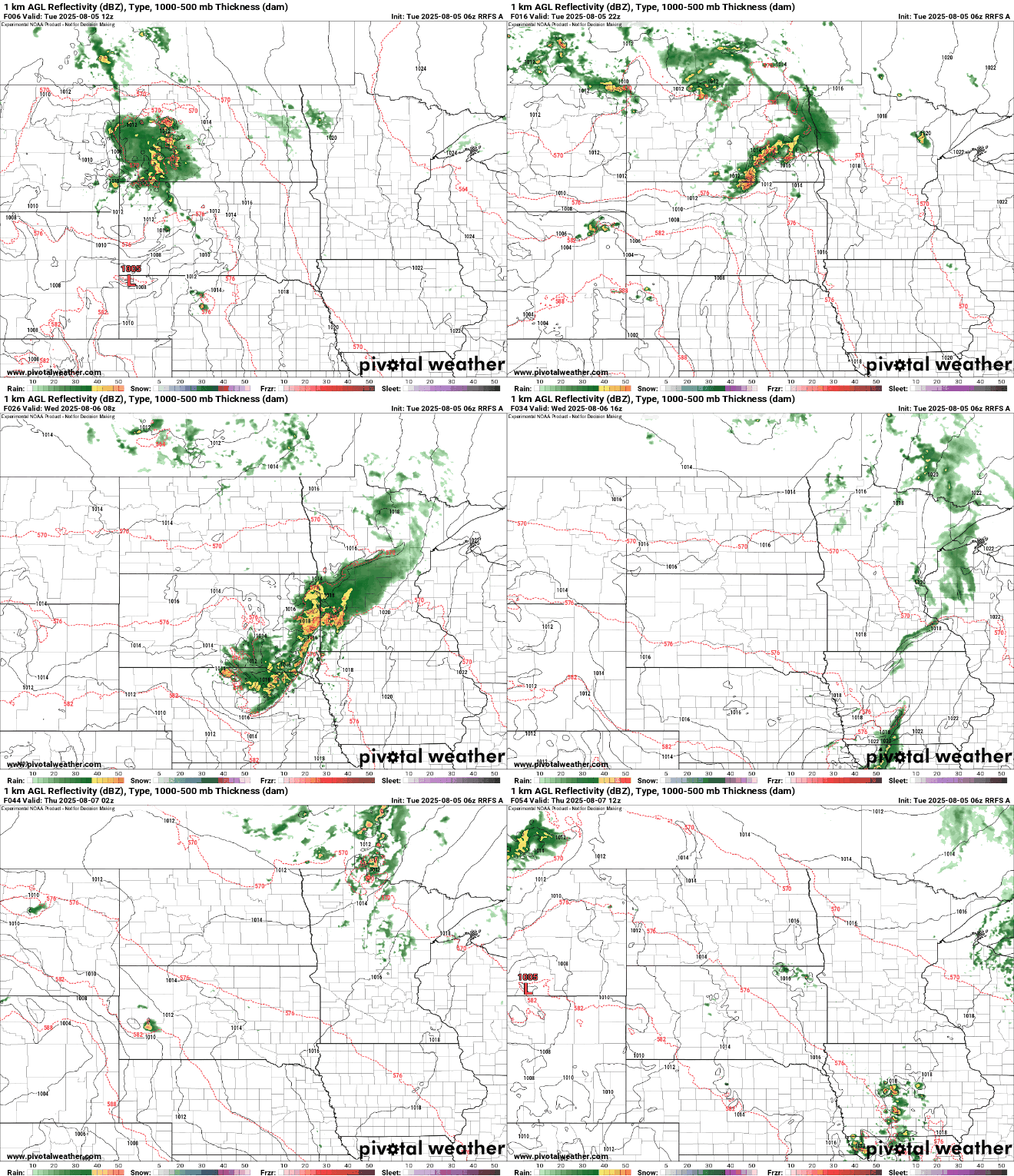
There will be a couple spotty showers or thunderstorms in mainly northern and western Minnesota Tuesday. More storms are likely to develop in the Dakotas Tuesday evening and overnight and track east into western Minnesota. About half of forecast models hold some of the showers together, reaching eastern Minnesota Wednesday morning, but half have it fizzling out before then. There’s also a marginal (level 1 of 5) severe risk for western Minnesota Tuesday night into early Wednesday.
An air quality alert is in place for northeast Minnesota Tuesday into Wednesday morning as wildfire smoke has drifted back in from the southeast.
Turn Up Your Support
MPR News helps you turn down the noise and build shared understanding. Turn up your support for this public resource and keep trusted journalism accessible to all.
Check the latest air quality conditions, alerts and forecasts here:
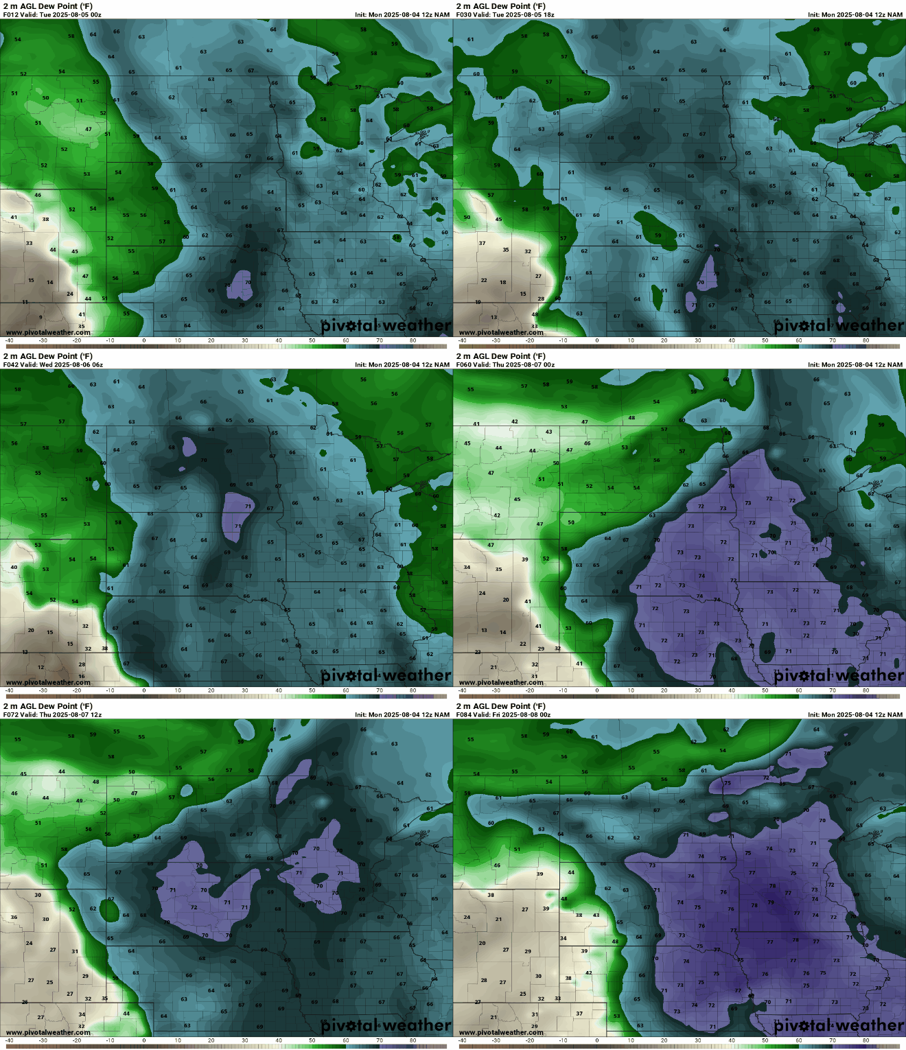
Dew points will continue to increase into the 60s Tuesday and into the low 70s late Wednesday into Thursday and Friday after a break from the tropical air the last several days.
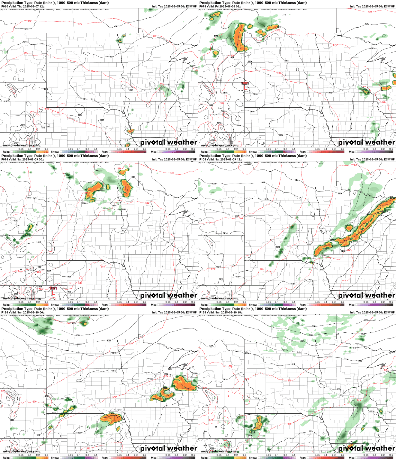
That increased moisture and also heat moving in means we’ll see the chance of some thunderstorms increase, too. No day will be a washout, but there are several minor disturbances that will be moving through, touching off occasional storms. Some isolated to spotty thunder is possible Thursday. There’s a better chance at scattered storms Friday night into Saturday.
In addition to humidity and thunder, we’ll also be heating up. Highs by Thursday and Friday will be near 90 degrees in the Twin Cities and southern Minnesota with higher heat indices.


