
End of week severe weather threat
Slight risk includes portions of the Twin Cities

Go Deeper.
Create an account or log in to save stories.
Like this?
Thanks for liking this story! We have added it to a list of your favorite stories.


Warm, humid air ahead of an approaching cold front could lead to dangerous storms Friday afternoon and evening.
Heat and humidity bring severe weather potential
Summer heat has returned to the Midwest with soaring dew points and temperatures climbing above seasonal averages. This hot and humid air, along with an approaching cold front, will create favorable conditions for thunderstorms on Friday.

There is a slight risk of severe weather for much of the state, including parts of the Twin Cities.
Some of these storms could become severe, especially Friday afternoon and evening. Once storms develop Friday afternoon, they are expected to organize into clusters and then form a line.
Storms will develop in the Dakotas Thursday night and move east, reaching the eastern half of the region by early Friday morning. The storms expected Friday afternoon and evening are more concerning, as a passing cold front will bring increased instability. While these storms are expected to follow a more northerly track, parts of the Twin Cities could still be impacted.
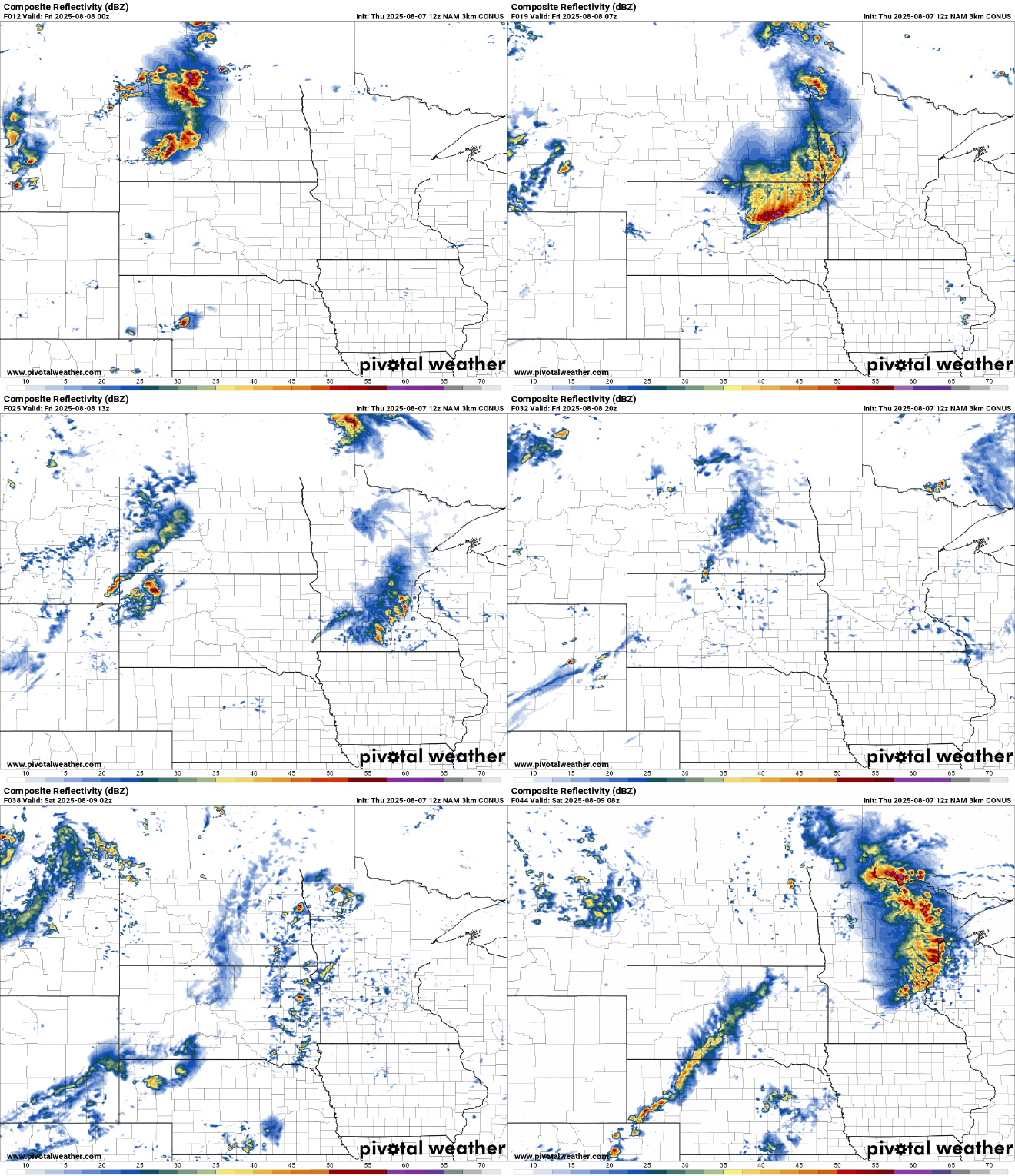
Larger hail and damaging winds will be the main threats, but we cannot rule out the possibility of a few weaker QLCS tornadoes.

Turn Up Your Support
MPR News helps you turn down the noise and build shared understanding. Turn up your support for this public resource and keep trusted journalism accessible to all.

