
Steamy with some storm chances, especially Friday night into Saturday
Friday could bring triple-digit heat indices

Go Deeper.
Create an account or log in to save stories.
Like this?
Thanks for liking this story! We have added it to a list of your favorite stories.


Dew points will be in the humid 70s Thursday and Friday. Heat indices could reach the triple digits Friday. Isolated to spotty storms are possible with the best chances Friday night into Saturday.
Steamy Thursday and Friday with storm chances ahead
It’ll be warmer and more humid Thursday. We’ll see partly cloudy skies with highs well into the 80s pretty much statewide with the exception of the North Shore. The heat index will be into the 90s across southern and western Minnesota.

Friday will be even hotter with highs near 90 degrees and afternoon heat indices in the 95 to 105 range across southern Minnesota.
There will be some isolated to spotty thunder chances Thursday mainly in southeast and northwest Minnesota midday into the afternoon and evening.
Turn Up Your Support
MPR News helps you turn down the noise and build shared understanding. Turn up your support for this public resource and keep trusted journalism accessible to all.
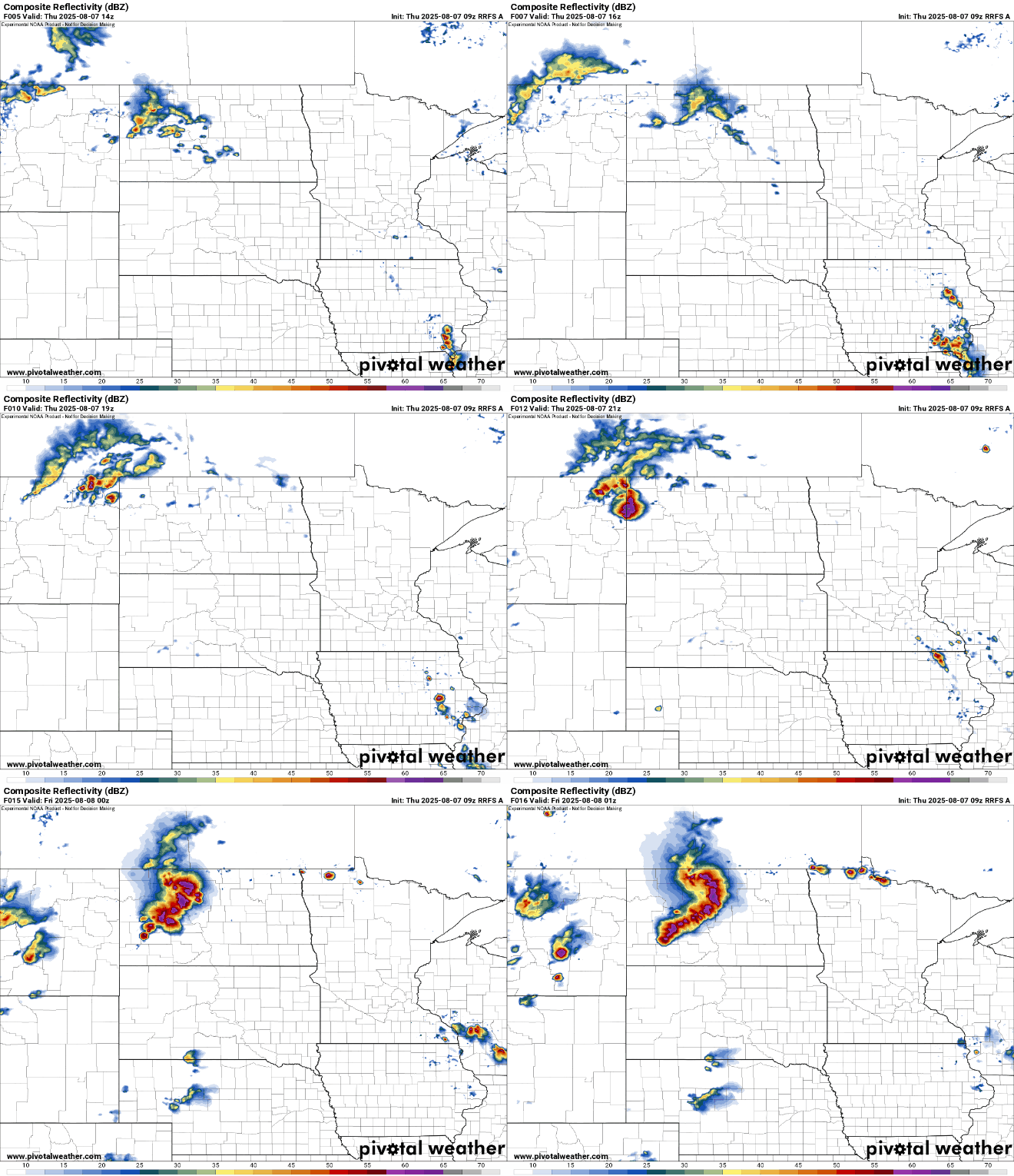
Overnight Thursday night storms will develop in the Dakotas and track east. There are two possible scenarios for the late Thursday night/early Friday storms. One, is a northerly track:
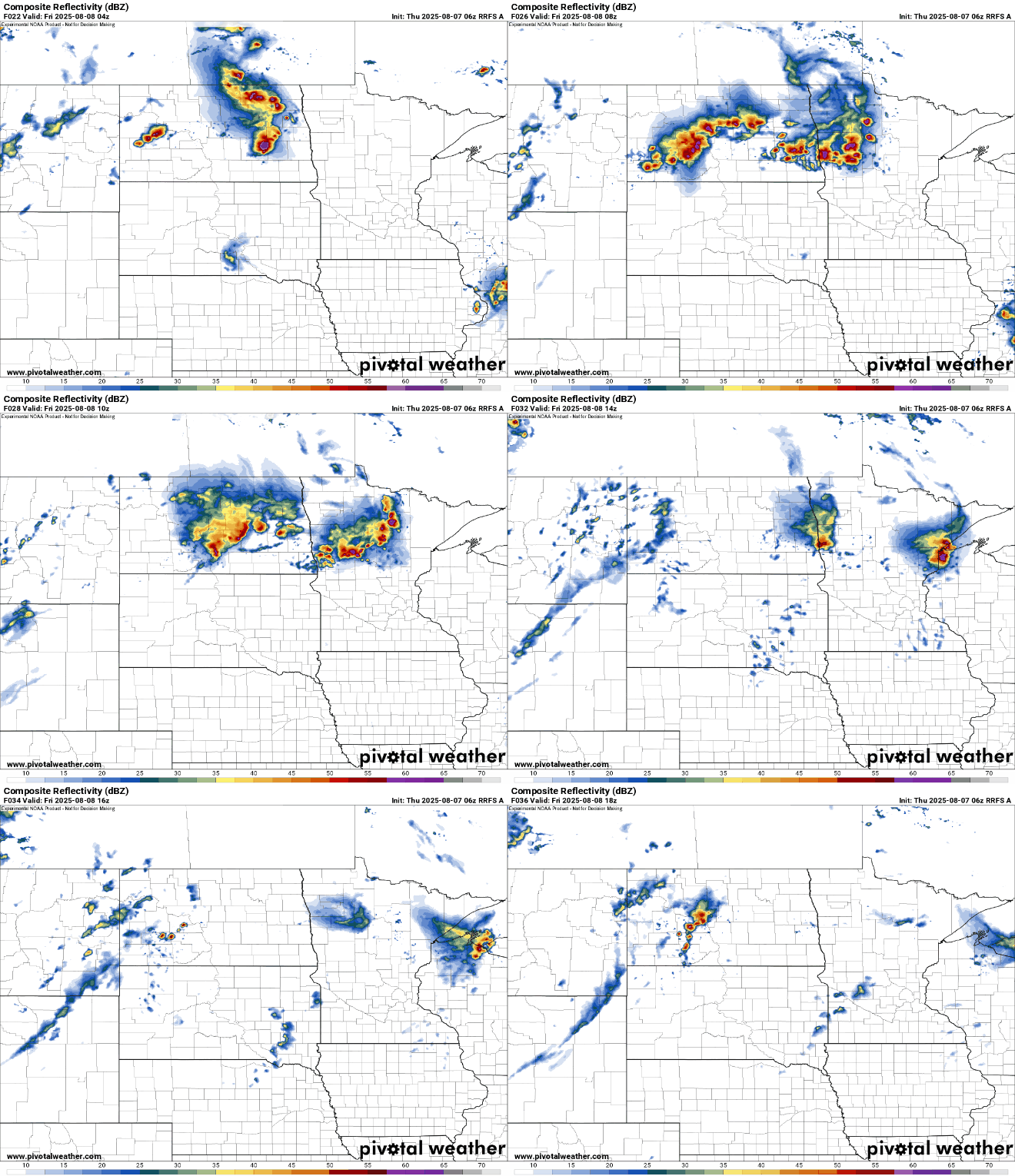
Most forecast models keep storms north, but some models are a bit more south, taking thunderstorms into central Minnesota late Thursday night into early Friday:
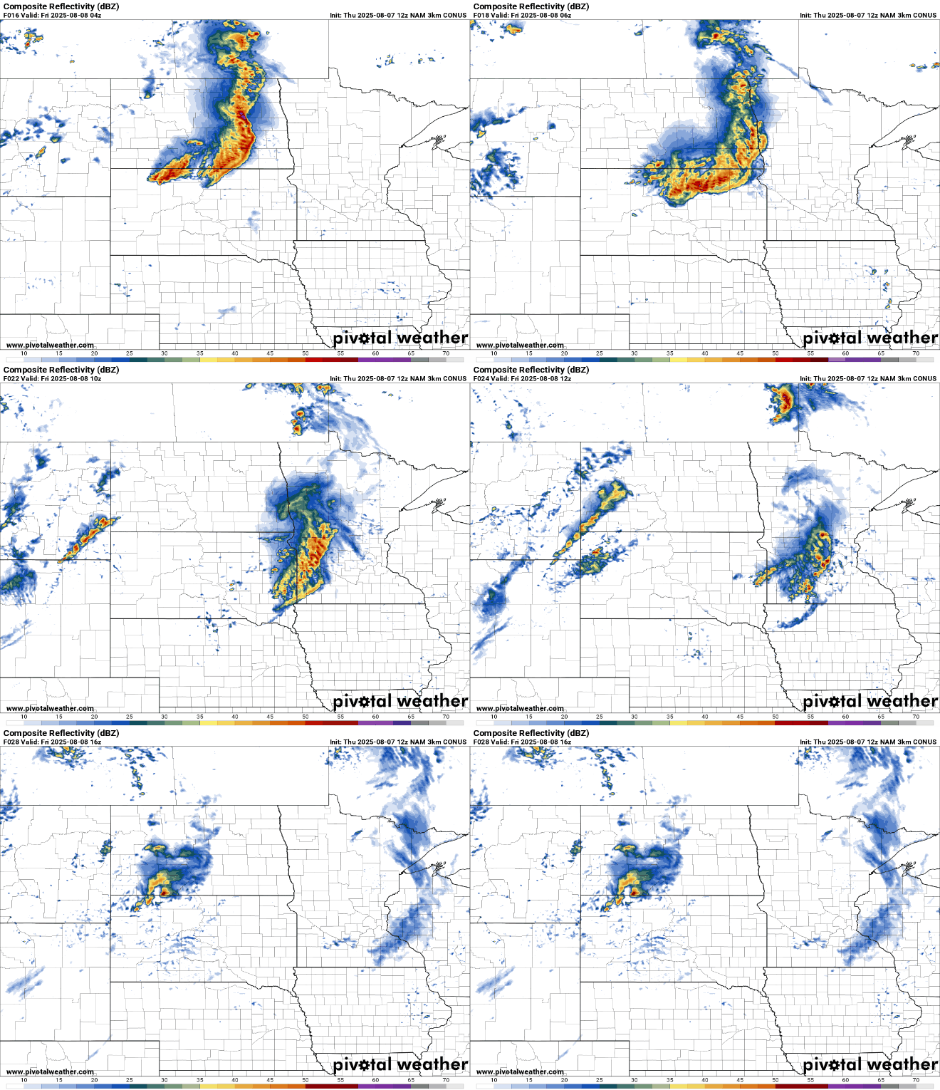
The best chances of widespread, scattered storms will come Friday night into Saturday morning ahead of a weak cool front. These storms, and the Thursday night storms could produce some high wind gusts and large hail along with some localized heavy rainfall:
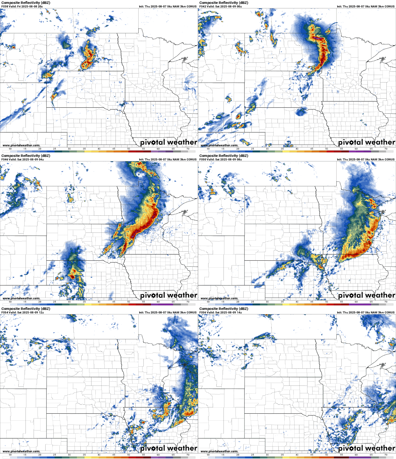
Storms that develop could become strong to severe in portions of Minnesota Thursday night and also Friday night into Saturday morning.

It will be slightly cooler and slightly less humid behind the front Sunday into early next week.

