
Hot, humid Friday with more storms Friday night, Saturday morning
Temperatures and dew points drop slightly for Sunday

Go Deeper.
Create an account or log in to save stories.
Like this?
Thanks for liking this story! We have added it to a list of your favorite stories.


It’ll be a very steamy Friday with afternoon heat indices in the triple digits for southern Minnesota. More storms are possible Friday night into Saturday — and some could be severe.
Hot and humid Friday with more storms Friday night
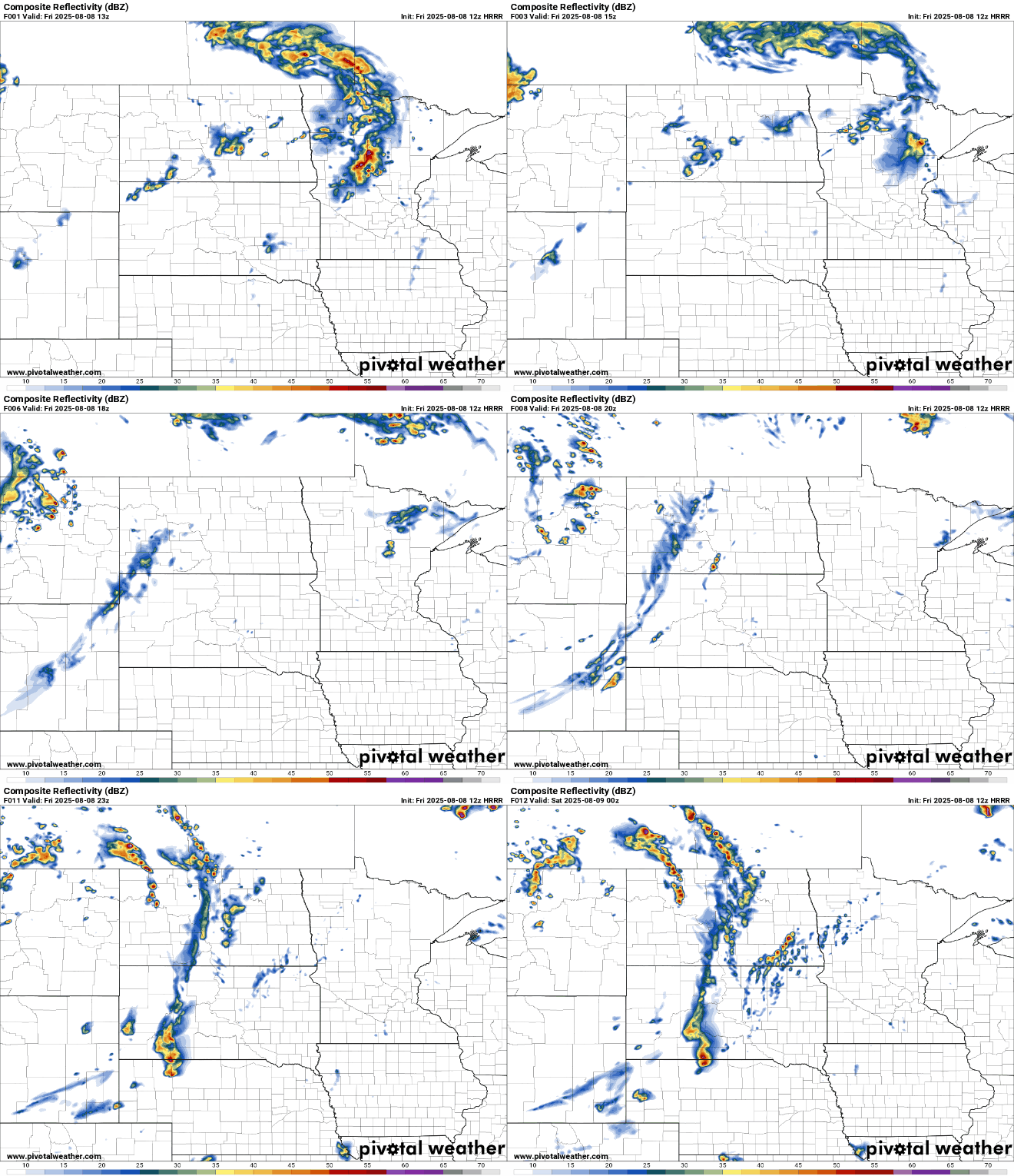
A broken line of thunderstorms will continue to drift east across northeast Minnesota and northern Wisconsin Friday morning into midday, largely fizzling out as it tracks east into more stable air. The storms produced severe winds early this morning of 76 mph in Crookston at 4:41 a.m. Friday.
Highs Friday afternoon will be in the low 90s for much of southern Minnesota with afternoon heat indices near 100 degrees.
There’s a heat advisory (orange) posted for portions of central and southern Minnesota into northwest Wisconsin Friday afternoon and evening.

The next round of storms will develop Friday evening in the Dakotas and track east overnight Friday into Saturday morning across much of Minnesota ahead of a weak cool front and surface low pressure area. Storms will linger and redevelop in southeast Minnesota Saturday afternon into Wisconsin in the evening Saturday.
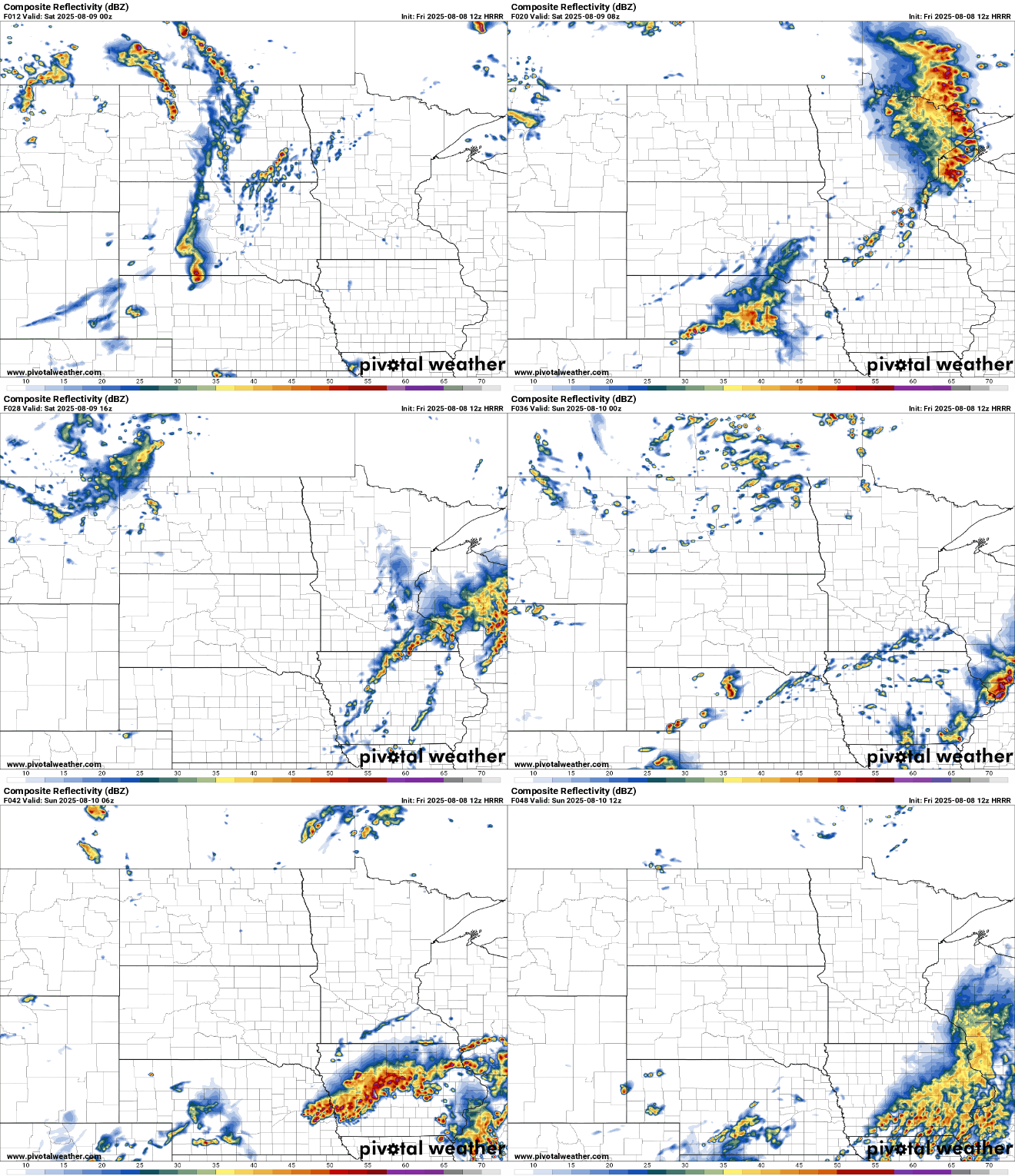
These storms could be severe with damaging wind gusts and large hail in particular, along with localized heavy rainfall. The best chance of severe weather is in central and northern Minnesota tonight into early Saturday. Later in the day Saturday into Saturday night the severe focus shifts to far southeast Minnesota into Wisconsin.

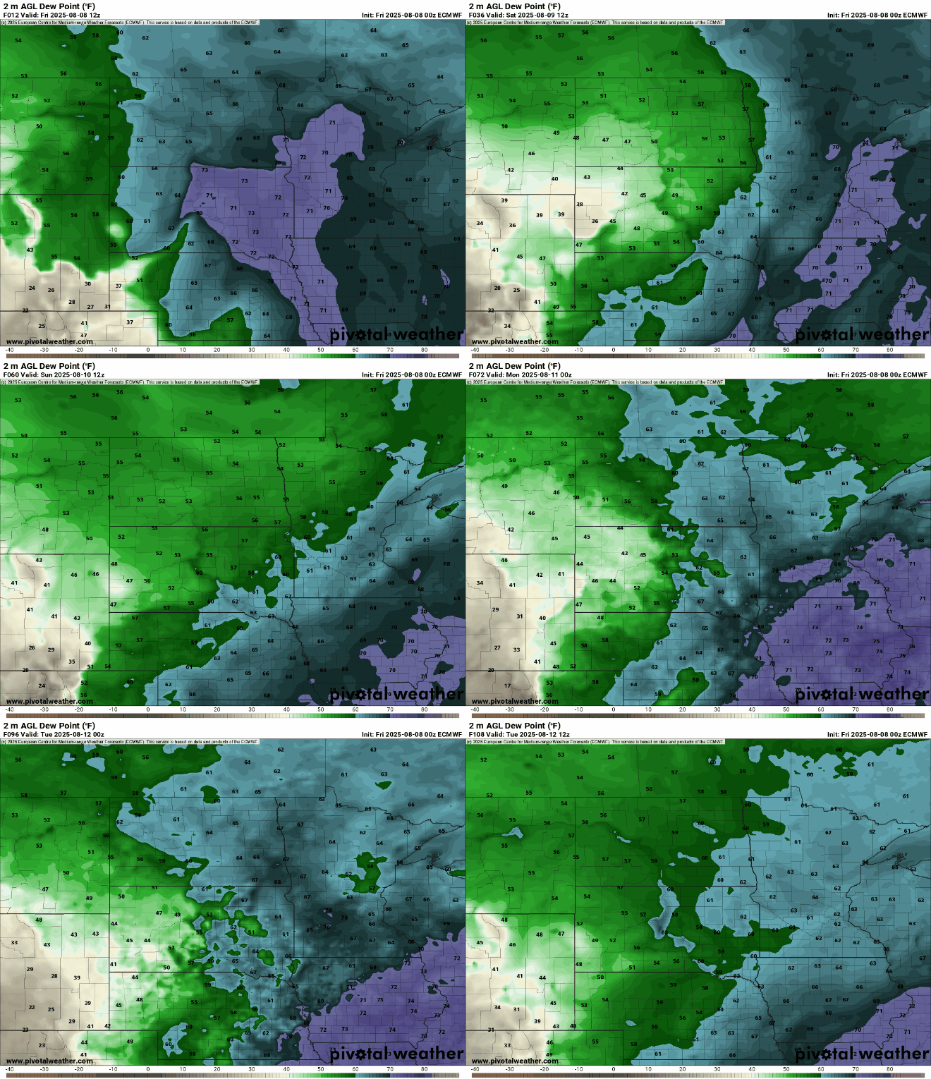
Behind the front, temperatures will be slightly cooler for the weekend and early next week but still in the mid-80s, which is above normal for southern Minnesota. Dew points will drop also from the 70s to the 60s. Not quite the cool, comfortable air we had last week, but it’ll be an improvement none the less.
Turn Up Your Support
MPR News helps you turn down the noise and build shared understanding. Turn up your support for this public resource and keep trusted journalism accessible to all.

