
Clear skies tonight, but more air quality concerns arise
Another air quality alert issued for Sunday

Go Deeper.
Create an account or log in to save stories.
Like this?
Thanks for liking this story! We have added it to a list of your favorite stories.


While Saturday night stays quiet with clear skies, air quality will worsen by Sunday, prompting another alert across the state.
Clear and calm
Early Saturday storms woke us up, but the night brings clear skies and calm conditions.
Temperatures tonight will fall into the upper 60s across the Twin Cities and southeastern Minnesota, with lows in the upper 50s to low 60s across the northern parts of the state.
Turn Up Your Support
MPR News helps you turn down the noise and build shared understanding. Turn up your support for this public resource and keep trusted journalism accessible to all.

A low-pressure system skirting the Canadian border will bring some cloud cover to northwest Minnesota, along with isolated storm chances. The cold front responsible for Saturday’s morning storms is expected to stall close to Wisconsin and Iowa. This will keep any precipitation chances to our southeast.
Sunday’s temperatures will feel much like Saturday’s, but with slowly decreasing dew points heading southeast.
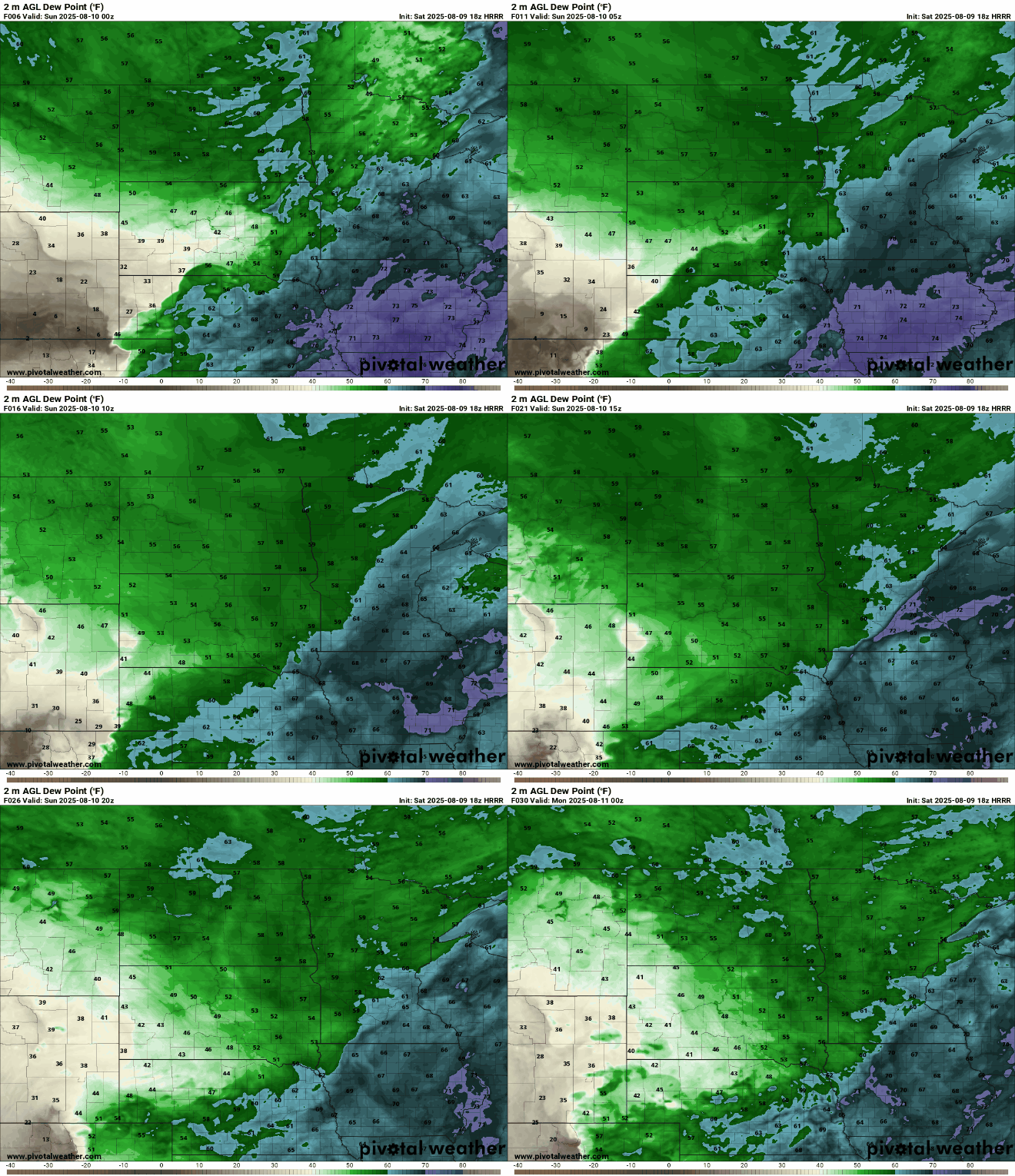
Highs will reach the mid to upper 70s in the north, and the lower 80s in the south.

Another air quality alert goes into effect for the state from Sunday at 9 a.m. through Tuesday at 9 a.m. Air quality will begin to deteriorate in western Minnesota early Sunday, spreading eastward through the evening.

Check the latest air quality conditions, alerts and forecast here:
MPCA website Current air quality conditions
MPCA website: Air quality forecasts
Next week looks seasonable for mid-August, with highs in the low to mid-80s and dew points in the 60s. No precipitation is expected until midweek or later.

