
Air quality deteriorates overnight as wildfire smoke drifts in from the west
Seasonal temperatures to start the week

Go Deeper.
Create an account or log in to save stories.
Like this?
Thanks for liking this story! We have added it to a list of your favorite stories.


Air quality is expected to deteriorate overnight as wildfire smoke drifts in from the west, bringing hazy skies to start the week, with seasonal temperatures continuing.
Deteriorating air quality
Our wildfire smoke took it’s time through the Dakotas on Sunday, but will be impacting western Minnesota by late tonight, and then eastern Minnesota by Monday morning.
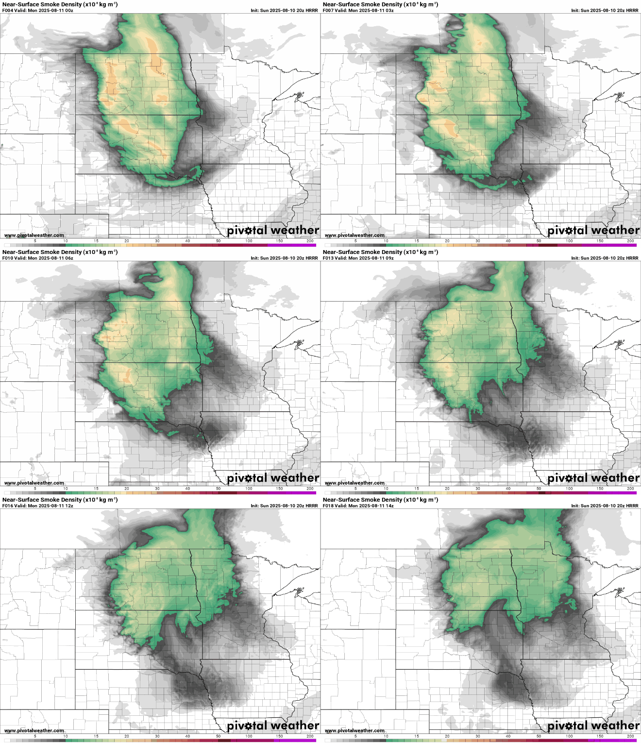
An air quality alert remains in effect until Tuesday at 9 a.m., with AQI levels expected to reach the orange and red categories across the state.
Turn Up Your Support
MPR News helps you turn down the noise and build shared understanding. Turn up your support for this public resource and keep trusted journalism accessible to all.

Check the latest air quality conditions, alerts and forecast here:
MPCA website Current air quality conditions
MPCA website: Air quality forecasts
Seasonal start to work week
Sunday night will be partly cloudy, with temperatures dropping into the low 60s in the south and mid to upper 50s in the north. Patchy fog may develop again in eastern Minnesota, similar to what we saw early Sunday morning.

High temperatures to start the week will be very seasonable for mid-August, with highs in the low to mid-80s and dew points holding in the 60s.

A weak disturbance could bring light showers mainly to northern Minnesota on Monday.
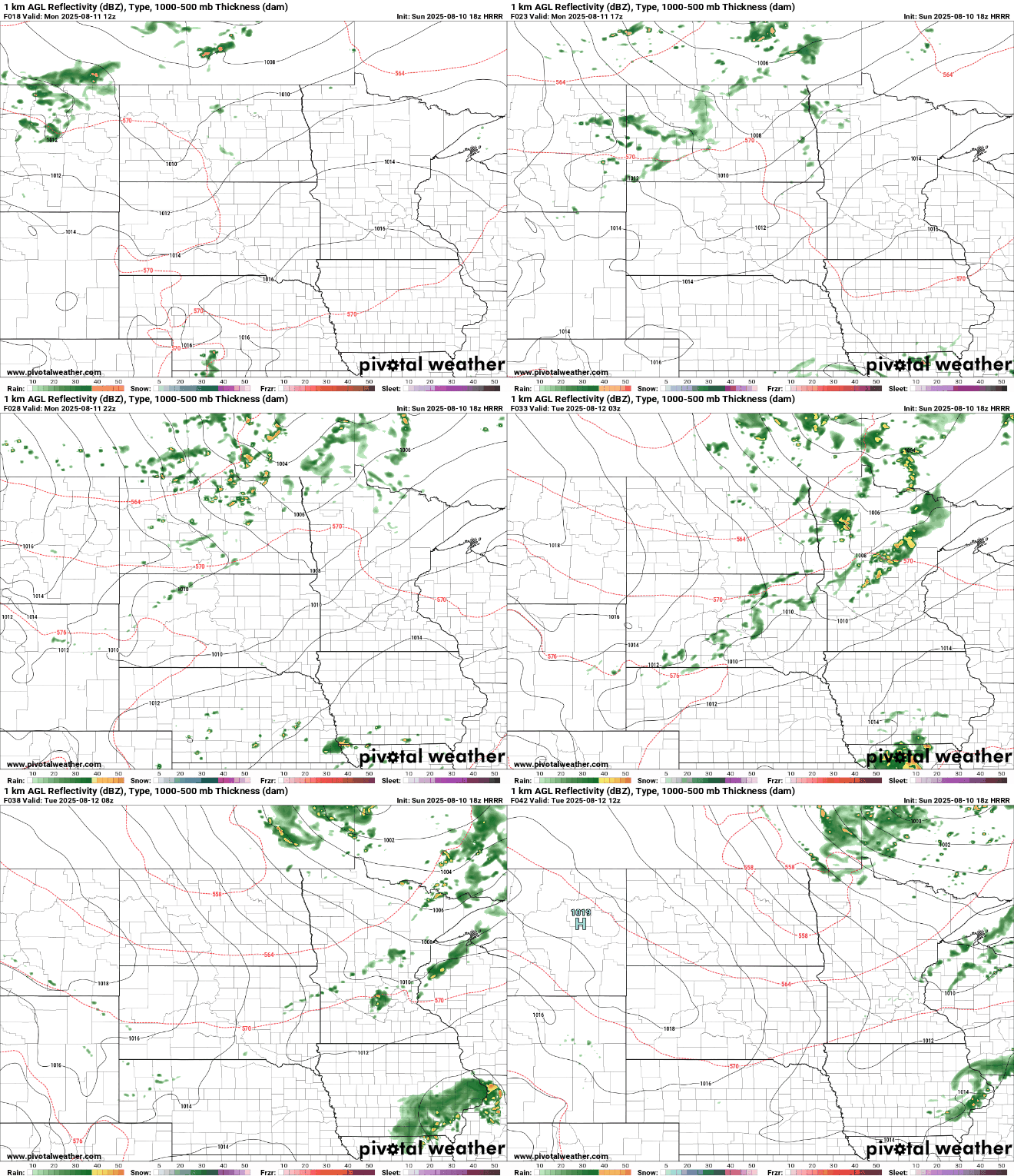
High pressure will bring sunshine and dry conditions Tuesday and Wednesday. Our next focus shifts to late week into the weekend as a stalled boundary nearby brings multiple rounds of showers and thunderstorms. Heavy rainfall is possible at some point next weekend.

