
Wildfire smoke returns for the start of the week with heat returning late week
A few thunderstorms are possible north Monday into Monday night
Go Deeper.
Create an account or log in to save stories.
Like this?
Thanks for liking this story! We have added it to a list of your favorite stories.


Monday will be pleasant other than the return of wildfire smoke. A few showers are possible late Monday north. Heat and humidity make a late-week comeback.
More comfortable air moves in but heat returns late week
We’ll have plenty of sun for most of central and southern Minnesota Monday. Afternoon highs will reach the low to mid-80s across the state with lower dew points than the weekend, mostly in the low 60s.

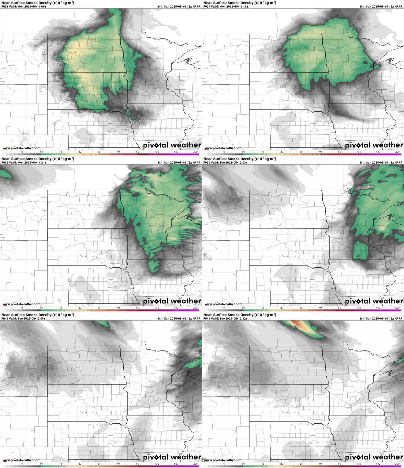
Canadian wildfire smoke is blowing back into the region prompting more air quality alerts.
Check the latest air quality conditions, alerts and forecasts here:
Turn Up Your Support
MPR News helps you turn down the noise and build shared understanding. Turn up your support for this public resource and keep trusted journalism accessible to all.
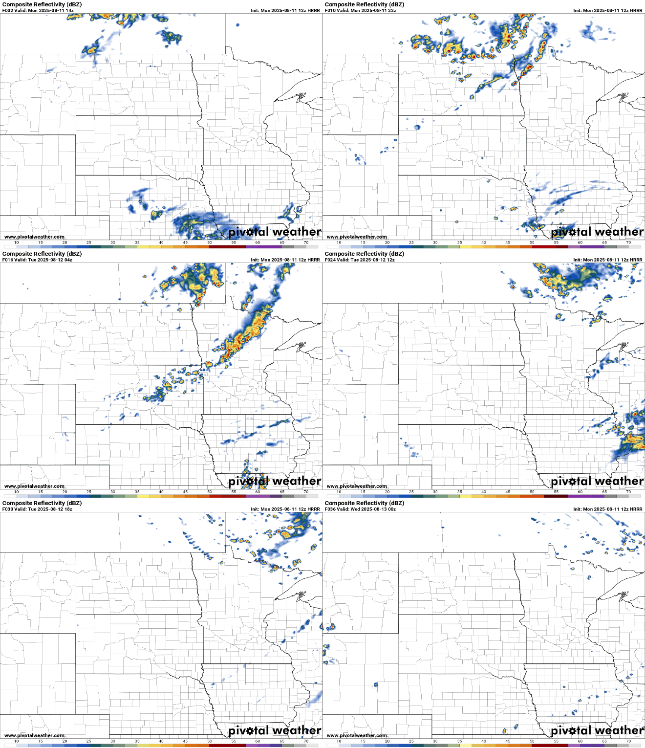
A few showers and thunderstorms are possible later in the day Monday across northern Minnesota. We could see a few thunderstorms farther south as well overnight Monday into early Tuesday ahead of another weak cool front.
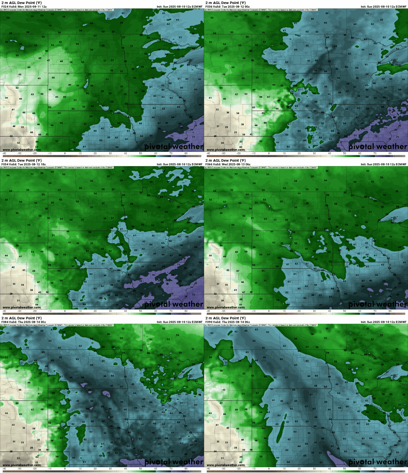
Tuesday will see a drop in both temperatures and dew points behind the cool front. Late in the day, dew points will drop into the more comfortable 50s for midweek.
Highs Tuesday will be a bit cooler, ranging from the low 70s north to the low 80s south, close to normal highs for the date.

Temperatures and dew points will increase yet again late this week, bringing back steamy conditions and also increasing the chance of thunderstorms heading into Friday night and the weekend.

